

Lo Bufador Nº1
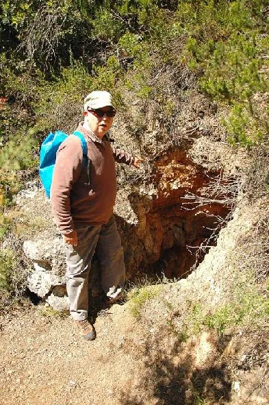
A 14 m deep fissure at Masroig (Priorat), with a 2 x 1.60 m entrance on a slope. Decomposed cavity with a SW-NE joint, galleries, crawls and short pitches.
EspeleoWorld
Lo Bufador Nº1
A 14 m deep fissure at Masroig (Priorat), with a 2 x 1.60 m entrance on a slope. Decomposed cavity with a SW-NE joint, galleries, crawls and short pitches.
Masroig, El · Priorat
Length: 40 m · Depth: 14 m
Updated record
https://espeleoworld.com/en/c/lo-bufador-n-1
Information can change. Always verify coordinates, access, weather, and cave conditions before setting out.
A 14 m deep fissure at Masroig (Priorat), with a 2 x 1.60 m entrance on a slope. Decomposed cavity with a SW-NE joint, galleries, crawls and short pitches.
Topographic

Espeleoindex · CC BY-NC 4.0, https://creativecommons.org/licenses/by-nc/4.0/ · Image © its author.
Photos
Espeleoindex · CC BY-NC 4.0, https://creativecommons.org/licenses/by-nc/4.0/ · Image © its author.
Description
Morphology
We find an entrance 2 x 1.60 metres located on a slope. We land on a cone of rubble; here a joint opens up with a SW-NE orientation and fairly regular dimensions, from 0.50 to 1 metre wide and with a variable height of 1 to 5 metres.
If we go in a NE direction we descend a 1.20 m drop and find a gallery 3 metres long; on the right a 2.50 metre crawl leads off and narrows between the blocks, although the fissure continues. On the ground, on the right, a small pit of a couple of metres can be seen, not accessible without clearing.
If we return to the base of the entrance pitch, we will go in a SW direction and after 3 metres we will find a 3 m pitch which we will descend to continue in the same direction; behind there is a small crawl of about 3 metres that becomes impenetrable. Six metres further on we find a 2.75 m drop that is easy to climb down; here a small hole makes a connection under a block; after 2 metres the joint (here 5 metres high and 0.90 wide) descends between wedged blocks down to the deepest point reached (- 14 m.). The cavity continues further down but is not passable.
Progression
We will have to descend a 4 m pitch. The rope was rigged from a pine tree and a deviation. To descend we must be careful of unstable blocks, a precaution we will take throughout the exploration as the cavity is quite decomposed.
History
The only references we have are those made known by members of GREC – les Corts and of GE Badalona who visited it on 9 February 2014.
User Comments (0)
No comments yet.
Be the first to share your experience!
Registered Explorations (0)
No explorations registered yet.
Register your visit to this cave!
Bibliography
- Totes les dades, topografia i fotografies han estat extretes del blog: espeleobloc.blogspot. Apunt del 24-3-2014. Autors: J. Llorca (GREC); X. Samarra i E. Porcel (GEB).
Nearby caves


Source: Espeleoindex (espeleoindex.com), modified. CC BY-NC 4.0, https://creativecommons.org/licenses/by-nc/4.0/