
Maps & discovery
LiDAR maps: spot the shape of a cave entrance
Look beyond the tree canopy. Explore known cave openings in detailed terrain imagery, from 25 cm data around Barcelona to the great chasm of Padirac.
EspeleoWorld ·
A different way to see the ground
LiDAR measures distance with laser pulses. Classified ground returns can be used to build a terrain model, then lit virtually to reveal relief. The result is a shaded map of slopes, hollows and edges rather than a photograph of trees and roofs. Our Spanish overview is a surface model, so vegetation and buildings can remain visible.
For cavers, the useful clues are often small: a closed depression, a sharp rim, a break in a slope. Start with known entrances and compare the image with the cave record. These examples show surface signatures near documented openings; the map does not reveal underground passages.
Explore this view →Try it in three steps
- Open a map link below, or choose LiDAR in the map selector. The option appears when a supported layer covers the view and its minimum zoom is reached.
- Zoom in to inspect the relief. The attribution at the bottom names the active data source and its resolution.
- Switch to the orthophoto for context, then compare with the cave record. Trees, interpolation and coordinate offsets can change what you see.
Known openings, seen from above
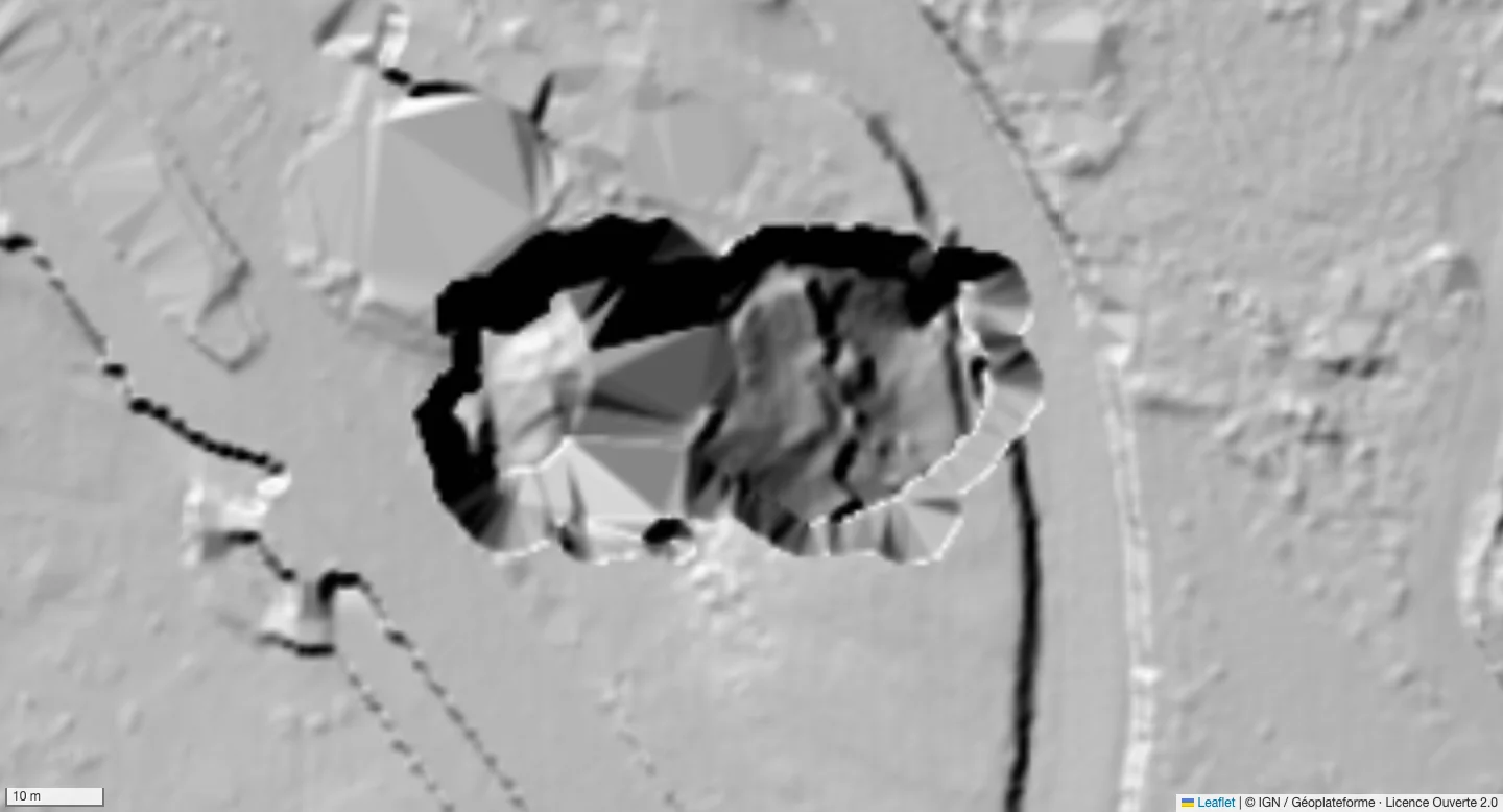
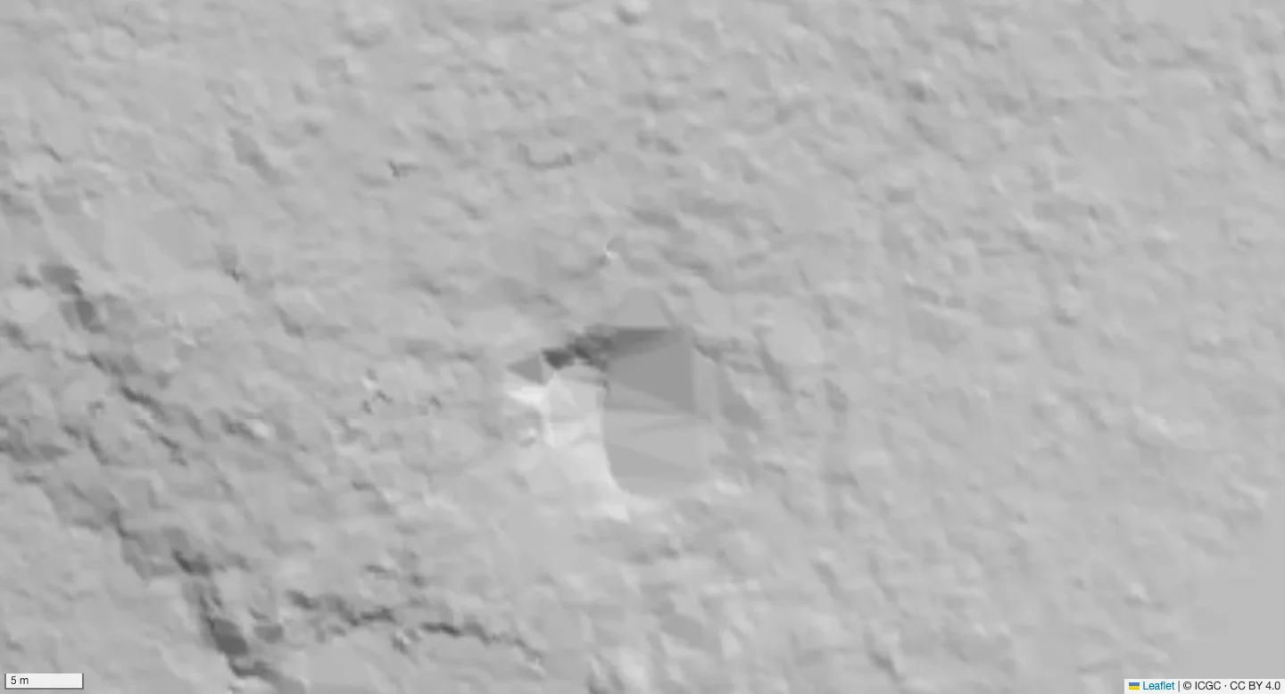
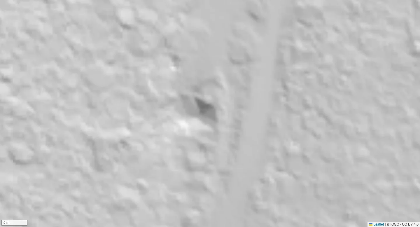
Known openings in contrasting terrain data: Can Sadurní uses AMB’s 2022 25 cm grid, Esquerrà uses ICGC’s 50 cm terrain where the finer layer has no data, and Padirac uses France’s 50 cm grid. Each pair is aligned at the same center and zoom.
Slide between the orthophoto and LiDAR at each entrance. Both images have the same center, zoom and orientation, so the ground stays aligned as the divider moves.
The amber rings locate the approximate entrance areas using the cave records and visible terrain. They are guide marks, not surveyed mouth outlines.
50 cm · LiDAR
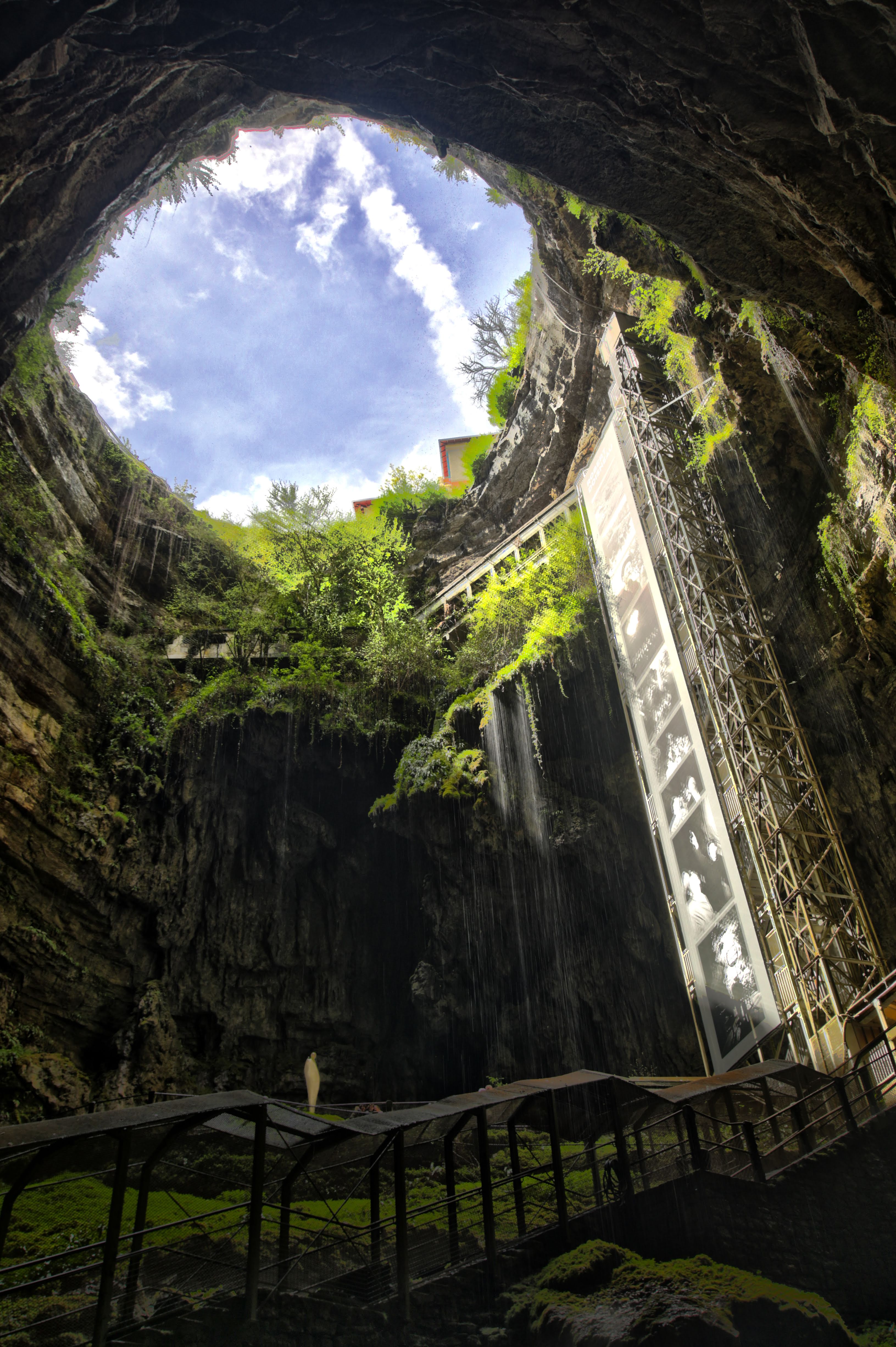
Gouffre de Padirac · a monumental opening at 50 cm
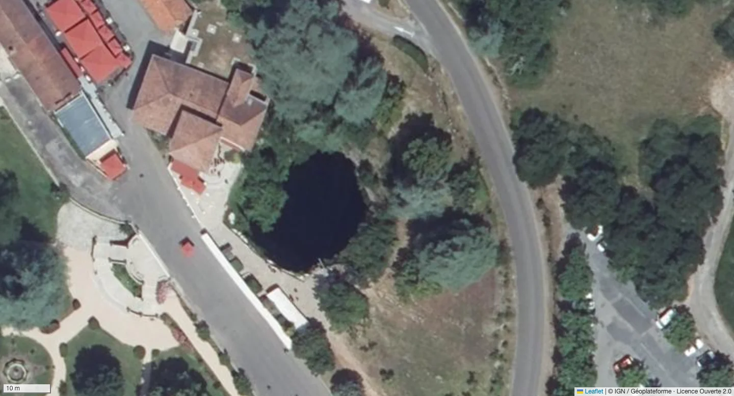
Drag the handle, tap either side, or use the arrow keys to compare.
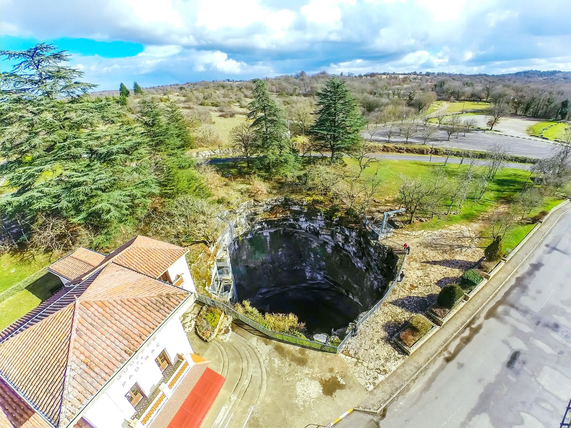
Padirac’s published entrance diameter is about 33 m. Its broad rim and deep surface hollow are conspicuous in IGN’s 50 cm hillshade. Dark areas and triangular faces inside the opening reflect shading and interpolation; they do not reconstruct the cave below.
25 cm · LiDAR
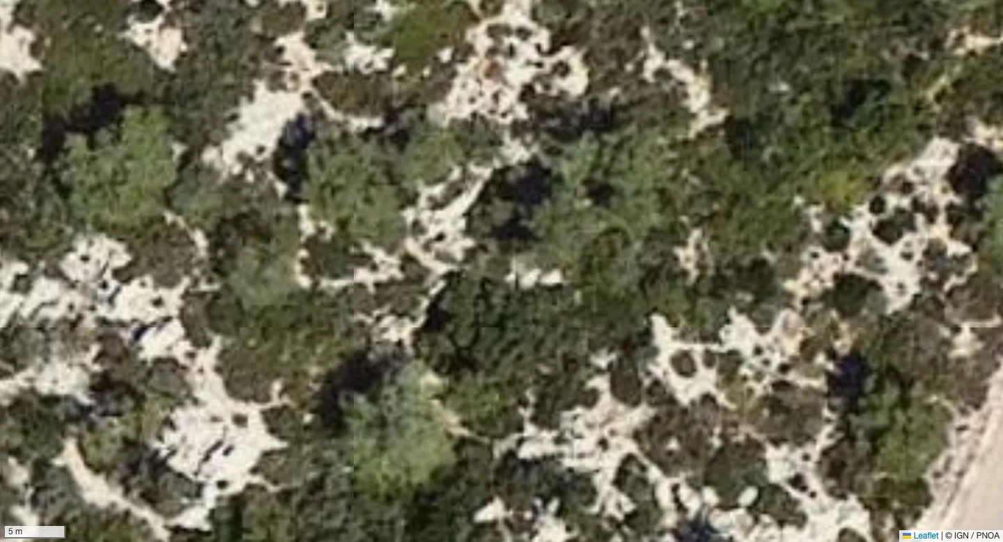
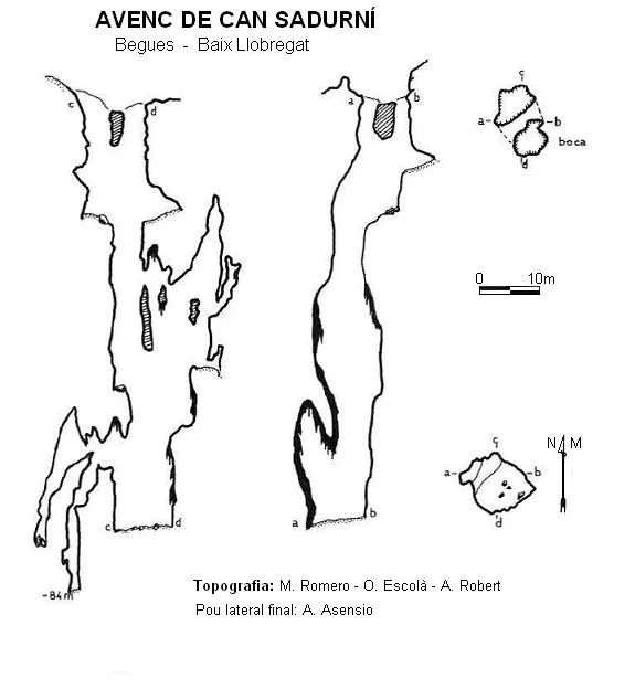
Can Sadurní · a broad opening beneath the trees
Drag the handle, tap either side, or use the arrow keys to compare.
The catalogue describes an entrance about 11 × 6 m, divided by a rock bridge. Near its recorded location, the AMB hillshade shows a distinct hollow with steep edges. The faceted interior is model interpolation, not a survey of the shaft. Published coordinates differ by roughly 20 m between inventories.
50 cm · LiDAR
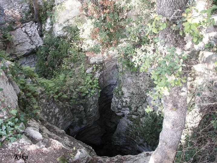
Esquerrà · a smaller shaft in 50 cm terrain
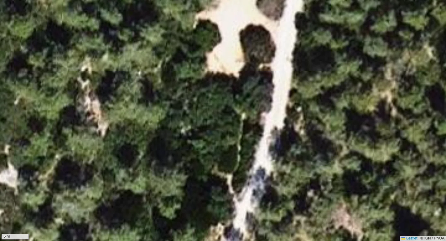
Drag the handle, tap either side, or use the arrow keys to compare.
Esquerrà’s documented entrance is roughly 5 m across. A compact, sharply shaded depression stands out near its coordinates. This is ICGC’s 50 cm terrain: the AMB 25 cm layer has a gap here. Angular interior faces reflect interpolation, not the exact mouth or vertical walls.
Where can I use it?
Coverage varies by provider, not by your language setting. This table describes the connected layers. Zoom is the display range; the highest zooms enlarge existing tiles.
| Region / provider | Grid spacing | Zoom | What is available |
|---|---|---|---|
| Spain · IGN | 2.5 m | 0–21 | 2.5 m surface overview; trees and buildings may remain. |
| Catalunya · ICGC | 50 cm | 12–21 | 50 cm bare-earth terrain, 2021–2023. |
| Barcelona metropolitan area · ICGC | 25 cm | 16–21 | 25 cm bare-earth terrain, 2022; limited to the published raster area. |
| Navarra · IDENA | 50 cm | 12–21 | 50 cm bare-earth hillshade, 2024. |
| France · IGN | 50 cm | 5–21 | 50 cm LiDAR HD; published tiles in mainland France and Corsica, with gaps. |
| North Rhine-Westphalia · Geobasis NRW | 25 cm | 9–21 | 25 cm interpolated terrain grid; statewide coverage. |
| South Tyrol · Province of Bolzano | 2.5 m | 9–21 | 2.5 m LiDAR terrain across the province. |
| South Tyrol valleys · Province of Bolzano | 50 cm | 16–21 | 50 cm valley-floor data from 2013; coarser terrain remains in mountain gaps. |
Coverage checked in November 2026. Boundaries and publication footprints can contain transparent gaps. Spain’s overview remains underneath finer regional layers; South Tyrol’s valley gaps reveal its coarser terrain. The picker hides LiDAR where no supported layer intersects the current view.
25 cm pixels, zoom 21: what does that mean?
25 cm is the terrain grid spacing, not a guarantee of 25 cm measurement accuracy or a detectable 25 cm hole. Point density, vegetation and processing all matter. Zooms 20–21 enlarge native imagery for closer inspection; they add no new measurements. NRW’s 25 cm grid is interpolated.
Reading the terrain carefully
A hollow may be a cave opening, an excavation or a processing artefact. Side-facing entrances can disappear in an overhead terrain model. Check the source record and survey before interpreting a feature; do not infer entrance dimensions or underground depth from these screenshots.