
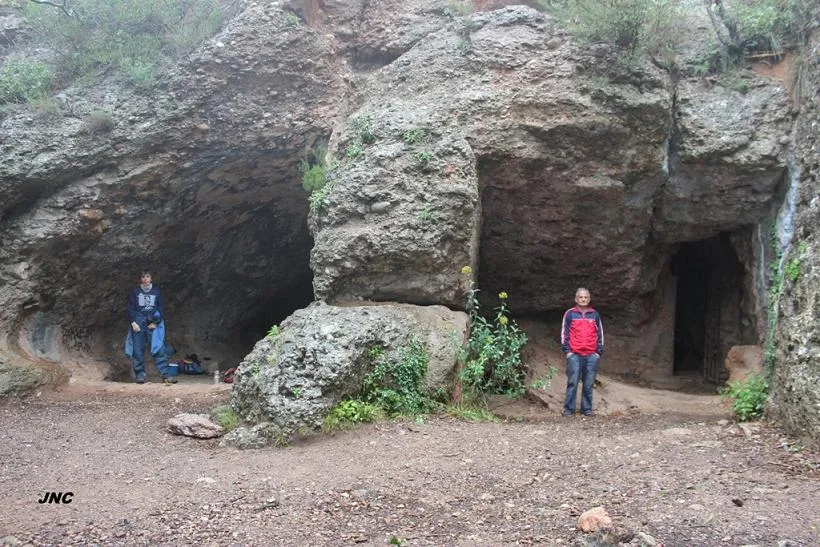
Cova del Frare
Coneguda cova de 80 m. de recorregut a la Canal de Can Pobla (Sant Llorenç del Munt)
EspeleoWorld
Cova del Frare
Coneguda cova de 80 m. de recorregut a la Canal de Can Pobla (Sant Llorenç del Munt)
Matadepera · Vallès Occidental
Length: 80 m
Updated record
https://espeleoworld.com/en/c/cova-del-frare
Information can change. Always verify coordinates, access, weather, and cave conditions before setting out.
An 80 m long cave in the Canal de Can Pobla, in Sant Llorenç del Munt, with a main gallery of 52 m and an important archaeological site from the early Neolithic.
Topographic
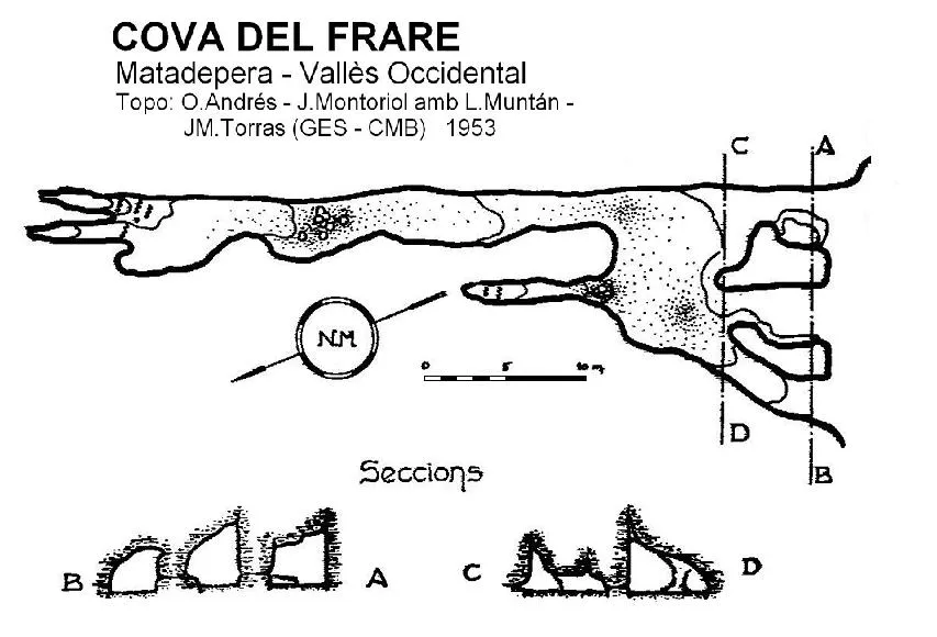

Espeleoindex · CC BY-NC 4.0, https://creativecommons.org/licenses/by-nc/4.0/ · Image © its author.
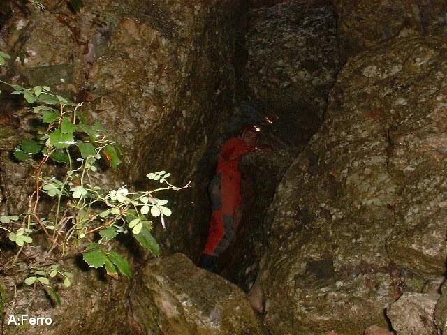
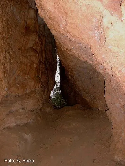
Photos

Espeleoindex · CC BY-NC 4.0, https://creativecommons.org/licenses/by-nc/4.0/ · Image © its author.
Description
Morphology
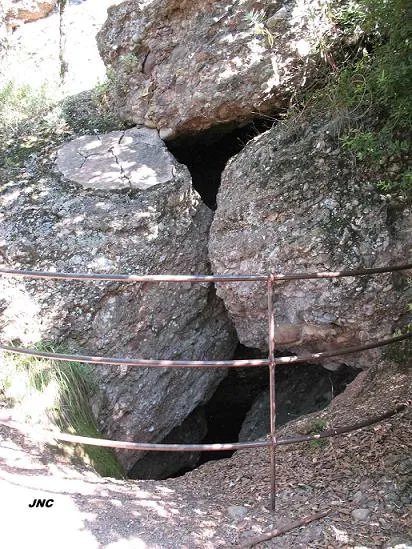
The entrance is of good dimensions and has three access openings, which connect a few metres in to a vestibule. In the easternmost sector of this vestibule the main gallery (NE-SW) of 52 metres in length originates, formed by the intersection of a joint with the bedding plane. Signs of a strong ancient erosive process are observed, masked by a more pronounced lithogenic process in the deepest sector.
Hydrology
It is an ancient spring that would have drained the waters of the southern area of the Mola, which, on their way towards the S, were stopped by the plane of the small dislocation of Can Pobla, thus generating the spring.
Other details
A well-known cave of 80 m in length in the Canal de Can Pobla (Sant Llorenç del Munt).
History
Known since time immemorial. The archaeological site studied (early Neolithic) is one of the most important for understanding human presence in Sant Llorenç del Munt.
Named del Frare because a penitent monk lived there and later Pere Costa, born in la Garriga in the year 1727 and died in Can Pobla in 1816. It had also been called Cau de la Moneda, because of the legend of the Moneders Falsos, although this name is attributed to different cavities, the best known being one of the concavities of the Òbits.
Mentioned in all the old catalogues: Puig y Larraz (1896); Font i Sagué (1897); Faura i Sans (1909). The first description and survey appears in the Guia Monogràfica de Sant Llorenç del Munt, published by the Centre Excursionista de Terrassa (1935). In the 1950s it was the subject of a more careful study, together with the other neighbouring cavities of the Canal de Can Pobla, by members of the GES – CM Barcelonès.
User Comments (0)
No comments yet.
Be the first to share your experience!
Registered Explorations (0)
No explorations registered yet.
Register your visit to this cave!
Bibliography
- GES-CMB (1974).- Catálogo espeleológico de la provincia de Barcelona. 198 pp. Club Montañés Barcelonés /Diputación Provincial de Barcelona.
- Montoriol, J.; Assens, J.; Andrés, O. (1955).- “El funcionamiento hidrológico actual del sistema hipogeo de la Canal de Can Pobla (Sant Llorenç del Munt. Barcelona)” Speleon T. VI (3): 127-154. Universidad de Oviedo.
- Coordenades i fotografies “JNC” facilitades per Navarro (Centre Excursionista de Castellar del Vallès)
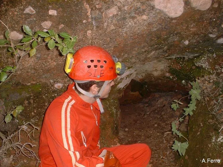
- Altres fotografies facilitades per Antoni Ferro (SIE – CE Àliga, Barcelona)
Nearby caves
Cova del Fondal
0.1 km · NW
Matadepera (Vallès Occidental)
2 topo.4 photos
Cova del Manel
0.1 km · NW
Matadepera (Vallès Occidental)
1 topo.22 photos
Avenc de Can Pobla
0.2 km · N
Matadepera (Vallès Occidental)
1 topo.4 photos
Cova dels Toixons
0.2 km · W
Matadepera (Vallès Occidental)
2 topo.9 photos
Source: Espeleoindex (espeleoindex.com), modified. CC BY-NC 4.0, https://creativecommons.org/licenses/by-nc/4.0/