
Cova de l'Or
Cova amb un desnivell de 14 metres a Castellet i la Gornal.
EspeleoWorld
Cova de l'Or
Cova amb un desnivell de 14 metres a Castellet i la Gornal.
Castellet i la Gornal · Alt Penedès
Length: 56 m · Depth: 14 m
Updated record
https://espeleoworld.com/en/c/cova-de-l-or
Information can change. Always verify coordinates, access, weather, and cave conditions before setting out.
Cave with a drop of 14 metres in Castellet i la Gornal, explored on 10 August 1971 by Angel Lagar and surveyed on 25 November 1973 by the SIRE.
Topographic

Espeleoindex · CC BY-NC 4.0, https://creativecommons.org/licenses/by-nc/4.0/ · Image © its author.
Photos

Espeleoindex · CC BY-NC 4.0, https://creativecommons.org/licenses/by-nc/4.0/ · Image © its author.
Description
Morphology
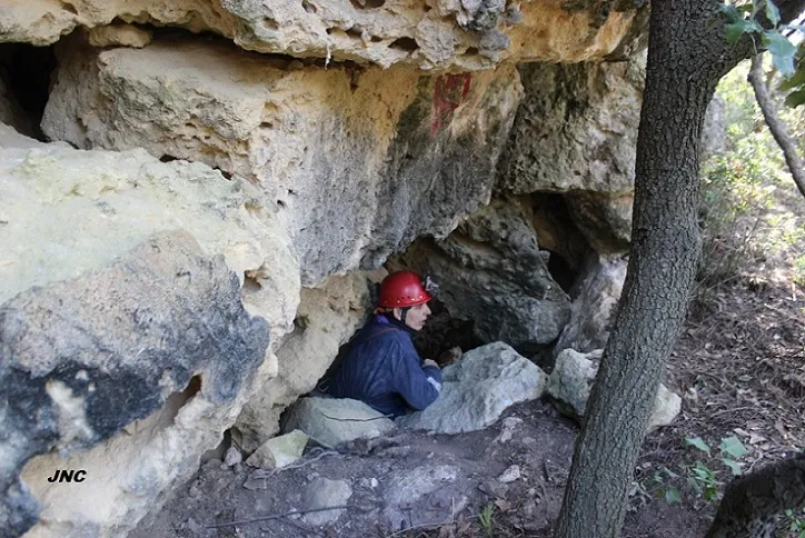
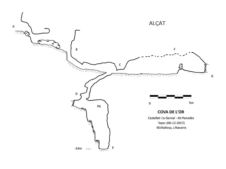
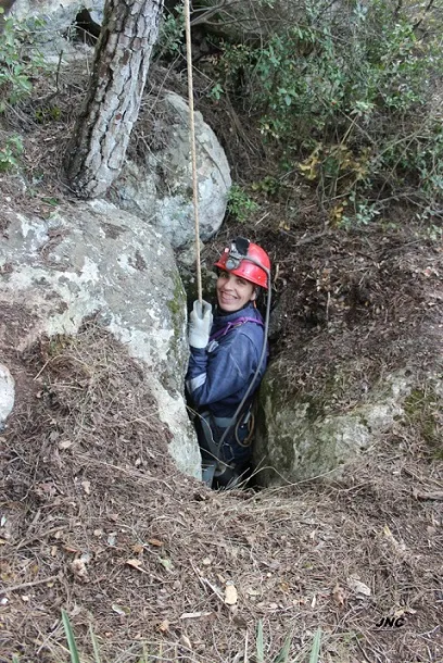
Access to the cavity is via a descending mouth between blocks and which shortly communicates again with the outside in a wide rise of 2.7m.
At the S end of the rise the cavity continues through a narrow crawlway on a pronounced slope and after a change of direction, the crawlway becomes more horizontal and communicates with the horizontal chamber of the cavity.
At the N end of the chamber there is a descending flat-out passage that leads us after some rises, to the shaft of the cavity of about -6m. Some block rises allow us to descend it to the lowest point of the cavity.
To access the S zone of the chamber it can be done by 2 different passages. The first of them is the most direct, through a 32x40cm flat-out passage and the second, after slightly ascending a rise of 1.3m, which communicates with a narrow and high crevice in a SW direction that goes in a few more metres until it ends on crossing with another orthogonal joint.
History
Angel Lagar with the collaboration of Mr Lluís Raspall of l'Arboç, explores the cavity on 10 August 1971.
On 25 November 1973 a team of the SIRE directed by Angel Lagar returns to the cavity to make the survey.
J. Virella in 1978 refers to it in Miscel.lania Penedesenca where he cites it with 16 metres of passage and -11 of depth.
In December 2017 Jordi Navarro and Montse Mañosa (Centre Excursionista Castellar) visit it and survey it for its cataloguing.
User Comments (0)
No comments yet.
Be the first to share your experience!
Registered Explorations (0)
No explorations registered yet.
Register your visit to this cave!
Bibliography
- Lagar, A; Cañelles, J; Torrella, J.(1974).-”Cavidades del Penedès (6ª nota). Senderos (182):21-23.UEC.
- Virella i Bloda, Joan (1978).-”Experiències a l'entorn de la localització d'Estacions Prehistòriques”. Miscel.lania Penedesenca (1):241-269.
- Valles, Jordi de (2023).-”Alt Penedès, Baix Penedès, Garraf, Tarragonès”. Catàleg Espeleològic de Catalunya (Vol.7):508 pp. Espeleo Club Muntanyenc Barcelonès / Federació Catalana d'Espeleologia. Barcelona.
- Butlletí Parroquial (La Veu Parroquiat) Gornal, Clariana i Sant Marçal nº 118 i 119.
- Original fitxa i fotografies facilitades per Jordi Navarro i Montse Mañosa (Centre Excursionista de Castellar del Vallès).
Nearby caves
Cova Petita de l'Or
0.0 km · NW
Castellet i la Gornal (Alt Penedès)
1 topo.3 photos
Coveta Enrassada
0.0 km · S
Castellet i la Gornal (Alt Penedès)
1 topo.3 photos
Avenc d'en Tort
0.0 km · N
Castellet i la Gornal (Alt Penedès)
2 topo.4 photos
Avenc Fals de l'Or
0.0 km · N
Castellet i la Gornal (Alt Penedès)
2 topo.4 photos
Source: Espeleoindex (espeleoindex.com), modified. CC BY-NC 4.0, https://creativecommons.org/licenses/by-nc/4.0/