
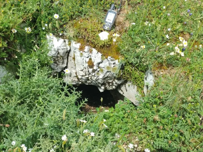
Cavità di Monte Capoccia Pelata
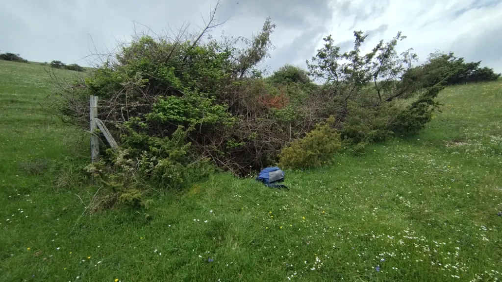
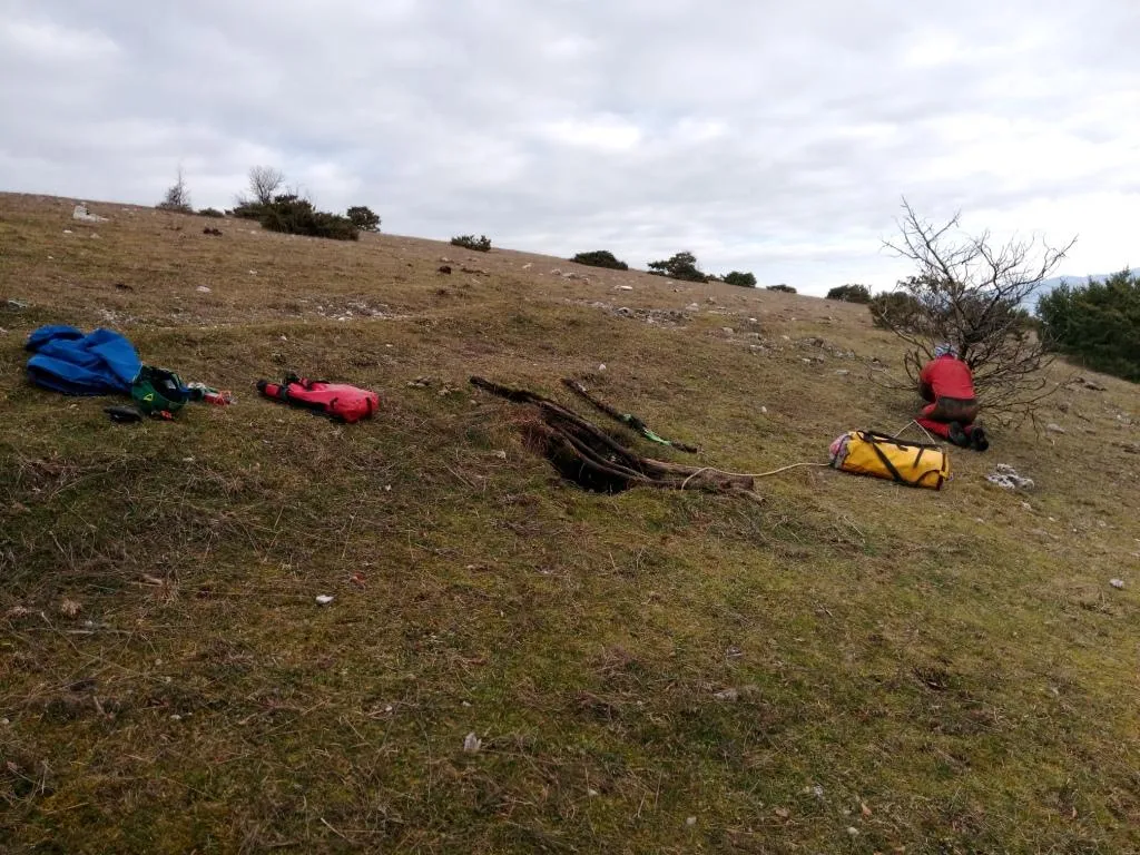
Cave formed on a fault in the Monti Martani, with horizontal development and deepening along the fracture, whose entrance, about 50 cm in diameter, opens in the flat meadow.
EspeleoWorld
Cavità di Monte Capoccia Pelata
Cave formed on a fault in the Monti Martani, with horizontal development and deepening along the fracture, whose entrance, about 50 cm in diameter, opens in the flat meadow.
Spoleto
Length: 45 m · Depth: 17 m
Updated record
https://espeleoworld.com/en/c/cavita-di-monte-capoccia-pelata-spoleto-perugia
Information can change. Always verify coordinates, access, weather, and cave conditions before setting out.
Cave formed on a fault in the Monti Martani, with horizontal development and deepening along the fracture, whose entrance, about 50 cm in diameter, opens in the flat meadow.
Topographic
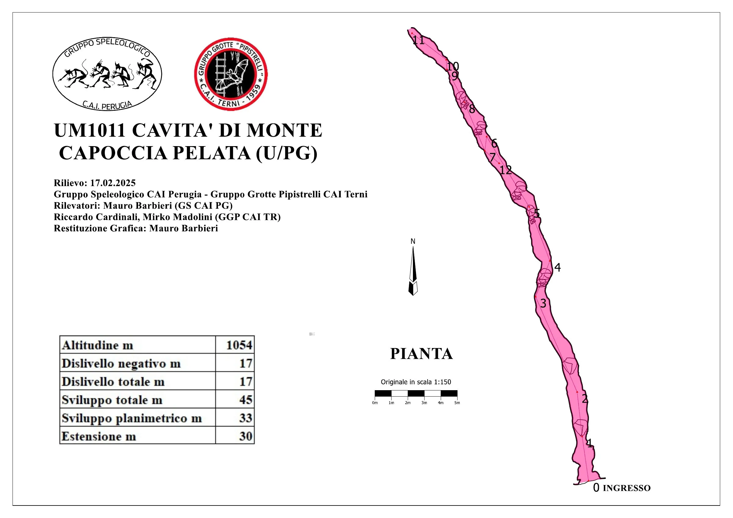
© Mauro Barbieri · CC BY-SA 4.0, https://creativecommons.org/licenses/by-sa/4.0/ · Federazione Umbra Gruppi Speleologici (FUGS), Catasto Speleologico dell'Umbria · https://catasto.fugs.it/index.php?mod=caves&op=view&id=1011
Photos
© Mauro Barbieri · LicenseRef-FUGS-media-per-item · Federazione Umbra Gruppi Speleologici (FUGS), Catasto Speleologico dell'Umbria · https://catasto.fugs.it/index.php?mod=caves&op=view&id=1011
Description
Morphology
Fissure formed on a fault with horizontal development but with deepening that follows the fracture, currently impassable but with the possibility of clearing and widening. Trend: horizontal/vertical. The cave develops within the Maiolica formation (Upper Jurassic-Lower Cretaceous, Tithonian-Aptian), stratified micritic limestones, along a tectonic structure with a north-western trend (about 330°). The fault within which the cave develops is directly connected to the tectonic system that develops in the Fosso di Pozzale valley and that gave rise to the other caves (Pozzale, Pozzicola and Pozzicoletto).
Speleothems
Abundant presence of moonmilk along the walls.
Hydrology
No significant air flows were detected - 2018. Water difficulties: other water-related.
Progression
Traversability: experts only; recommended period all year round. Progression difficulty: pits, narrow passages, traverses. Rigging: temporary; an aerial traverse must be rigged along the fracture since the cave is made slippery by the abundant presence of moonmilk on the walls. Hazards: dangerous access.
History
Notes on the name: it takes its name from the mountain of the same name.
Bio
Bats: certainly present given the presence of guano on 17/02/2025.
User Comments (0)
No comments yet.
Be the first to share your experience!
Registered Explorations (0)
No explorations registered yet.
Register your visit to this cave!
Bibliography
LOTTI B. (1917) Il gruppo montuoso del Monte Martano MONTANARI R. (1940) I Monti Martani FAMIANI F. & CARDINALI R. (2018) Esplorazioni Monti Martani Gennaio-Febbraio 2018
Nearby caves


Source: Catasto Cavità Umbria (Federazione Umbra Gruppi Speleologici, FUGS) (catasto.fugs.it), modified. LicenseRef-FUGS-no-licence-stated Federazione Umbra Gruppi Speleologici (FUGS), Catasto Speleologico dell'Umbria · https://catasto.fugs.it/index.php?mod=caves&op=view&id=1011 · data as of 2025 · Source: Catasto Cavità Umbria (Federazione Umbra Gruppi Speleologici, FUGS) (catasto.fugs.it), modified. LicenseRef-FUGS-media-per-item Federazione Umbra Gruppi Speleologici (FUGS), Catasto Speleologico dell'Umbria · data as of 2025