
Tuta de Sota el Castell
Petita cova de 23 metres de recorregut sota el Castell de Rocabruna (Camprodon)
EspeleoWorld
Tuta de Sota el Castell
Petita cova de 23 metres de recorregut sota el Castell de Rocabruna (Camprodon)
Camprodon · Ripollès
Length: 23 m · Depth: 3 m
Updated record
https://espeleoworld.com/en/c/tuta-de-sota-el-castell
Information can change. Always verify coordinates, access, weather, and cave conditions before setting out.
Small cave with a passage of 23 metres beneath the Castell de Rocabruna (Camprodon), with two entrances that currently connect through a very tight passage.
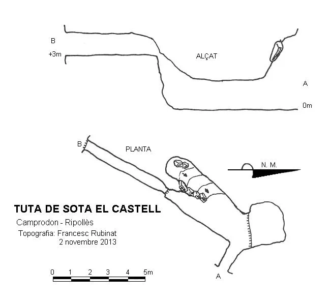
Topographic
Espeleoindex · CC BY-NC 4.0, https://creativecommons.org/licenses/by-nc/4.0/ · Image © its author.
Photos
Espeleoindex · CC BY-NC 4.0, https://creativecommons.org/licenses/by-nc/4.0/ · Image © its author.
Description
Morphology
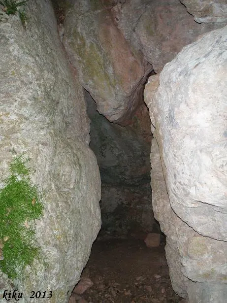
The entrance gives access to a perpendicular gallery. To the right, a rise of +0.80 metres allows us to access a short gallery of 2.50 metres. On the left side we find that the gallery divides: the right-hand one climbs in a slope and ends at 5.40 metres, while the left-hand one has a passage of 5.08 metres; at the end of this one, and by means of a very narrow passage in the ceiling, it connects with a gallery of 4.85 metres that leads back out to the exterior.
History
Known since time immemorial by the people of the area, they were explored in 1931 by Manuel Bassa i Armengol (Centre Excursionista Catalunya). He mentions these two caves of Sota el Castell, but indicates that they do not connect. We do not know whether anyone has cleared them since then, but currently both connect, although the passage is very tight.
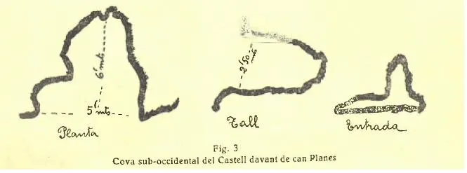
In the Catàlegs Espeleològics de Catalunya (Borràs-Miñarro-Talavera Vol.4, 1981 and J. De Valles Vol.3, 2009), this cavity appears catalogued with a topographic sketch by Manuel Bassa (1931) that does not correspond to this cavity; we assume that a confusion arose in the interpretation of Manuel Bassa's text, since in reality the sketch corresponds to a cavity that Bassa calls “Cova sub-occidental del Castell davant de can Planes”, and which appears in these catalogues as “Tuta nº 4 del Castell de Rocabruna”.
User Comments (0)
No comments yet.
Be the first to share your experience!
Registered Explorations (0)
No explorations registered yet.
Register your visit to this cave!
Bibliography
- Bassa i Armengol, Manuel. (1932).-”Rocabruna”. Butlletí del Centre Excursionista Catalunya (449):293-308. Centre Excursionista de Catalunya.
- Borràs,J;Miñarro,JM;Talavera,F.(1980).-”el Ripollès, la Garrotxa i l'Alt Empordà” Catàleg Espeleològic de Catalunya (vol.4):1-296. ed. Políglota. Barcelona.
- Freixa Sala, Jordi. Wikiloc.Rocabruna-Castell i Baumes. Ruta pujada el 7 de juny 2013.
Nearby caves



Source: Espeleoindex (espeleoindex.com), modified. CC BY-NC 4.0, https://creativecommons.org/licenses/by-nc/4.0/