
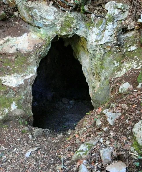
Tuta d'Escales
Cavitat de 36 metres de recorregut a Montagut i Oix.
EspeleoWorld
Tuta d'Escales
Cavitat de 36 metres de recorregut a Montagut i Oix.
Montagut i Oix · Garrotxa
Length: 34 m · Depth: 10 m
Updated record
https://espeleoworld.com/en/c/tuta-d-escales
Information can change. Always verify coordinates, access, weather, and cave conditions before setting out.
A cavity with 36 metres of passage in Montagut i Oix, known since ancient times and surveyed in 1989.
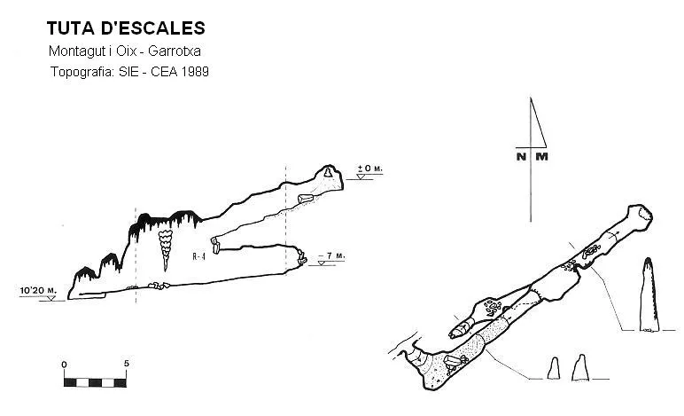
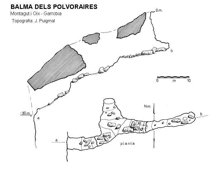
Topographic
Espeleoindex · CC BY-NC 4.0, https://creativecommons.org/licenses/by-nc/4.0/ · Image © its author.
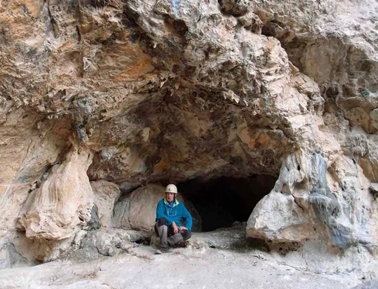
Photos
Espeleoindex · CC BY-NC 4.0, https://creativecommons.org/licenses/by-nc/4.0/ · Image © its author.
Description
Morphology
A 1.7x1 metre entrance gives access to a descending gallery that leads us to the head of a 4 metre drop; at its base we find a gallery that continues in both directions. Following the gallery in a NW direction, we must pass through a narrow passage formed by some flowstone; next the gallery continues with a height that varies because of some small boulders along its route, finally reaching a chamber whose floor is formed by a false floor made of stalagmitic flowstone.
Returning to the base of the drop, we will follow the gallery in the opposite direction, finding it blocked after a few metres by an accumulation of blocks.
Speleothems
The floor of the final chamber is formed by a false floor made of stalagmitic flowstone.
History
It seems that despite being known since ancient times, no data about it were known until it appeared referenced in the Alpina map in the 1973 edition. In 1980 a brief note appears in Volume 4 of the Catàleg Espeleològic de Catalunya, without providing more information. In 1989, the SIE del CE Àliga, accompanied by Mr. Àngel Arias who shows them where the cavity is located, explore it and make the survey of it.
User Comments (0)
No comments yet.
Be the first to share your experience!
Registered Explorations (0)
No explorations registered yet.
Register your visit to this cave!
Bibliography
- Borràs,J;Miñarro,JM;Talavera,F.(1980).-”el Ripollès, la Garrotxa i l'Alt Empordà” Catàleg Espeleològic de Catalunya (vol.4):1-296. ed. Políglota. Barcelona.
- Juderias, J.C.(1998).-”Tuta d'Escales (Alta Garrotxa)”. EspeleoSie (33):8-9. SIE-CE Àliga. Barcelona.
- Revisió de coordenades, situació i fotografia extretes del web: geb.cat (del Grup d'Espeleologia de Badalona). Apunt del 7-8-2019. Dades: Ferran Cardona (Espeleo Club Muntanyenc Barcelonès)
Nearby caves


Source: Espeleoindex (espeleoindex.com), modified. CC BY-NC 4.0, https://creativecommons.org/licenses/by-nc/4.0/