
Graller Nº2 de la Pardina
Esquerda de 14 metres de fondària al Montsec de Viudà (Àger)
EspeleoWorld
Graller Nº2 de la Pardina
Esquerda de 14 metres de fondària al Montsec de Viudà (Àger)
Àger · Noguera
Length: 65 m · Depth: 14 m
Updated record
https://espeleoworld.com/en/c/graller-n-2-de-la-pardina
Information can change. Always verify coordinates, access, weather, and cave conditions before setting out.
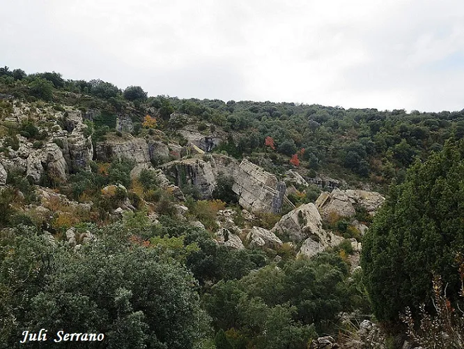
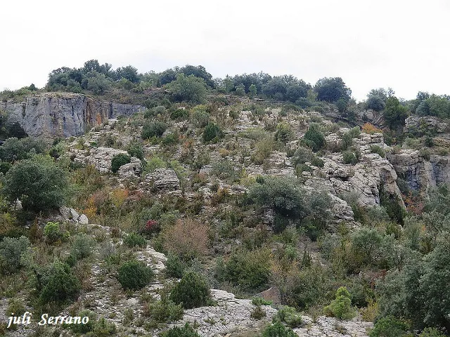
A 14-metre-deep fissure at Montsec de Viudà (Àger), at the head of the barranc de la Pardina, known as los Grallers.
Topographic
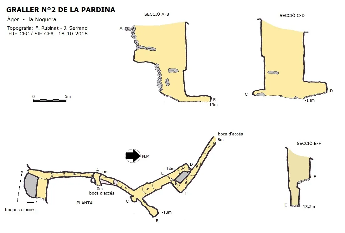
Espeleoindex · CC BY-NC 4.0, https://creativecommons.org/licenses/by-nc/4.0/ · Image © its author.
Photos
Espeleoindex · CC BY-NC 4.0, https://creativecommons.org/licenses/by-nc/4.0/ · Image © its author.
Description
Morphology
It is a fissure that runs mostly under open sky. If we enter by the highest point, we descend a one-metre drop that will place us inside the fissure; in a N direction we find a series of drops that must be rigged to descend, which place us at the top of a slope of stones; at the end of the slope we find a small conduit that ends in a small chamber; again at the end of the slope the fissure turns to the left until reaching the deepest point at -14 metres, here we find a conduit that immediately turns to the right and is blocked by some blocks through which light is visible but which prevent connection with another part of the fissure.
Positioned again inside the drop of the highest point, if we head S, we must descend a small drop followed by a slope and a hole-riddled passage where we find a junction; if we continue straight on we will come out of the fissure in an area of large blocks which form a kind of square full of vegetation and which is quite impassable. Positioned again at the junction, on the left we must climb a drop and immediately we will come out to the exterior by another point of this square full of large blocks and vegetation.
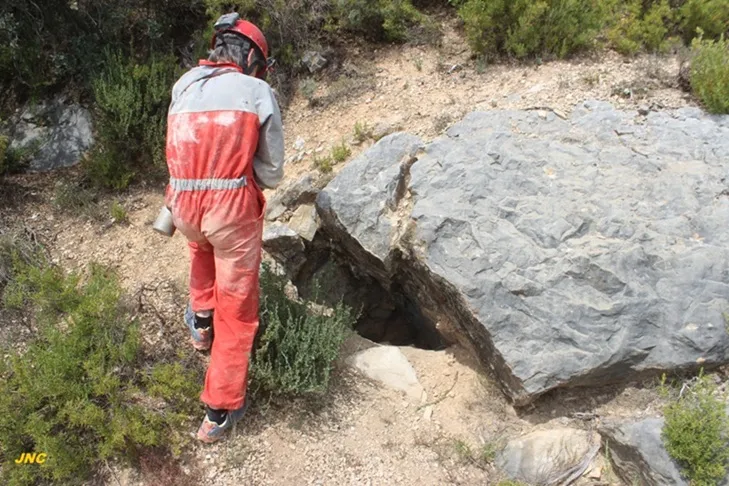
If we enter by the lower part of the cavity, located a little higher up than the graller no. 1, we will access by a fissure that descends where at the end of it there are some blocks on the right that prevent passing through the aforementioned passage; continuing straight on the fissure rises and turns to the right, where we find a 4-metre pit, at the base of which we find the lowest point of the aforementioned fissure.
Progression
It can be accessed by two points. If we enter by the highest point, we will descend a one-metre drop that will place us inside the fissure; in a N direction we find a series of drops that must be rigged to descend.
If we enter by the lower part of the cavity, located a little higher up than the graller no. 1, we will access by a fissure that descends; continuing straight on the fissure rises and turns to the right, where we find a 4-metre pit.
History
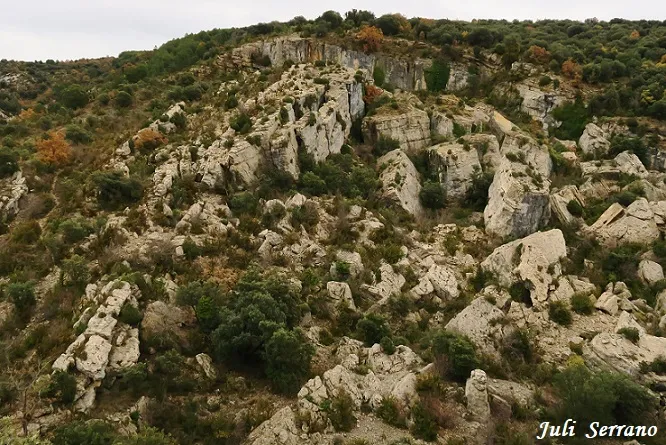
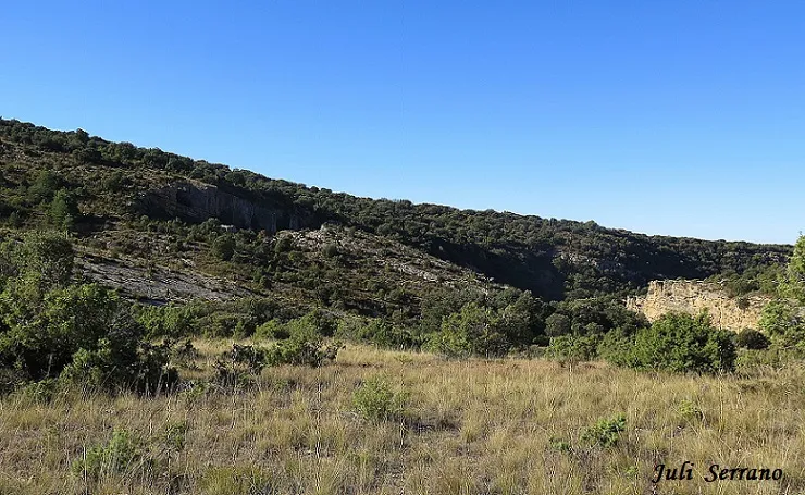
It is a very fractured area with fissures and large blocks at the head of the barranc de la Pardina, at the confluence with the barranc de Pedroneta. Known of old in the area, they are known as los Grallers; GEFOMA locates them in the course of the 70s of the last century, but does not manage to explore them. In recent years, on the crag that closes the barranc on the hydrographic left bank, several climbing routes have been opened.
In some hiking guides they are erroneously called els Amorriadors or Amorridors. To be correct, this toponym should be placed outside the barranc, a hundred metres further to the NE, where there is an area of large trees and water.
Toponymy:
- Amorriador: Place where livestock rest at midday.
- Amorriar: To gather wool livestock at midday in a shaded place.
(diccionari de la llengua catalana), (Viccionari).
User Comments (0)
No comments yet.
Be the first to share your experience!
Registered Explorations (0)
No explorations registered yet.
Register your visit to this cave!
Bibliography
- Dades inèdites facilitades per Juli Serrano (SIE-CEA) i Francesc Rubinat (ERE-CEC).
Nearby caves


Source: Espeleoindex (espeleoindex.com), modified. CC BY-NC 4.0, https://creativecommons.org/licenses/by-nc/4.0/