
Espluga del Feixar
Shelter carved at Cap del Pla (Lladurs), known since time immemorial and used as a dwelling.
EspeleoWorld
Espluga del Feixar
Shelter carved at Cap del Pla (Lladurs), known since time immemorial and used as a dwelling.
Lladurs · Solsonès
Length: 5 m
Updated record
https://espeleoworld.com/en/c/espluga-del-feixar
Information can change. Always verify coordinates, access, weather, and cave conditions before setting out.
Shelter carved at Cap del Pla (Lladurs), known since time immemorial and used as a dwelling.
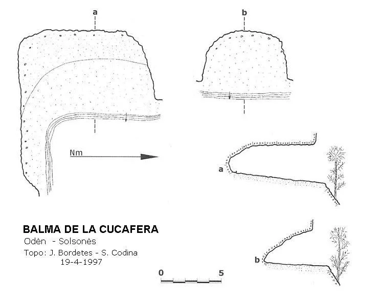
Topographic
Espeleoindex · CC BY-NC 4.0, https://creativecommons.org/licenses/by-nc/4.0/ · Image © its author.
Photos
Espeleoindex · CC BY-NC 4.0, https://creativecommons.org/licenses/by-nc/4.0/ · Image © its author.
Description
Morphology
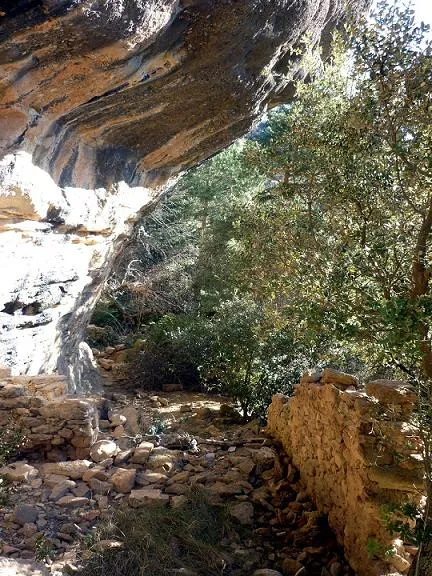
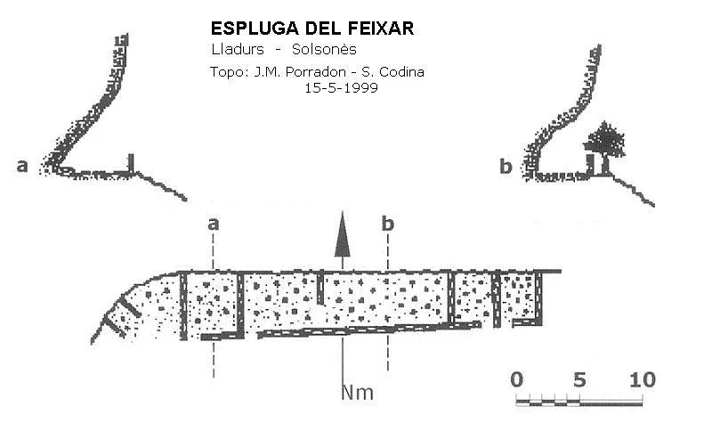
The shelter is more than 30 metres wide, 5 metres high at the entrance and 5 metres deep. It is oriented to the S, protected from wind and rain, with a splendid view over the Cap del Pla.
Speleothems
We will still find a roof tile, a squared-off rock and a Travertine rock in the middle of the rubble.
Hydrology
On the easternmost side there is a waterfall from a small torrent that they used to collect rainwater.
Other details
Currently gorse and brambles are invading it without mercy.
History
Known since time immemorial, it was used as a dwelling. On the ICGC map it appears cited as Espluga del Freixar.
User Comments (0)
No comments yet.
Be the first to share your experience!
Registered Explorations (0)
No explorations registered yet.
Register your visit to this cave!
Bibliography
- Codina, Salvador.(2002).-”Balma de la Gaita”. Corriol (127):10-11. Centre Excursionista del Solsonès.
- Valles, Jordi de. (2009).-”Alt Urgell, Noguera, Pla d'Urgell, Segarra, Solsonès, Urgell” Catàleg Espeleològic de Catalunya (2):315. EC Gràcia/FCE.
- Foto de Isidre Blanc, extreta de Mapio.net
Nearby caves



Source: Espeleoindex (espeleoindex.com), modified. CC BY-NC 4.0, https://creativecommons.org/licenses/by-nc/4.0/