Bauma de l'Enruador

Balma a l'obaga d'Isanta (Lladurs), explored by Salvador Codina on 31-05-2008.

Lladurs • Solsonès 8m 3m

Balma a l'obaga d'Isanta (Lladurs), explored by Salvador Codina on 31-05-2008.

Characteristics

Location

Balma a l'obaga d'Isanta (Lladurs).

From Solsona we will follow the LV-4241b road to the Hostal del Cap del Pla, from here we will follow the GR-7, in a NE direction, until we reach a clearing crossed by a forest track. We will go down this track to the left in a N direction, cross the head of the torrent de Font Ferrera, and on a bend we will find on the left a flat area with a pile of rocks grouped in the middle, with a sign to go and see els Rocs basculants de les Gaites.

We will continue going down, cross another torrent and, levelling out, we will find a first balma with a stone wall that was used as a corral. A few metres further on, we will find the main remains of the collapsed walls of the house that had been used as a dwelling at l'Espluga del Feixar, covered by holm oaks and box trees.

We will continue along the path going up to the ridge, Tossal de la Bandera. Below the casa de les Gaites there is a channel called del Duc because there is a cave in the middle of the wall where this nocturnal bird had its nest. We will continue going down the other slope, little by little the path becomes a narrow trail, after a crossroads, a few metres further on we will find the bauma de les Mascarelles, we will turn left following a small narrow trail that little by little descends the slope passing through a ridge, formerly protected by trunks held with iron stakes driven into the rock to be able to pass with loaded animals, this passage called el mal pas because of its difficulty. We will continue going down leaving the narrow trail on the right that goes down to the casa del Martí, currently in ruins. A few metres further on we will find the balma above the path.

Coordinates without much precision.

Map

Entrances

Always verify coordinates and access conditions before setting out.

  1. Enruador, Bauma de L'

    Elevation: 1105 m

    42.098536, 1.517308
    UTM 31T (ETRS89) 377395 4661780
Download all entrances as GPX

Description

Morphology

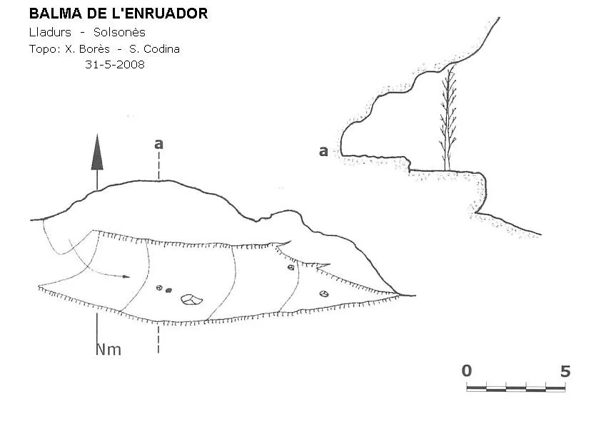
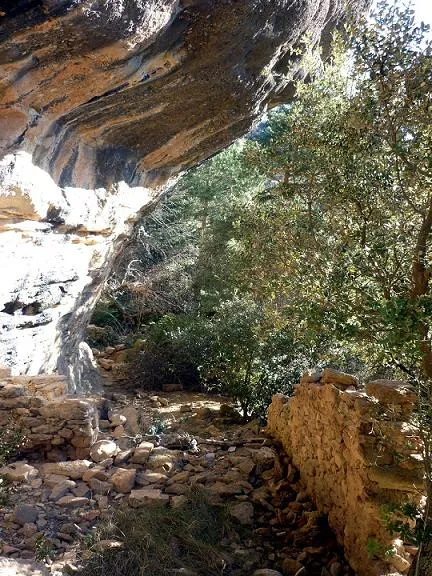
It is a wide stepped balma, it is about 15 metres wide by 8 metres high which decreases to 1 metre at the back, the route is 8 metres.

History

The only references we have are from the exploration carried out by Salvador Codina on 31-05-2008.

User Comments (0)

No comments yet.

Be the first to share your experience!

Registered Explorations (0)

No explorations registered yet.

Register your visit to this cave!

Bibliography

  1. Valles, Jordi de (2008).-”Alt Urgell, Noguera, Pla d'Urgell, Segarra, Solsonès, Urgell”. Catàleg Espeleològic de Catalunya (vol.2):1-384. ECG/FCE.

Source: Espeleoindex (espeleoindex.com), modified. CC BY-NC 4.0, https://creativecommons.org/licenses/by-nc/4.0/