
Cova Ii de Fotedera
Sea cave with a 42 m passage at Tossa de Mar (Selva), explored in August 1980 by members of SIS – CE Terrassa.
EspeleoWorld
Cova Ii de Fotedera
Sea cave with a 42 m passage at Tossa de Mar (Selva), explored in August 1980 by members of SIS – CE Terrassa.
Tossa de Mar · Selva
Length: 42 m
Updated record
https://espeleoworld.com/en/c/cova-ii-de-fotedera
Information can change. Always verify coordinates, access, weather, and cave conditions before setting out.
Sea cave with a 42 m passage at Tossa de Mar (Selva), explored in August 1980 by members of SIS – CE Terrassa.
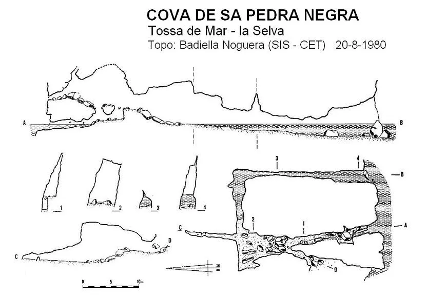
Topographic
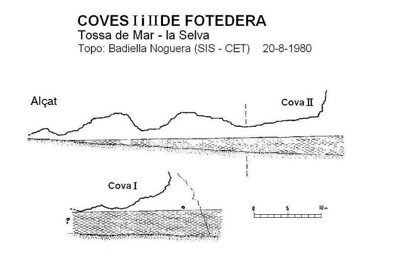
Espeleoindex · CC BY-NC 4.0, https://creativecommons.org/licenses/by-nc/4.0/ · Image © its author.
Description
Morphology
The entrance is 3 metres high, 2.5 deep under water and 1 metre wide, although under water it widens to 3 metres.
Hydrology
The water depth decreases along the passage.
Progression
The passage continues to 10 metres, where it turns to the left, remaining parallel to the nearby cave I. The water depth then decreases, until reaching a small final beach, where the cave narrows and passage becomes impossible.
History
The only reports we have are those published by members of SIS – CE Terrassa who explored it in August 1980.
When these caves were published, the place name of the cove where they are located was Futadera and it was later standardised to Fotedera.
User Comments (0)
No comments yet.
Be the first to share your experience!
Registered Explorations (0)
No explorations registered yet.
Register your visit to this cave!
Bibliography
- Badiella, Eduard; Badiella, Xavier; Badiella, Enric (1982).- “Les cavitats del litoral de la comarca de la Selva”. SIS (9): 37-64 / Arxiu del Centre Excursionista de Terrassa (29): 577-604. Terrassa.
Nearby caves

Source: Espeleoindex (espeleoindex.com), modified. CC BY-NC 4.0, https://creativecommons.org/licenses/by-nc/4.0/