
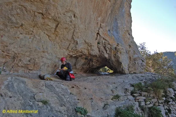
Cova del Bisbe
A 56-metre-long cave in Sales de Llierca, with a single gallery and a Middle Palaeolithic site.
EspeleoWorld
Cova del Bisbe
A 56-metre-long cave in Sales de Llierca, with a single gallery and a Middle Palaeolithic site.
Sales de Llierca · Garrotxa
Length: 56 m · Depth: 5 m
Updated record
https://espeleoworld.com/en/c/cova-del-bisbe
Information can change. Always verify coordinates, access, weather, and cave conditions before setting out.
A 56-metre-long cave in Sales de Llierca, with a single gallery and a Middle Palaeolithic site.
Topographic
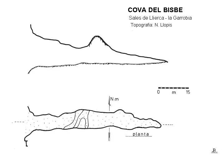
Espeleoindex · CC BY-NC 4.0, https://creativecommons.org/licenses/by-nc/4.0/ · Image © its author.
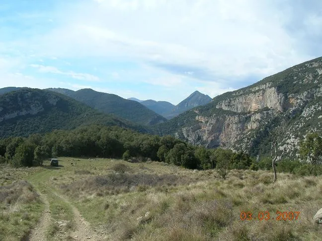
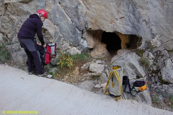
Photos
Espeleoindex · CC BY-NC 4.0, https://creativecommons.org/licenses/by-nc/4.0/ · Image © its author.
Description
Morphology
Formed by a single gallery slightly ascending in its first half and then continuing practically flat until the end. The first section has a fairly high ceiling, 10 or 12 metres; but a little beyond the halfway point of the route, the ceiling gradually lowers until it meets the floor. The entrance-to-end route (elevation A-B) calculated from the most recent and most accurate survey gives a total of 56 m. Until now it was credited with a route of 68 m.
History
Known since time immemorial. Puig i Larraz already mentions it in 1896 and Norbert Font i Sagué includes it in 1897 in the Catálech Espeleològich de Catalunya.
It is a Middle Palaeolithic site, excavated in 1933 and 1969.
According to a popular legend, it is said that a bishop of Perpinyà had been hidden there. Another legend refers to some Christians hidden from the Muslim invasion.
User Comments (0)
No comments yet.
Be the first to share your experience!
Registered Explorations (0)
No explorations registered yet.
Register your visit to this cave!
Bibliography
- Borràs,J;Miñarro,JM;Talavera,F.(1980).-”el Ripollès, la Garrotxa i l'Alt Empordà” Catàleg Espeleològic de Catalunya (vol.4):216-217. ed. Políglota. Barcelona.
- Valles, Jordi de(2009).-”Berguedà, Cerdanya, Garrotxa, Ripollès” Catàleg Espeleològic de Catalunya (vol.3):215-216. EC Gràcia / FCE.
- Topografia (2021) i fotografies, facilitades per Toni Inglès i Alfred Montserrat (ERE – CEC). Novembre 2021
Nearby caves


Source: Espeleoindex (espeleoindex.com), modified. CC BY-NC 4.0, https://creativecommons.org/licenses/by-nc/4.0/