
Cova S'Espasa
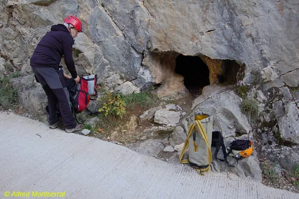
A 34-metre-long cave in Montagut i Oix, northwest of Sadernes, on a cliff above the riera d'Escales.
EspeleoWorld
Cova S'Espasa
A 34-metre-long cave in Montagut i Oix, northwest of Sadernes, on a cliff above the riera d'Escales.
Montagut i Oix · Garrotxa
Length: 34 m · Depth: 5 m
Updated record
https://espeleoworld.com/en/c/cova-s-espasa
Information can change. Always verify coordinates, access, weather, and cave conditions before setting out.
A 34-metre-long cave in Montagut i Oix, northwest of Sadernes, on a cliff above the riera d'Escales.
Topographic
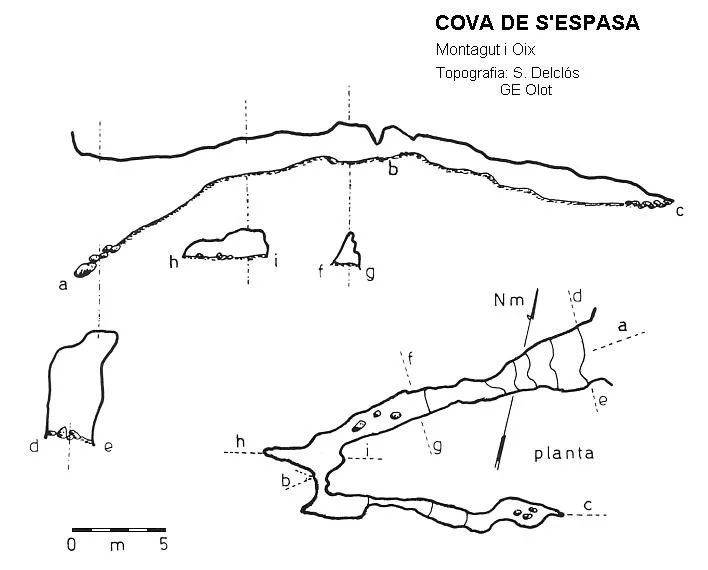
Espeleoindex · CC BY-NC 4.0, https://creativecommons.org/licenses/by-nc/4.0/ · Image © its author.
Description
Morphology
Through an entrance a little more than 5 metres high, one enters an ascending gallery that quickly loses height until it becomes a passage of small dimensions and almost horizontal. A few metres further on it makes a bend, gaining width and a little height, but it narrows again and the gallery turns almost 180º, continuing narrow and slightly descending until it is choked by sediments.
Progression
To reach the cave it is necessary to descend by rappel from the upper part.
History
Explored by the GE Olot in the first half of the 70s of the last century.
User Comments (0)
No comments yet.
Be the first to share your experience!
Registered Explorations (0)
No explorations registered yet.
Register your visit to this cave!
Bibliography
- Borràs,J;Miñarro,JM;Talavera,F.(1980).-”el ripollès, la garrotxa i l'alt empordà” Catàleg Espeleològic de Catalunya (vol.4):1-296. ed. Políglota. Barcelona.
Nearby caves

Source: Espeleoindex (espeleoindex.com), modified. CC BY-NC 4.0, https://creativecommons.org/licenses/by-nc/4.0/