
Cova de Coll Roig
An ascending cave with 35 m of passage in Montagut i Oix (Garrotxa), known as cova de Coll Roig or cova del Celler.
EspeleoWorld
Cova de Coll Roig
An ascending cave with 35 m of passage in Montagut i Oix (Garrotxa), known as cova de Coll Roig or cova del Celler.
Montagut i Oix · Garrotxa
Length: 35 m · Depth: 16 m
Updated record
https://espeleoworld.com/en/c/cova-de-coll-roig
Information can change. Always verify coordinates, access, weather, and cave conditions before setting out.
An ascending cave with 35 m of passage in Montagut i Oix (Garrotxa), known as cova de Coll Roig or cova del Celler.
Topographic
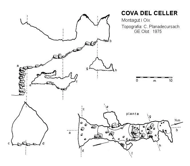
Espeleoindex · CC BY-NC 4.0, https://creativecommons.org/licenses/by-nc/4.0/ · Image © its author.
Photos
Espeleoindex · CC BY-NC 4.0, https://creativecommons.org/licenses/by-nc/4.0/ · Image © its author.
Description
Morphology
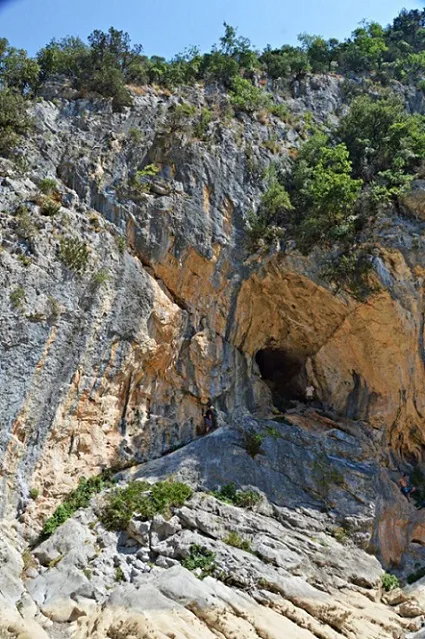
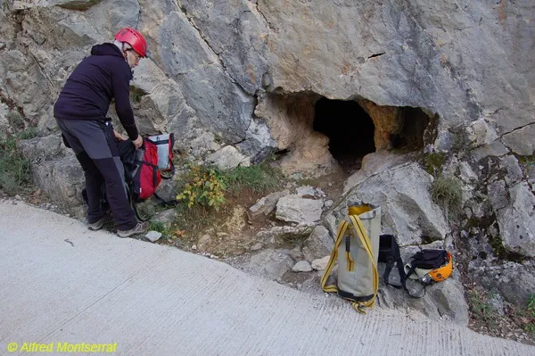
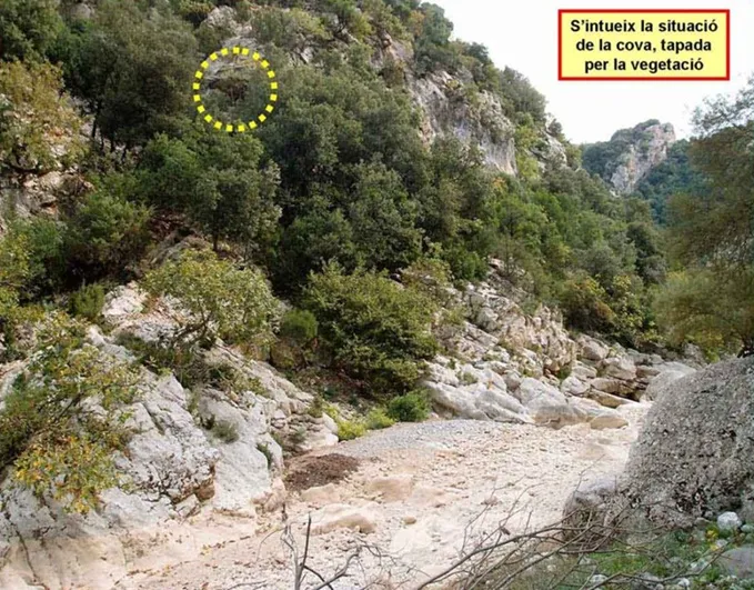
The entrance is 10 m high by 6 m wide. It is hanging about 10 metres above the riera d'Escales; fortunately a narrow ledge on the left side allows us to reach it without much difficulty.
The initial dimensions quickly diminish. The whole cavity has an ascending layout until reaching the terminal small chamber where it widens slightly, but above all the height of the ceiling increases as a consequence of the existence of some aven-like shafts. Almost halfway along the gallery there are two branches on either side, the left one is the most important, with a shaft that places the ceiling at 5 m, while the right one is small and narrow.
The cavity presents a clear erosion-corrosion morphology, although it has been partially masked by a relatively developed lithogenic process, as well as by the existence of blocks of regular size.
Speleothems
The cavity has been partially masked by a relatively developed lithogenic process.
Hydrology
The riera d'Escales, very wide and covered with blocks and good-sized cobbles, can often be dry.
Progression
From Sadernes, where the track that goes up the riu Llierca begins (further upstream, riera de Sant Aniol), after walking about 2 km we will reach the parking area marked with the number 3. Here a small path starts on the left that heads for the riverbed (often dry) that is very close to us. We will cross it and continue on the other side, now climbing steeply, until we reach coll Roig, which forms the divide between the rieres de Sant Aniol and d'Escales. All that we have climbed we will now have to descend on the other slope, making some switchbacks, until we reach the bed of the riera de Escales. We will go up the bed about 200 m and very soon we will see the large cave entrance, on the left hydrographic bank and hanging about 10 m above the level of the gravel of the riera. A narrow ledge on the left side allows us to reach it without much difficulty.
Other details
The cave has been known since time immemorial given the large size of the entrance and because it is clearly visible beside the itinerary that runs along the bed of the riera d'Escales.
History
The first and so far only published survey was made by the G.E. d'Olot in 1975. However, some confusion has arisen around its name.
Everyone knows this cavity by the name cova de Coll Roig, since it appears under that name in the description of the hiking itineraries that run through the area. And this name also appears on the Editorial Alpina map.
But the G.E. d'Olot, when making the survey, called it “Cova del Celler”, and thus it was published in the speleological catalogue of Catalonia by Borràs-Miñarro-Talavera (Vol.-4, year 1980). And thus it also appeared published in the more recent catalogue by Jordi de Valles (Vol.-3, year 2009). In the latter, the cova de Coll Roig is also listed, without a survey, of which it is limited to saying that it is on the left bank of the riera d'Escales. In reality, cova del Celler and cova de Coll Roig are the same cavity.
It may have contributed to the confusion that in the vicinity of coll Roig there is the so-called “Celler de les Monges”, a kind of rock shelter or overhang with remains of buildings where climbers usually practise. Further away from the area, towards the west, there is the so-called “Celler de la Manllada”, a fairly important rock shelter.
To add further confusion, on the ICGC map the name “Cova de les Cabres” appears labelled.
Note from Espeleoindex: This record replaces (December 2019) the one that until now we had catalogued as Cova del Celler.
User Comments (0)
No comments yet.
Be the first to share your experience!
Registered Explorations (0)
No explorations registered yet.
Register your visit to this cave!
Bibliography
- Borràs, J; Miñarro, JM; Talavera,F.(1980).- ”el Ripollès, la Garrotxa i l'Alt Empordà” Catàleg Espeleològic de Catalunya (vol.4):1-296. Ed. Políglota. Barcelona.
- Revisió i actualització de totes les dades, topografia i fotografies extretes del web: geb.cat (del Grup d'Espeleologia de Badalona). Apunt del 10-9-2019. Dades: F. Cardona (ECM Barcelonès), J. Cuenca, X. Samarra i F. Miret (GE Badalona)
Nearby caves


Source: Espeleoindex (espeleoindex.com), modified. CC BY-NC 4.0, https://creativecommons.org/licenses/by-nc/4.0/