
Cova de la Riera d'escales
Interessant cova de 40 m de recorregut a l'Alta Garrotxa
EspeleoWorld
Cova de la Riera d'escales
Interessant cova de 40 m de recorregut a l'Alta Garrotxa
Montagut i Oix · Garrotxa
Length: 40 m · Depth: 8 m
Updated record
https://espeleoworld.com/en/c/cova-de-la-riera-d-escales
Information can change. Always verify coordinates, access, weather, and cave conditions before setting out.
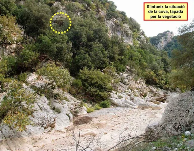
A 40 m long cave in Alta Garrotxa, with three entrances, located on the left bank of the riera d'Escales, 15 m of elevation above the streambed and about 270 m west of the cova de Coll Roig.
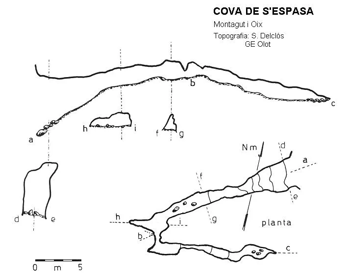
Topographic
Espeleoindex · CC BY-NC 4.0, https://creativecommons.org/licenses/by-nc/4.0/ · Image © its author.
Photos
Espeleoindex · CC BY-NC 4.0, https://creativecommons.org/licenses/by-nc/4.0/ · Image © its author.
Description
Morphology
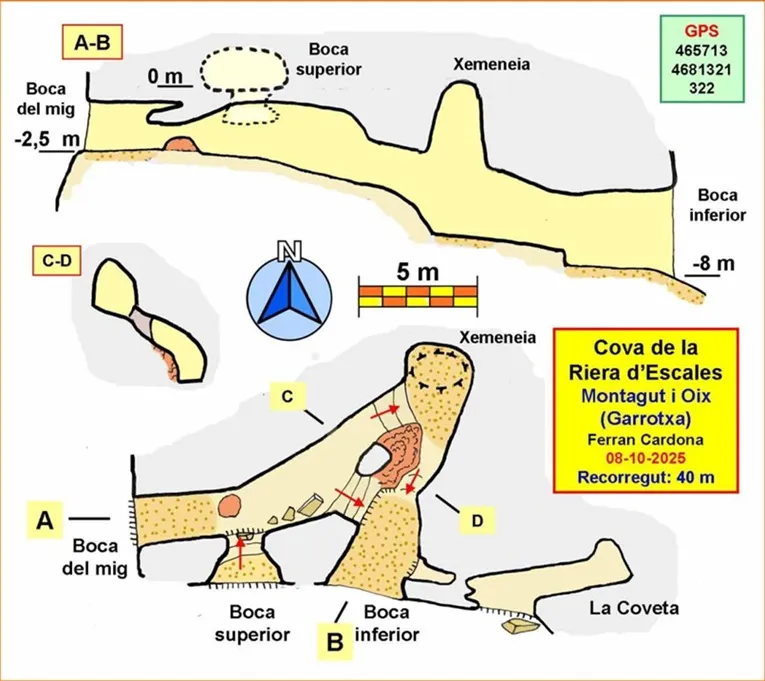
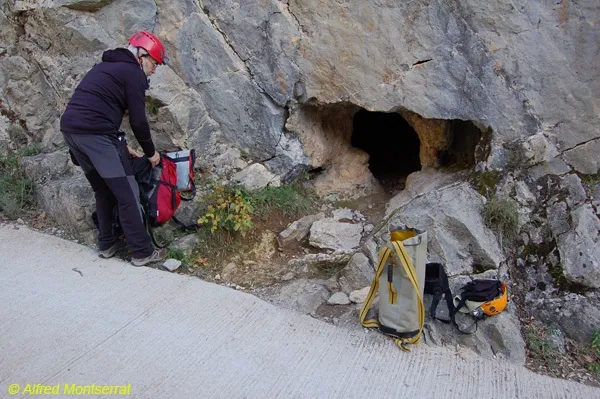
The cave has three entrances, the lower one being the largest and the easiest to access, since the other two are hanging. Setting the zero level at the upper entrance, the lower entrance is at level -8 m and the middle one at -2.5 m.
We can describe the cave as formed by two galleries with an ascending layout that form a closed angle between them. Right at the angle there is a chimney 6.5 m high. A ramp with a step connects both galleries. At the end of the second gallery we find the middle entrance. The access to the upper entrance is located a little elevated a few metres before the middle entrance. There are other small passages difficult to represent as they overlap the galleries and with which the cavity reaches a length of 40 m.
Speleothems
The most decorated part of the cavity is found a few metres from the entrance; in the rest bare rock predominates.
History
Known by some hikers and by some local people. The place name Cova de la Riera d'Escales and the cave symbol appear labelled on the Editorial Alpina map 'Alta Garrotxa', at least since the 2018-2019 edition.
Despite these antecedents, the cave does not appear in any catalogue or in any speleological review, being speleologically unpublished. That being so, in October 2025 Ferran Cardona (ECM Barcelonès) decided to go and carry out the cataloguing tasks.
User Comments (0)
No comments yet.
Be the first to share your experience!
Registered Explorations (0)
No explorations registered yet.
Register your visit to this cave!
Bibliography
Totes les dades, topografia i fotografies han estat extretes del web: geb.cat (del Grup d'Espeleologia de Badalona). Apunt del 14-10-2025. Dades: Ferran Cardona (ECM Barcelonès)
Nearby caves


Source: Espeleoindex (espeleoindex.com), modified. CC BY-NC 4.0, https://creativecommons.org/licenses/by-nc/4.0/