
Cova de les Valls
A 45 m long cave at the Sau reservoir, Tavertet, located at the confluence of the Torrent de les Valls with the reservoir.
EspeleoWorld
Cova de les Valls
A 45 m long cave at the Sau reservoir, Tavertet, located at the confluence of the Torrent de les Valls with the reservoir.
Tavertet · Osona
Length: 45 m · Depth: 1 m
Updated record
https://espeleoworld.com/en/c/cova-de-les-valls
Information can change. Always verify coordinates, access, weather, and cave conditions before setting out.
A 45 m long cave at the Sau reservoir, Tavertet, located at the confluence of the Torrent de les Valls with the reservoir.
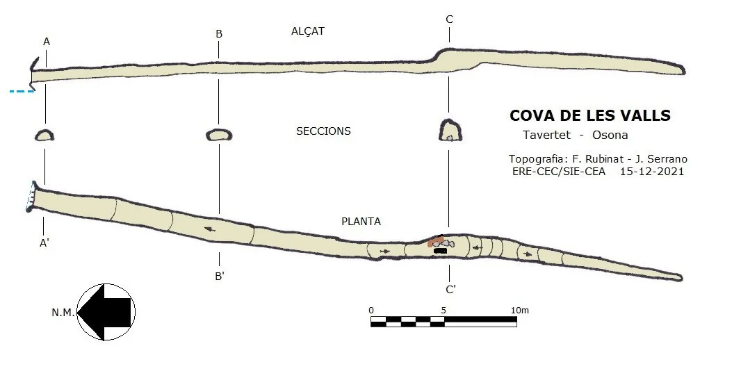
Topographic
Espeleoindex · CC BY-NC 4.0, https://creativecommons.org/licenses/by-nc/4.0/ · Image © its author.
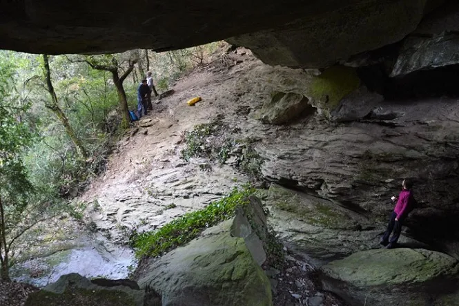
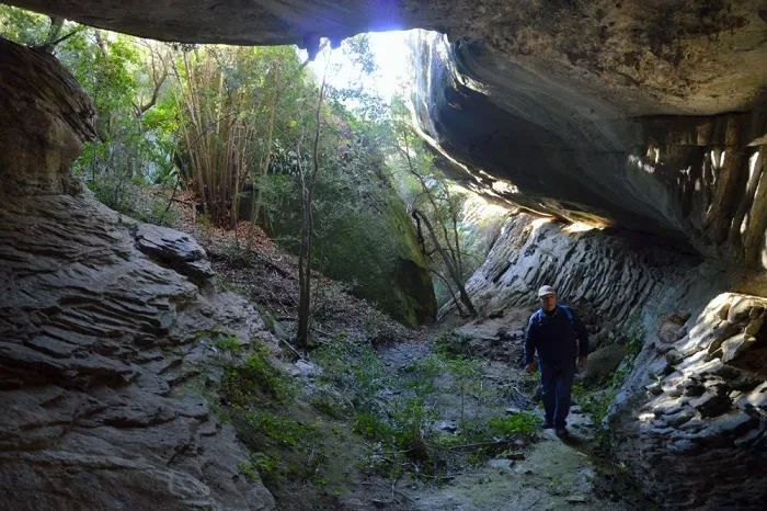
Photos
Espeleoindex · CC BY-NC 4.0, https://creativecommons.org/licenses/by-nc/4.0/ · Image © its author.
Description
Morphology
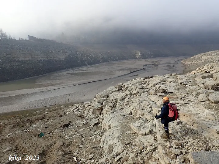
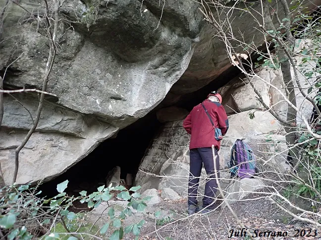
The 1.16x0.62 metre mouth is located a little more than two metres above the bed of the torrent when the reservoir level is low. Past the entrance mouth we still find the rails used in the years 2000-2003 to extract the earth that sedimented the whole conduit. In this stretch the gallery rises imperceptibly for 22 metres in which the gallery keeps almost the same dimensions; from this point the gallery descends slightly for about 5 metres where its section is reduced a little due to the sedimentation caused by the entry of the reservoir waters. At this point the gallery gains width and height and this is where we find all the tools that were used to remove the sediments (wheelbarrow, buckets, shovel, etc.). The gallery rises one metre due to the accumulated sediments and begins to descend over 12 metres until it becomes impassable.
Hydrology
Currently (December 2021) part of the rails that were installed to remove sediments are covered by the sediments brought by the reservoir water; along the gallery we find pieces of trunks brought by the water as well as various plastic waste. The cavity is likely to have been sedimented after the construction of the Sau dam; we only have data from the reservoir water flow record of the last ten years from the Agència Catalana de l'Aigua; in June 2020 the flow reached 96% of its capacity, making it necessary to open gates to drain, so it seems that it is when it reaches this level that water enters the cave.
History
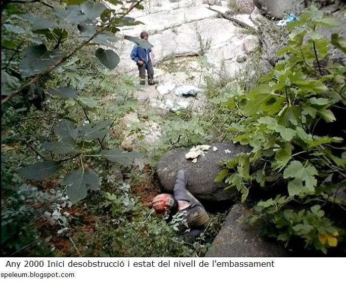
At the beginning of the year 2000 Jordi Mor i Benedito(†), together with Pere Güell and other members of the Associació d'Investigacions i Recerques del Cabrerès, located an old spring that was no more than 20 cm in diameter and from which a strong air current came out. They began to remove the sediments, cleaning the conduit until reaching the rock walls and ceiling. To carry out this task they assembled some rails that are still preserved, along which a wagon circulated on which they loaded the extracted material. At 15 metres they located among the sediments a limestone axe of 10.5x5.5 cm with a bifacial structure belonging to the “Acheulean” period, apparently dated to the Lower Palaeolithic (according to Jordi Mor in the blog: arquehomo.blogspot.com).
At the end of 2002 they had opened 32 metres of gallery, having reached a higher and wider area than the previous stretch, but they saw a risk of collapse of the cave vault at this point and the dissolution of the group shortly afterwards due to disagreements among its members left the cavity in its current state.
The aforementioned risk point is practically nil, since in reality in this sector a stone and mud that held it have now fallen and the ceiling is now safe.
In 2013 Jordi Mor published some data about this cave in a personal blog, but as regards its situation he gives totally erroneous indications supposedly to make its location more difficult. This meant that different prospecting trips had to be used over the last three years until on 15 December 2021 it could finally be located.
As for the toponymy, we do not know whether due to the time elapsed since he was there or due to ignorance of the toponymy or he cites it erroneously, since he refers to the Casa de la Vall, Torrent de la Vall and finally the Cova de la Vall, when the correct names of these are the Casa de les Valls, the Torrent de les Valls and therefore the cave should be the Cova de les Valls, a name that we believe is more correct than the previous one and it is by this that we name the cavity.
User Comments (0)
No comments yet.
Be the first to share your experience!
Registered Explorations (0)
No explorations registered yet.
Register your visit to this cave!
Bibliography
- Totes les dades, coordenades topografia i fotografies han estat facilitades per Francesc Rubinat (ERE del CEC) i Juli Serrano (SIE del CEA).
- speleum.blogspot.com/2013/11/ (fotografies i història)
Nearby caves


Source: Espeleoindex (espeleoindex.com), modified. CC BY-NC 4.0, https://creativecommons.org/licenses/by-nc/4.0/