
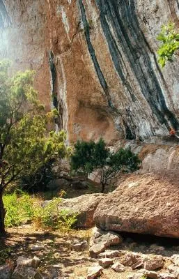
Balma del Roc del Rumbau
Wide rock shelter with rock paintings in Peramola, at the Roc del Rumbau, also known as la Roca dels Moros.
EspeleoWorld
Balma del Roc del Rumbau
Wide rock shelter with rock paintings in Peramola, at the Roc del Rumbau, also known as la Roca dels Moros.
Peramola · Alt Urgell
Length: 10 m
Updated record
https://espeleoworld.com/en/c/balma-del-roc-del-rumbau
Information can change. Always verify coordinates, access, weather, and cave conditions before setting out.
Wide rock shelter with rock paintings in Peramola, at the Roc del Rumbau, also known as la Roca dels Moros.
Topographic
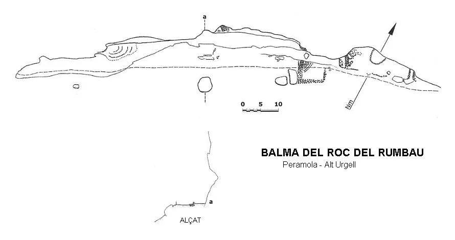

Espeleoindex · CC BY-NC 4.0, https://creativecommons.org/licenses/by-nc/4.0/ · Image © its author.
Photos

Espeleoindex · CC BY-NC 4.0, https://creativecommons.org/licenses/by-nc/4.0/ · Image © its author.
Description
Morphology
Rock shelter about one hundred metres wide and some 10 metres deep, with rock paintings.
Progression
Continuing along the path, just on reaching the last cultivated fields, a path begins on the left that, in a steep climb, leads to the rock paintings of the Roc del Rumbau, also known as la Roca dels Moros.
Other details
Currently (2016), a metal fence protects the painting.
History
The first reports about this group of paintings located in a rock shelter were communicated to Mr. L. Díez-Coronel in 1969 by Messrs. F. Riart Jou, M. Bach Porredón and J. Bach Vila, residents of the locality, and he made them known in the journal "Ilerda" two years later.
It is a small group of schematic paintings dated to 6500-3500 before our era. It is one of the first examples of human presence in these parts.
It is declared a Bé Cultural d'Interès Nacional-Zona Arqueològica (BCIN).
Ley 6/85 de 52 junio del Patrimonio Histórico Español.
Llei 9/93 de 30 de setembre del Patrimoni Cultural Català.
World Heritage. UNESCO, December 1998.
User Comments (0)
No comments yet.
Be the first to share your experience!
Registered Explorations (0)
No explorations registered yet.
Register your visit to this cave!
Bibliography
- Castells i Camp, Josep; Hernández Herrero, Gemma.(1990).-”Pintures Rupestres de Catalunya: un patrimoni desconegut i amenaçat. El projecte (Corpus de Pintures Rupestres de Catalunya)”. Tribuna d'Arqueologia (1989-1990):31-39.
- Valles, Jordi de (2008).-”Alt Urgell,Noguera, Pla d'Urgell, Segarra, Solsonès, Urgell” Catàleg Espeleològic de Catalunya (vol.2):92-93. EC Gràcia/FCE.
- Fotos i documentació extret del web (cultura.gencat.cat).
- Situació extreta del web (caminsdeperamola.wordpress.com), post del dia 30 de setembre de 2010.
- Revisió de coordenades i foto actual facilitada per Alfred Montserrat (ERE-CEC).
Nearby caves
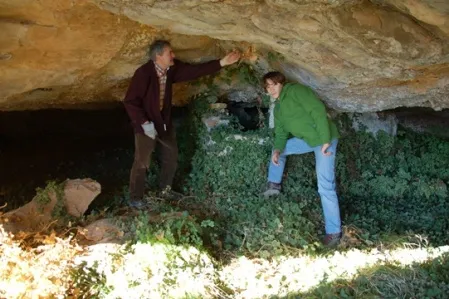
Espluga de la Font del Cerveró
1.8 km · W
Peramola (Alt Urgell)
1 topo.2 photos
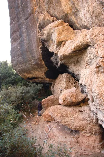
Espluga de la Masia del Cerveró
1.8 km · W
Peramola (Alt Urgell)
1 topo.5 photos

la Catedral
1.9 km · W
Peramola (Alt Urgell)
1 topo.3 photos
Avenc de la Roca del Corb
2.0 km · W
Peramola (Alt Urgell)
2 topo.5 photos
Source: Espeleoindex (espeleoindex.com), modified. CC BY-NC 4.0, https://creativecommons.org/licenses/by-nc/4.0/