
Avenc de l'ú
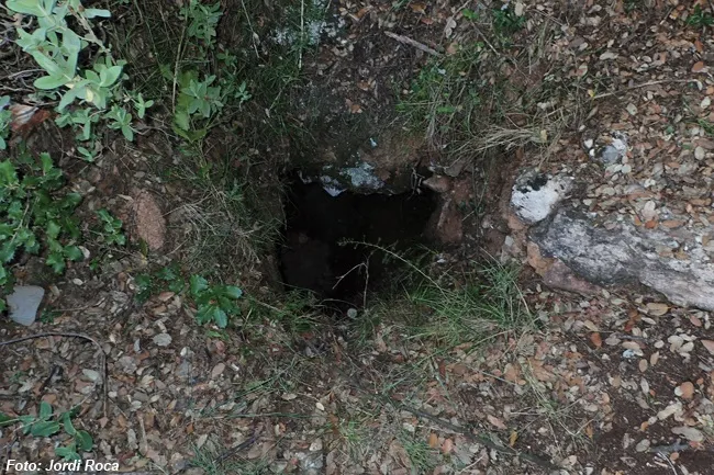
Small pit 6 metres deep in the Serra l'Obac (Mura), discovered on 15-01-2000 and explored on 13-03-2004.
EspeleoWorld
Avenc de l'ú
Small pit 6 metres deep in the Serra l'Obac (Mura), discovered on 15-01-2000 and explored on 13-03-2004.
Mura · Bages
Length: 9 m · Depth: 6 m
Updated record
https://espeleoworld.com/en/c/avenc-de-l-u
Information can change. Always verify coordinates, access, weather, and cave conditions before setting out.
Small pit 6 metres deep in the Serra l'Obac (Mura), discovered on 15-01-2000 and explored on 13-03-2004.
Topographic
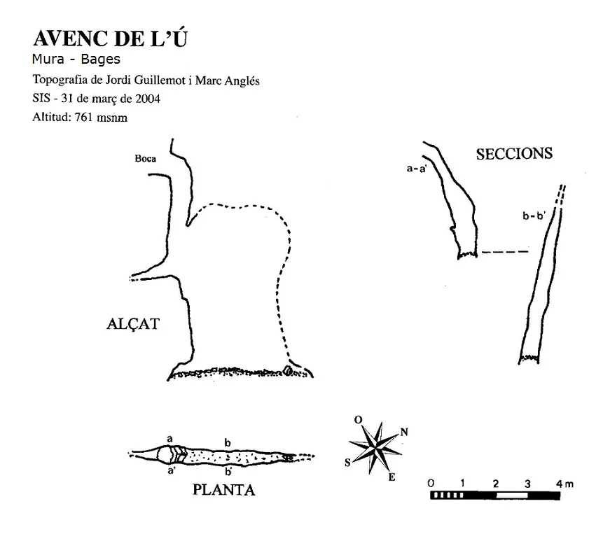
Espeleoindex · CC BY-NC 4.0, https://creativecommons.org/licenses/by-nc/4.0/ · Image © its author.
Description
Morphology
The small earthy entrance of 0.60X0.25 metres had to be widened until it allowed the tight passage of a person. Footing is at -3 metres, the point where the joint, besides widening, changes direction, from the N85 of the first pit, it passes to another of N28. This new pit of -3 metres, wide and generous, allows the descent to the bottom located at -6 metres. The floor is full of sediments, we also find a collapsed slab of wall.
Speleothems
The pit of -3 metres is well adorned with concretions.
Progression
The small earthy entrance of 0.60X0.25 metres had to be widened until it allowed the tight passage of a person. Footing is at -3 metres, the point where the joint, besides widening, changes direction, from the N85 of the first pit, it passes to another of N28. This new pit of -3 metres, wide and generous, allows the descent to the bottom located at -6 metres.
Other details
The pit of -3 metres is well adorned with roots and spiders.
History
It was discovered on 15-01-2000 by Jordi Guillemot and Clara Formosa of the Centre Excursionista de Terrassa. Due to its narrowness, they did not manage to explore it until 13-03-2004, when several members of a small group called Espeleopringuer managed to introduce an individual inside; the hard work was in getting him back out. The name was given to it by a rocky needle separated from the crag that dominates a high spot located right in the middle between the avenc de l'Ú and the cova de l'Ú; this promontory is known as the Fortalesa de l'Ú.
User Comments (0)
No comments yet.
Be the first to share your experience!
Registered Explorations (0)
No explorations registered yet.
Register your visit to this cave!
Bibliography
- Guillemot i Marcet, Jordi; Anglés i Vila, Marc (2008).-”La cova i l'avenc de l'U”. Arxiu Centre Excursionista de Terrassa (114):263-266. CE Terrassa.
- Valles Tena, Jordi de (2016).-”Bages, Barcelonès, Maresme, Vallès Occidental, Vallès Oriental” Catàleg Espeleològic de Catalunya (vol.5):196-197. ECG/FCE
Nearby caves

Source: Espeleoindex (espeleoindex.com), modified. CC BY-NC 4.0, https://creativecommons.org/licenses/by-nc/4.0/