
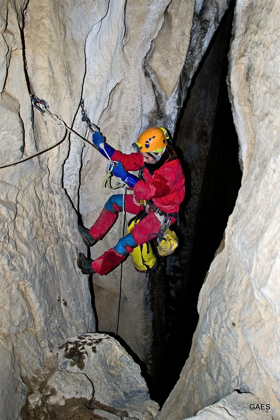
Torca del Regato Calero
The Torca del Regato Calero, in Rasines (Cantabria), is a pit with a vertical extent of about 350 m and about 25 km of development, explored by the GAES since 1981.
EspeleoWorld
Torca del Regato Calero
The Torca del Regato Calero, in Rasines (Cantabria), is a pit with a vertical extent of about 350 m and about 25 km of development, explored by the GAES since 1981.
Rasines
Length: 25000 m · Depth: 350 m
Updated record
https://espeleoworld.com/en/c/torca-del-regato-calero-rasines
Information can change. Always verify coordinates, access, weather, and cave conditions before setting out.
The Torca del Regato Calero, in Rasines (Cantabria), is a pit with a vertical extent of about 350 m and about 25 km of development, explored by the GAES since 1981.
Photos
© GAES · none-stated · GAES (Grupo de Espeleología), espeleo-gaes.blogspot.com · https://espeleo-gaes.blogspot.com/2013/02/02022013-regato-calero-ii-visita.html
Description
Morphology
The Torca del Regato Calero has several routes of shafts that separate and rejoin. Shafts and ramps lead to a central labyrinth of galleries. In the deep zone are the Olentzero gallery, the Cochina gallery and the Sala del Elfo, and in the lower part a river flows.
The so-called third way connects a lower gallery, at -275 m, with another located at -90 m.
As for its history, the GAES explored it in 1985 and it was surveyed again in 2013.
Hydrology
The lower level is traversed by a river whose galleries can flood with rising water, which makes the zone dangerous. The deepest point, at -350 m, was reached in 2019 after finding the river again and connecting with a point already visited by another way. Near the classic bottom, small streams disappear into impassable sections.
Other details
The FEE catalogue of large cavities (2024) gives a depth of -350 m (2019 data) and a length of about 25,000 m, approximate (2020 data). Other sources offer smaller figures, prior to the latest surveys. We have not verified them.
History
The GAES made the first explorations in 1981.
- 2013: re-equipping and new survey of the route of the third shaft.
- Later campaigns: side galleries, climbs and deep sectors.
- June 2019: the deepest point is reached, at -350 m.
- Olentzero gallery: work stopped since February 2020 and resumed in November 2025.
User Comments (0)
No comments yet.
Be the first to share your experience!
Registered Explorations (0)
No explorations registered yet.
Register your visit to this cave!
Nearby caves

Contains information from Grottocenter (Wikicaves), grottocenter.org, made available under the Open Database License (ODbL 1.0, https://opendatacommons.org/licenses/odbl/1-0/), modified. · https://grottocenter.org/ui/entrances/168706 · data as of 2026 · Text written by Espeleoworld from public sources. Please ask us before reusing it. · Text by José Luis Membrado Julián (Grandes Cavidades Españolas 2024), GAES (blog) (RN-103: última escalada en G. Cochina y ...), GAES (blog) (08.06.2019 RN-103 porteo de material al exterior), GAES (blog) (02.02.2013 Regato Calero II visita), GAES (blog) (1 y 2.11.2013 Regato Calero II - Tercera vía de pozos), GAES (blog) (29.11.2025 RN-103 volvemos a la G. Olentzero) · adapted by Espeleoworld (normalized, translated); the adaptation is licensed Our own text, written from public sources. Please ask us before reusing it. · The derived data is available on request under the ODbL: [email protected]