
la Baumassa
Gran Bauma obrada a Llaés (Ripoll).
EspeleoWorld
la Baumassa
Gran Bauma obrada a Llaés (Ripoll).
Ripoll · Ripollès
Length: 15 m
Updated record
https://espeleoworld.com/en/c/la-baumassa
Information can change. Always verify coordinates, access, weather, and cave conditions before setting out.
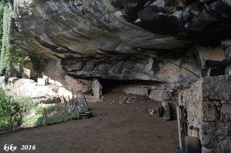
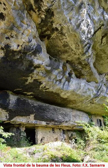
Large worked rock shelter at Llaés (Ripoll), 53 m wide and 12 m high, north-south oriented, with a hut still in use and remains of constructions.
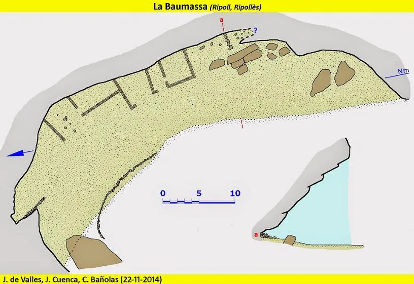
Topographic
Espeleoindex · CC BY-NC 4.0, https://creativecommons.org/licenses/by-nc/4.0/ · Image © its author.
Photos
Espeleoindex · CC BY-NC 4.0, https://creativecommons.org/licenses/by-nc/4.0/ · Image © its author.
Description
Morphology
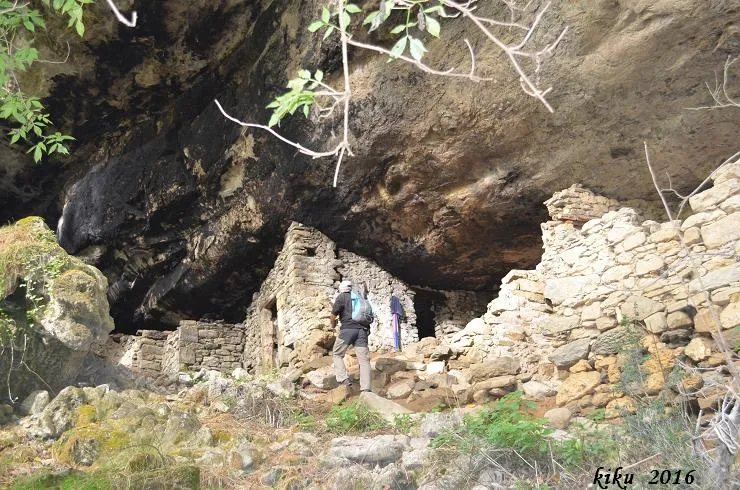
Fairly large rock shelter, about 53 m wide and 12 m high. Unlike the other rock shelters of the sector, oriented east-west, this one is oriented north-south. The floor, fairly flat, is covered by a layer of goat and sheep excrement that has bred a multitude of fleas, which makes visiting it not very advisable. On the right (south) two large blocks stand out. Further to the left there is a group of parallelepiped blocks, behind which there is a dark part that quickly loses height until it becomes impracticable.
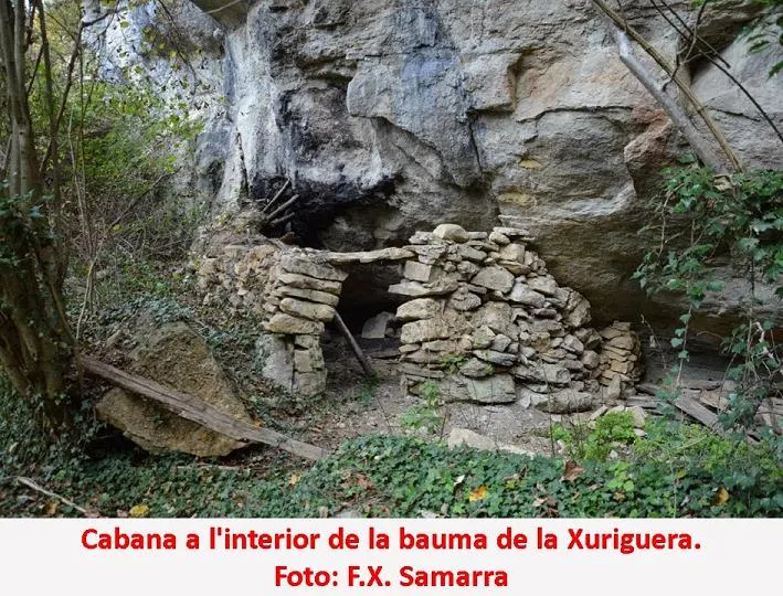
The central part is occupied by a hut still in use, and to its left there are remains of constructions.
The northern limit is very imprecise and is completely occupied by vegetation.
Other details
The entire front of the rock shelter is bounded by a fence to prevent the livestock from escaping; also outside the rock shelter and next to the torrent there is another fence to prevent the livestock from falling into the torrent.
History
Known since time immemorial. The last inhabitant of the rock shelter of whom we have record was Margarida Jofre Juncà, who died of pneumonia in 1920, but it is very possible that the abandonment of the rock shelter as a dwelling was later.
User Comments (0)
No comments yet.
Be the first to share your experience!
Registered Explorations (0)
No explorations registered yet.
Register your visit to this cave!
Bibliography
- Torruella, J.; Capdevila, N.; Vilaseca, D. (2008).- "Bauma de la Xuriguera" El 855 (129):52-53
- Valles, J. De (2009) .- Catàleg Espeleològic de Catalunya (Vol.3):290. ECG/FCE.
- Coordenades,
dades i topografia extretes del blog de Jordi de Valles
(cavitatsdecatalunya.blogspot.com.es) post del dia 22 de gener de
2015.
Participants: Josep Cuenca i Francesc Xavier Samarra (Grup d'Espeleologia de Badalona) Ferran Cardona i Jordi de Valles (Espeleo Club de Gràcia), amb Carme Bañolas.
Nearby caves


Source: Espeleoindex (espeleoindex.com), modified. CC BY-NC 4.0, https://creativecommons.org/licenses/by-nc/4.0/