
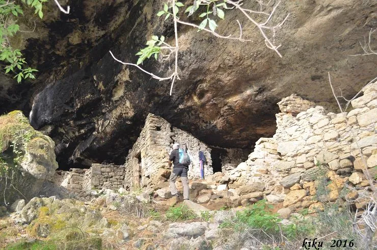
Bauma del Teixidor
Large Bauma worked at Llaés (Ripoll), the largest in the area, inhabited until 1952.
EspeleoWorld
Bauma del Teixidor
Large Bauma worked at Llaés (Ripoll), the largest in the area, inhabited until 1952.
Ripoll · Ripollès
Length: 17 m
Updated record
https://espeleoworld.com/en/c/bauma-del-teixidor
Information can change. Always verify coordinates, access, weather, and cave conditions before setting out.
Large Bauma worked at Llaés (Ripoll), the largest in the area, inhabited until 1952.
Topographic
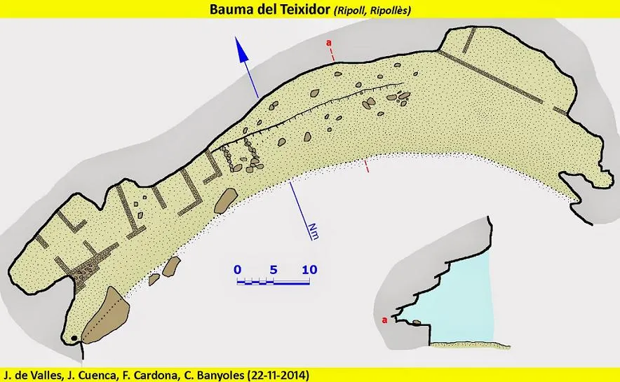
Espeleoindex · CC BY-NC 4.0, https://creativecommons.org/licenses/by-nc/4.0/ · Image © its author.
Photos
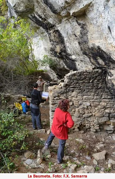
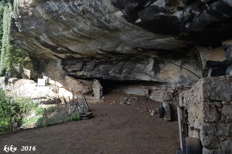
Espeleoindex · CC BY-NC 4.0, https://creativecommons.org/licenses/by-nc/4.0/ · Image © its author.
Description
Morphology
It is the largest bauma in the area, with a width of 85 metres and a depth of 17 metres, it is about 18 to 20 metres high.
For its description we can divide it into three sectors:
East zone: on the right, a deposit of tova produces a dark zone slightly elevated above the level of the bauma. We also find a ramp that leads us to an enclosure of about 2 metres in height, 25 metres in width and 7 metres in depth that was used as a pen to keep the flock, "capable of more than 200 head of wool-bearing livestock (sic)", as Ramon Vinyeta describes it.
Central zone: The floor is flat and at 8 or 9 metres from the edge of the bauma there is a rise of 2.5 metres (in the central part) that can be overcome by ramps on both sides. Once on top of this landing, we can see how stone has been extracted from the walls for construction.
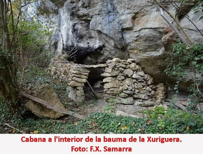
West zone: It is the zone occupied by the constructions that served as housing, quite damaged by the passage of time. Despite everything, a door and the oven are still preserved.
Progression
From the house of the Teixidor one must follow the track that emerges on the right and follow it for about 850 m, until finding a turn-off to the right going down, (beforehand we will have seen a first turn-off that we must not take). In 10 minutes we will arrive directly at the bauma.
History
Known since time immemorial. It was inhabited until 1952.
Bio
At both ends of the balma there is a dark zone where lesser horseshoe bats (Rhinolophus hipposideros) have been seen.
User Comments (0)
No comments yet.
Be the first to share your experience!
Registered Explorations (0)
No explorations registered yet.
Register your visit to this cave!
Bibliography
- Borràs, J.; Miñarro, J.M.; Talavera, F. (1980).- Catàleg Espeleològic de Catalunya. (Vol. 4):100.Ed. Políglota. Barcelona
- Font, N. (1897).- "Catàlech de Catalunya (Continuació)" Butlletí del Centre Excursionista de Catalunya (3):79-84.
- Pella, J. (1883).- Historia del Ampurdán.
- Torras, C.A. (1921).- Ripollès.
- Torruella, J.; Capdevila, N.; Vilaseca, D. (2008).- "La Bauma del Teixidor" El 855 (126):42-43
- Vinyeta, R. (1950).- "Trogloditas en la sierra de Milany: un curioso estudio de geografía humana" Bol. Sec. de Montaña y C.A.D.E. p. 85-89.
- Vinyeta, R, (1986).- El Vidranès. Ed. Celblau. Torelló
- Valles, J. de (2009).- Catàleg Espeleològic de Catalunya Vol. 3.
- Coordenades,
dades i topografia extretes del blog de Jordi de Valles
(cavitatsdecatalunya.blogspot.com.es) post del dia 15 de gener de
2015.
Participants: Josep Cuenca i Francesc Xavier Samarra (Grup d'Espeleologia de Badalona) Ferran Cardona i Jordi de Valles (Espeleo Club de Gràcia), amb Carme Bañolas.
Nearby caves


Source: Espeleoindex (espeleoindex.com), modified. CC BY-NC 4.0, https://creativecommons.org/licenses/by-nc/4.0/