
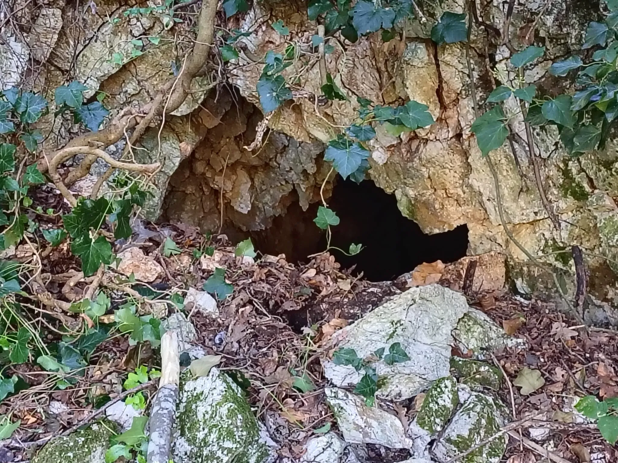
Grotta di Monte Prata
Natural sinkhole currently being excavated, with a descending trend and demanding traversability, at Cesi, Le Prata.
EspeleoWorld
Grotta di Monte Prata
Natural sinkhole currently being excavated, with a descending trend and demanding traversability, at Cesi, Le Prata.
Terni
Length: 5 m · Depth: 6 m
Updated record
https://espeleoworld.com/en/c/grotta-di-monte-prata-terni-terni
Information can change. Always verify coordinates, access, weather, and cave conditions before setting out.
Natural sinkhole currently being excavated, with a descending trend and demanding traversability, at Cesi, Le Prata.
Photos

Catasto Cavità Umbria (Federazione Umbra Gruppi Speleologici, FUGS) · LicenseRef-FUGS-media-per-item · Image © its author.
Description
Morphology
Natural sinkhole currently being excavated, with a descending trend. Geology: SAA Scaglia Rossa - Upper Cretaceous-Middle Eocene (Turonian-Lutetian); stratified micritic limestones; stratified.
Progression
Traversability: demanding; recommended period: all year.
User Comments (0)
No comments yet.
Be the first to share your experience!
Registered Explorations (0)
No explorations registered yet.
Register your visit to this cave!
Nearby caves
Source: Catasto Cavità Umbria (Federazione Umbra Gruppi Speleologici, FUGS) (catasto.fugs.it), modified. LicenseRef-FUGS-no-licence-stated Federazione Umbra Gruppi Speleologici (FUGS), Catasto Speleologico dell'Umbria · https://catasto.fugs.it/index.php?mod=caves&op=view&id=960 · data as of 2025 · Source: Catasto Cavità Umbria (Federazione Umbra Gruppi Speleologici, FUGS) (catasto.fugs.it), modified. LicenseRef-FUGS-media-per-item Federazione Umbra Gruppi Speleologici (FUGS), Catasto Speleologico dell'Umbria · data as of 2025