
Forat de Sant Tomàs
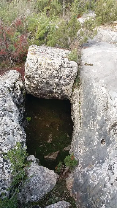
Avenc de 34 metres de fondària a Castelló de Farfanya.
EspeleoWorld
Forat de Sant Tomàs
Avenc de 34 metres de fondària a Castelló de Farfanya.
Castelló de Farfanya · Noguera
Length: 97 m · Depth: 34 m
Updated record
https://espeleoworld.com/en/c/forat-de-sant-tomas
Information can change. Always verify coordinates, access, weather, and cave conditions before setting out.
A 34-metre-deep pit in Castelló de Farfanya, explored on 21 March 1971 by the RES - CE Pirenaic.
Topographic
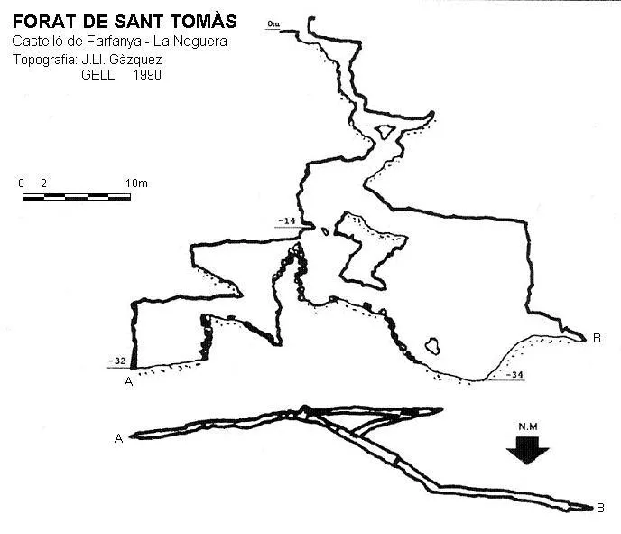
Espeleoindex · CC BY-NC 4.0, https://creativecommons.org/licenses/by-nc/4.0/ · Image © its author.
Description
Morphology
The cavity begins with a series of ramps cut by vertical steps, one of them quite narrow, which lead to a 3-metre drop where contact is made with the main fissure of the cavity; a second drop of 6.5 metres places us at the base of the fissure. In an E direction, the cavity continues for some 25 metres until it becomes impenetrable at the point where the change of materials occurs. In a W direction, and after climbing about 6 metres, one can reach another stepped vertical of 10 metres, followed by another of 5 metres, where it ends in the form of a meander obstructed by a stalagmitic flow.
Speleothems
The final meander is obstructed by a stalagmitic flow.
Progression
It begins with a series of ramps cut by vertical steps, one of them quite narrow, which lead to a 3-metre drop where contact is made with the main fissure of the cavity; a second drop of 6.5 metres places us at the base of the fissure. In an E direction, the cavity continues for some 25 metres until it becomes impenetrable at the point where the change of materials occurs. In a W direction, and after climbing about 6 metres, one can reach another stepped vertical of 10 metres, followed by another of 5 metres, where it ends in the form of a meander obstructed by a stalagmitic flow.
History
The first exploration took place on Sunday 21 March 1971 by members of the RES - CE Pirenaic (Barcelona) based on the indications received from the local people. They had to carry out a dig to be able to get through.
User Comments (0)
No comments yet.
Be the first to share your experience!
Registered Explorations (0)
No explorations registered yet.
Register your visit to this cave!
Bibliography
- Gàzquez i Pons, Josep Lluis, (1995).-”Catàleg Espeleològic de la Noguera” Grallera (3-4):1-90. GE Lleidatà. Lleida.
- Navarro; Vela.(1971).-”Cuatro primeras para el R.E.S.” Butll. Centre Exc. Pirenaic (190). Barcelona.
Nearby caves

Source: Espeleoindex (espeleoindex.com), modified. CC BY-NC 4.0, https://creativecommons.org/licenses/by-nc/4.0/