Espluga de Riu Fred

A worked rock shelter at Riu Fred (Lladurs), with a dwelling construction, known in the area since time immemorial.

Lladurs • Solsonès 8m

A worked rock shelter at Riu Fred (Lladurs), with a dwelling construction, known in the area since time immemorial.

Characteristics

Location

Although in various publications it has been placed in the municipality of Odèn, it is actually in the municipality of Lladurs, since the Riu Fred forms the boundary of the municipal term.

From Solsona we will follow the C-26 road, and shortly we will turn off onto the LV-4011 road that climbs to Cambrils via the pont del Clop; further on we will turn off onto the private path of the Torre de Montpol, but a few metres before crossing the main gate of the property, we will continue to the left along the forest track, crossing a cattle grid. We will continue uphill, leaving a path on the left, and continue climbing until the path crosses some fields, on the ridge, enclosed by a fence. We will leave the vehicle at this point. We will cross the field, taking care to leave the gates well closed, and then continue along the path on the left, which first descends, levels out, and then descends in various bends to a turn with an identifying sign for a hunting reserve and a path cut off some 20 metres further on in a N direction. The path continues descending in a S direction, towards a gully, the path being cut off. We will descend along an old footpath still in good condition, passing a spur with a good view over the barranc del riu Fred. We will continue descending, passing the head of a small torrent with a steep gradient, with great caution because the path has slipped, but some iron stakes are still driven into the rock that held the wooden beams for the pack animals and the flock to cross.

We will go on descending through various switchbacks, finding varied and exuberant vegetation, and we will also observe towards the east a small arch of rock hanging beneath a spur. We will reach the river bed and cross it in an easterly direction, following a narrow path upstream along the left bank of the river, fairly level. After about five minutes of walking we will descend to the river and cross it again. We will follow an abandoned but cleared path; further on the path rises gently, it seems to lose itself because we will find some marshes that come down from a spring formed by travertines, with some remarkably sized box trees, in a wild spot. If we climb up a gully situated above the spring with box trees, we will be able to come out on top of the crag. Continuing a few more minutes, we will reach a small esplanade at the foot of the crag where we will find the walls of the house, covered in ivy, as well as the wall of black-coloured rock, produced by the soot of thousands of fires that have been lit there.

Very approximate coordinates to be checked.

Map

Entrances

Always verify coordinates and access conditions before setting out.

  1. Riu Fred, Espluga de

    Elevation: 687 m

    42.100877, 1.427186
    UTM 31T (ETRS89) 369947 4662173
Download all entrances as GPX

Description

Morphology

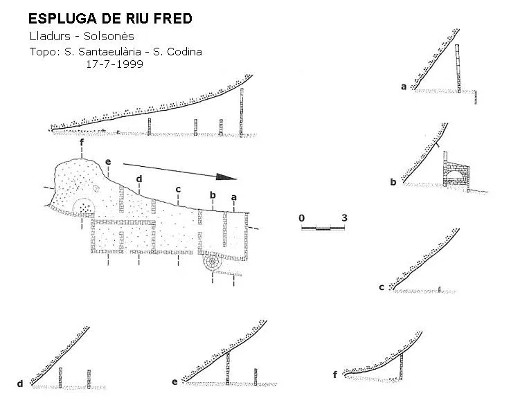
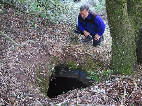
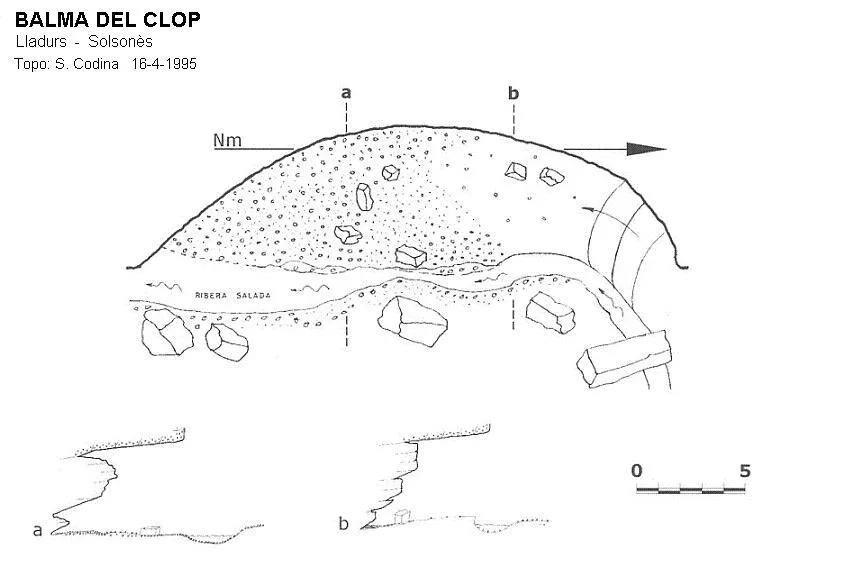
Rock shelter with a dwelling construction; in the southern part one can enter some 8 metres under the rock. It is more than 15 metres wide, and has a maximum height of just over 4 metres.

Hydrology

Some marshes that come down from a spring formed by travertines.

History

Known in the area since time immemorial.

The walls of the house are very varied, possibly from different periods, half a metre thick, some cut square and others with earth and codolells, tuff stone, including the highest ones, made of mud blocks 1 by 1.5 metres, with small windows. We will also find more modern solid bricks. We will also still see the wooden lintels at the doors, the stone sink, built-in cupboards, and it is worth noting a wooden pole with a hole at the end, driven some 10 metres up on the wall of the rock shelter, coinciding vertically beside an oven for bread still well preserved.

User Comments (0)

No comments yet.

Be the first to share your experience!

Registered Explorations (0)

No explorations registered yet.

Register your visit to this cave!

Bibliography

  1. Codina, Salvador.(2000).-”Espluga del Riufred”. Corriol (117):10-11. Centre Excursionista del Solsonès.
  2. Valles, Jordi de. (2009).-”Alt Urgell, Noguera, Pla d'Urgell, Segarra, Solsonès, Urgell” Catàleg Espeleològic de Catalunya (2):353-354. EC Gràcia/FCE.

Source: Espeleoindex (espeleoindex.com), modified. CC BY-NC 4.0, https://creativecommons.org/licenses/by-nc/4.0/