
Coves d'Antona
A group of independent caves with rock paintings in Artesa de Segre, accessed via tracks and channels, with several rock shelters containing red-brown figures.
EspeleoWorld
Coves d'Antona
A group of independent caves with rock paintings in Artesa de Segre, accessed via tracks and channels, with several rock shelters containing red-brown figures.
Artesa de Segre · Noguera
Length: 15 m · Depth: 8 m
Updated record
https://espeleoworld.com/en/c/coves-d-antona
Information can change. Always verify coordinates, access, weather, and cave conditions before setting out.
A group of independent caves with rock paintings in Artesa de Segre, accessed via tracks and channels, with several rock shelters containing red-brown figures.
Topographic
Espeleoindex · CC BY-NC 4.0, https://creativecommons.org/licenses/by-nc/4.0/ · Image © its author.
Photos
Espeleoindex · CC BY-NC 4.0, https://creativecommons.org/licenses/by-nc/4.0/ · Image © its author.
Description
Morphology
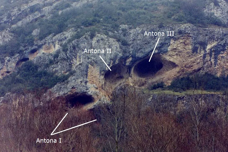
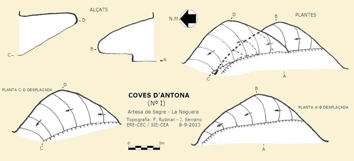
The group consists of three caves; Antona I is located on a lower level, actually formed by two superimposed rock shelters, but access to both is at the same level; the left-hand one forms a steep ramp until it is positioned above the roof of the right-hand rock shelter. The cavity is about 23 metres wide and 8 metres deep.
Antona II and Antona III are actually a large rock shelter with two parallel conduits; access to both is somewhat dangerous; inside, the rock floor is quite slippery with a slope at the final part of up to 60º.
Antona II: its elevation difference is +8 metres and 14 metres of passage.
Antona III: its elevation difference is +6 metres and 15 metres of passage.
Antona IV has an entrance of 5x3 metres and 9 metres deep.
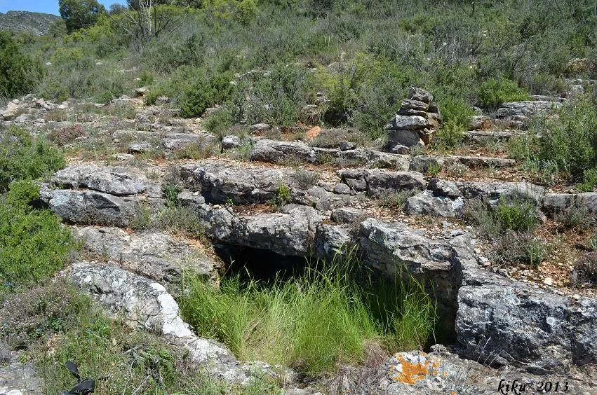
Antona V has an entrance 9.5 metres wide by just over 2 metres high and 9 metres deep. It is structured on a 36º inclined stratum.
Progression
From Artesa de Segre, follow the direction towards Baldomar and just after crossing the bridge over the Segre river, turn left; after covering 35 metres from the road, follow the track to the right; at 575 metres, follow the track to the right; at 780 metres, follow the track to the left; at 1300 metres, continue straight ahead; at 1800 metres, follow the track to the right; at 2200 metres, leave the track and follow a disused track to the left until the end; this route is 680 metres long.
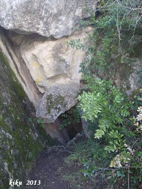
The end of the track leads to an old abandoned crop field; cave I opens in the right-hand wall; access is through the middle of the forest without a clear path. Caves II and III open just above the previous one; you must climb a channel and at the end make a delicate scramble to the left to access them.
We have named cave IV as such because we have no further references; it is the easiest to access, located at the end of the crop field beside the path.
Cave V is accessed via the same channel that leads to caves II and III, but without making the scramble to the left; in this case, continue to the end of the channel and a little to the right.
Apart from these catalogued caves, on the cliff there are at least half a dozen more of this kind of cave for which we have no reference.
Other details
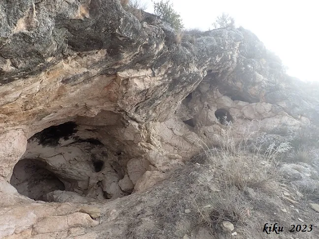
In this rock shelter, 16 red-brown figures are identified on the left wall of the cave in a space of 7 metres; their state of conservation is very poor.
Antona II has three figures; their state of conservation is very poor.
Antona III has 15 figures; their state of conservation is very poor.
History
Known since ancient times and archaeologically documented since the 70s of the last century.
User Comments (0)
No comments yet.
Be the first to share your experience!
Registered Explorations (0)
No explorations registered yet.
Register your visit to this cave!
Bibliography
- Maya, J.L.(1977).-Lérida Prehistórica
- Díez-Coronel, L.(1979).-XIV Congreso Nacional de Arqueología. Vitoria, 1975.
- Maluquer de Motes, J.(1981).-El poblament antic a la comarca de la Noguera
- Maluquer de Motes, J.(1982).-Les excavacions arqueològiques a Catalunya en els darrers anys
- Viñas, R.; Alonso, A.; SARRIÀ, E.(1983).-La pintura rupestre en Catalunya.
- AADD (1990).-Inventari del patrimoni arqueològic de Catalunya. Corpus de pintures rupestres. La Conca del Segre
- Valles, Jordi de (2009).-”Alt Urgell, Noguera, Pla d'Urgell, Segarra, Solsonès, Urgell”. Catàleg Espeleològic de Catalunya. Vol. 2: 1-384. EC Gràcia/FCE.
- Oms Arias, F.X.; Petit Mendizàbal, M.A.; López Cachero, F.J.(2016).-Del neolític a l'edat del bronze en el Mediterrani occidental. Estudis en homenatge a Bernat Martí Oliver.
- Fotos extretes de Invarque.cultura.gencat.cat (Inventari del Patrimoni Arqueològic i Paleontològic de Catalunya).
- Coordenades, dades topografies i fotografies facilitades per Juli Serrano i Montse Roca (SIE-CEA) i Francesc Rubinat (ERE-CEC).
Nearby caves


Source: Espeleoindex (espeleoindex.com), modified. CC BY-NC 4.0, https://creativecommons.org/licenses/by-nc/4.0/