
Cova dels Encantats
Petita cova amb un llac temporal a Sant Joan les Fonts
EspeleoWorld
Cova dels Encantats
Petita cova amb un llac temporal a Sant Joan les Fonts
Sant Joan les Fonts · Garrotxa
Length: 12 m · Depth: 1 m
Updated record
https://espeleoworld.com/en/c/cova-dels-encantats-sant-joan-les-fonts
Information can change. Always verify coordinates, access, weather, and cave conditions before setting out.
A small cave with a temporary lake in Sant Joan les Fonts, known to some local hikers and speleologically undocumented.
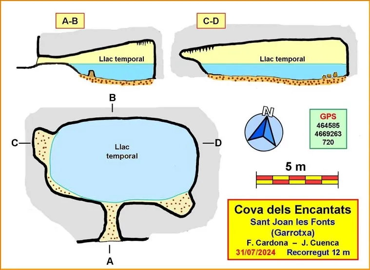
Topographic
Espeleoindex · CC BY-NC 4.0, https://creativecommons.org/licenses/by-nc/4.0/ · Image © its author.
Photos
Espeleoindex · CC BY-NC 4.0, https://creativecommons.org/licenses/by-nc/4.0/ · Image © its author.
Description
Morphology
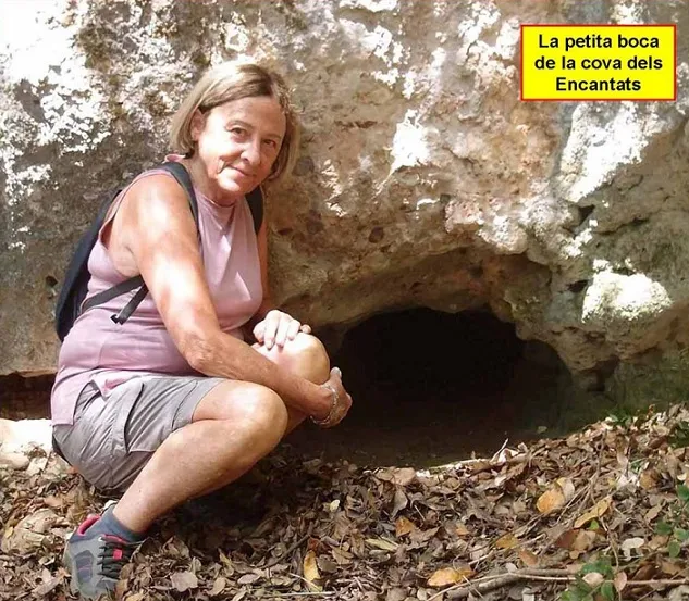
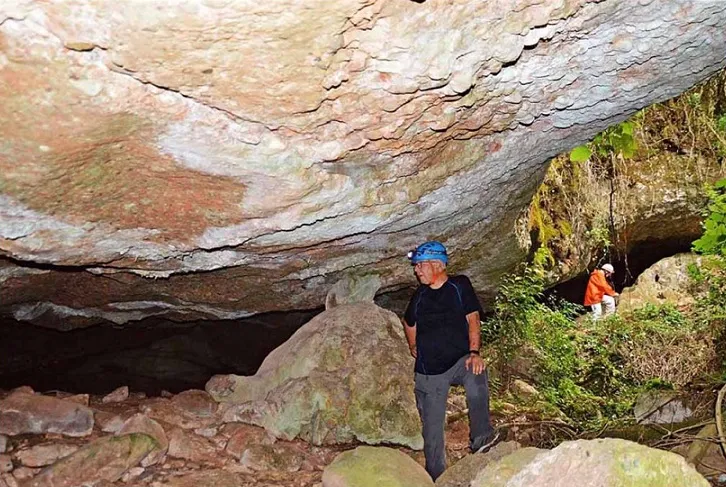
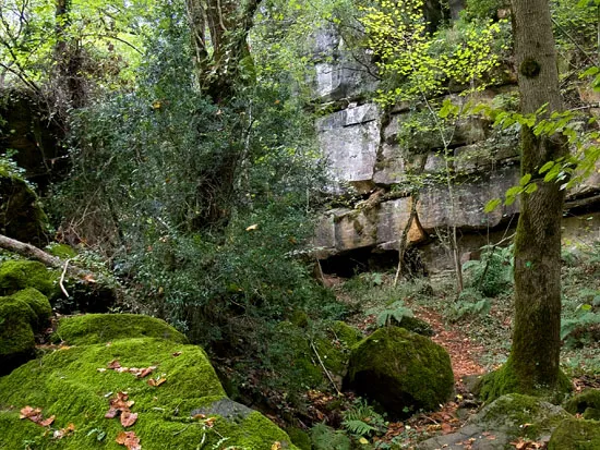
The cova dels Encantats opens at the foot of a small rocky wall. The mouth is very narrow, which forces us to enter completely crawling for a couple of metres. After these, it suddenly opens into a chamber in which we can stand upright. The chamber has dimensions of 10×5 metres, between rectangular and elliptical in shape.
Speleothems
We find some decorated corners and noteworthy is a flood level mark on the walls that indicates how far the water reaches when the lake is full. The water inputs appear to come from the NW side of the chamber, where there is also a prominent speleothem.
Hydrology
Almost the entire chamber is occupied by a temporary lake. During the visit, made at the end of July in a week of strong heat, the lake was dry but with the floor covered in wet mud. The depth of the lake reaches one metre. At a farmhouse in Santa Pau, whose occupants know the terrain and the cave very well, we were informed that during the summer it is normal to find the cave without water, but that in other seasons it is most usual to find it with water and that it is easy to find small animals that enter the cave to drink. The water inputs appear to come from the NW side of the chamber, where there is also a prominent speleothem. The inputs fill the lake until it reaches the level mark that we clearly see on some sections of wall. This level corresponds to the elevation of the mouth, so that if the lake is full and new inputs arrive, the mouth is the overflow and will act as a spring. From the dimensions of the lake we have made a calculation to determine the volume of water stored, which we can estimate at around 25 cubic metres (25,000 litres of water).
Progression
The mouth is very narrow, which forces us to enter completely crawling for a couple of metres.
History
The cova dels Encantats is known to some people of the area and to some local hikers, but in general it can be said that few people know it. Speleologically undocumented, it does not appear in any speleological catalogue. The cave is marked on the Editorial Alpina map 'Garrotxa' in its latest edition (2024-2025). Documented at the end of July 2024 by members of the ECM Barcelonès and the GE Badalona.
User Comments (0)
No comments yet.
Be the first to share your experience!
Registered Explorations (0)
No explorations registered yet.
Register your visit to this cave!
Bibliography
Totes les dades, topografia i fotografies han estat extretes del web: geb.cat (del Grup d'Espeleologia de Badalona). Apunt del 2-9-2024. Dades: Ferran Cardona (ECM Barcelonès), Josep Cuenca i Ana Ruiz (GE Badalona)
Nearby caves


Source: Espeleoindex (espeleoindex.com), modified. CC BY-NC 4.0, https://creativecommons.org/licenses/by-nc/4.0/