
Baumes d'en Caxurma
Curiós fenomen subterrani de 387 m. de recorregut a la Garrotxa.
EspeleoWorld
Baumes d'en Caxurma
Curiós fenomen subterrani de 387 m. de recorregut a la Garrotxa.
Montagut i Oix · Garrotxa
Length: 387 m · Depth: 19 m
Updated record
https://espeleoworld.com/en/c/baumes-d-en-caxurma
Information can change. Always verify coordinates, access, weather, and cave conditions before setting out.
A subterranean phenomenon with a 387 m route in the Garrotxa, known since time immemorial, with inscriptions over 100 years old and explored speleologically since the 1940s.
Topographic
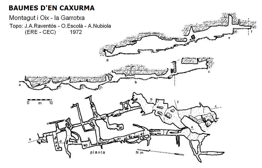
Espeleoindex · CC BY-NC 4.0, https://creativecommons.org/licenses/by-nc/4.0/ · Image © its author.
Photos
Espeleoindex · CC BY-NC 4.0, https://creativecommons.org/licenses/by-nc/4.0/ · Image © its author.
Description
Morphology
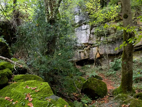
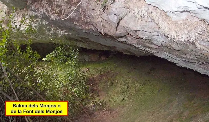
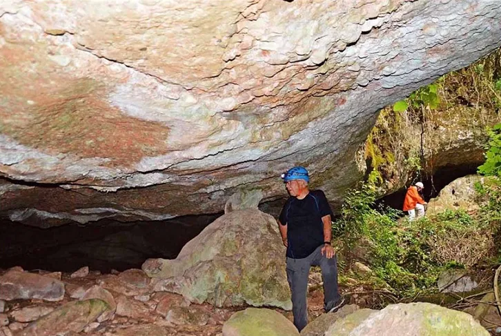
The largest of the cavities known by this name has its entrance among blocks and descends gently to the start of a slightly descending gallery with some connections to the outside through the ceiling side. Structured according to an orthogonal network of fractures, with numerous clastic products that give it a rugged route, in which one must scramble down from block to block.
The lithological materials in which the Balmes d'en Caxurma are located are somewhat complicated. According to the map of the Institut Geològic they are marls with lutites, and according to the ICC geological map they would be sandstones; in any case, both agree that they are from the Lutetian. In principle we lean more toward the second option.
Progression
Advancing, one quickly finds a first fork; continuing to the right, the entrance gallery continues among blocks until it becomes totally impenetrable; shortly before this end and through a small hole on the left, one enters a narrow gallery with a rugged route over small steps and descending and ascending ramps. Along this gallery there are, both to the right and to the left, different conduits just over 10 metres long at the longest. After a small step and right beside it, on the left according to the direction of travel, a series of small galleries begins which, like the one a few metres further on, lead to the parallel gallery that we will discuss next. From this last fork and continuing forward, by a short ascending ramp one can exit to the outside through the northernmost opening of the cavity.
Returning to the second fork, now to the right, one reaches a gallery parallel to the entrance one, with a higher ceiling and an ascending route among blocks. Soon on the left one finds the other conduit that leads to the previous gallery; further on the ceiling lowers considerably, then rises again immediately and continues thus for a few more metres, where by an ascending step of about 2 metres one reaches the entrance vestibule.
Other details
Given the apparently labyrinthine structure of the cavity, cords and various markings, not always discreet, are found, aimed at finding the right way. In one of the small chambers there is a wall with multiple inscriptions and engravings, among which some centuries-old ones can be distinguished.
History
Known since time immemorial by the people of the region. Inscriptions over 100 years old testify to human presence inside.
The first reference we know of a visit, let us say speleological, is the one carried out by members of the then Olot delegation of the Centre Excursionista de Catalunya around the mid-1940s.
We have no further data until the explorations carried out during the campaigns that members of the ERE – CEC (led by J.A. Raventós and O. Escolà) conducted in the Garrotxa in the late 1960s and early 1970s. They locate, explore and survey the cavity in 1972, although the complete record remained unpublished until its publication in the Catàleg Espeleològic de Catalunya (Borràs; Miñarro; Talavera; 1980).
A doubt remains: Font i Sagué, in his catalogue (1897), mentions a cavity in Montagut, without citing the source of information, which he calls Cova del Baquer and of which he says only that it is on the mountain of the Devesa. Could it be an old name for the Balmes d'en Caxurma?
User Comments (0)
No comments yet.
Be the first to share your experience!
Registered Explorations (0)
No explorations registered yet.
Register your visit to this cave!
Bibliography
- Borrás,J.;Miñarro,JM.;Talavera,F.(1980).-Catàleg Espeleològic de Catalunya: el Ripollès, la Garrotxa i l'Alt Empordà. Vol.4: 296 pp. Políglota. Barcelona.
- Coordenades, fotografies i altres dades extretes del blog: Espeleobloc (post del 21-11-2011)
Nearby caves


Source: Espeleoindex (espeleoindex.com), modified. CC BY-NC 4.0, https://creativecommons.org/licenses/by-nc/4.0/