
Cova Cartanyà
Coneguda cova d'uns 212 m. de recorregut a la vall del Brugent (Conca de Barberà)
EspeleoWorld
Cova Cartanyà
Coneguda cova d'uns 212 m. de recorregut a la vall del Brugent (Conca de Barberà)
Vilaverd · Conca de Barberà
Length: 212 m · Depth: 24 m
Updated record
https://espeleoworld.com/en/c/cova-del-cartanya
Information can change. Always verify coordinates, access, weather, and cave conditions before setting out.
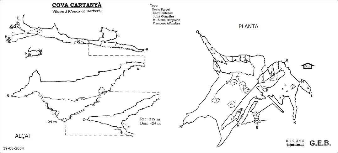
A cave of about 212 m of passage in the Brugent valley, in the Conca de Barberà, with three entrances, two levels and a major clastic collapse.
Topographic
Espeleoindex · CC BY-NC 4.0, https://creativecommons.org/licenses/by-nc/4.0/ · Image © its author.
Photos
Espeleoindex · CC BY-NC 4.0, https://creativecommons.org/licenses/by-nc/4.0/ · Image © its author.
Description
Morphology
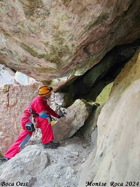
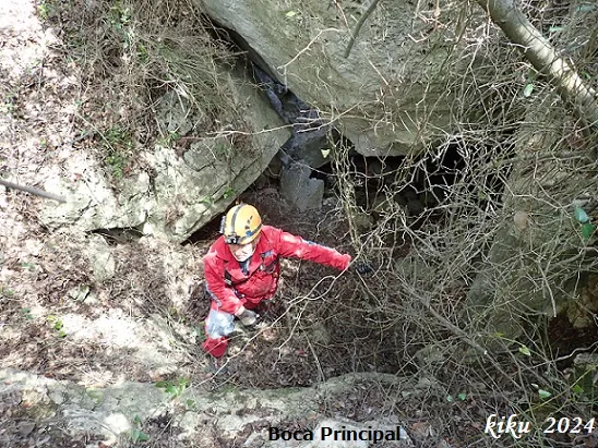
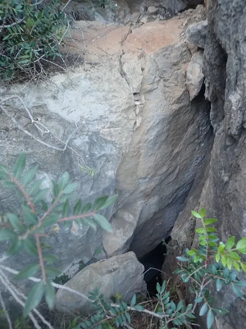
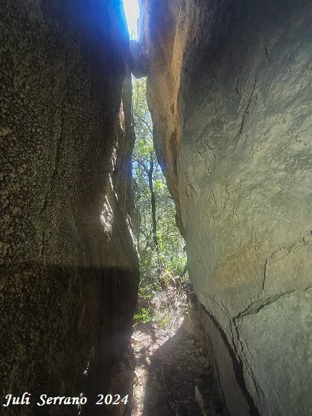
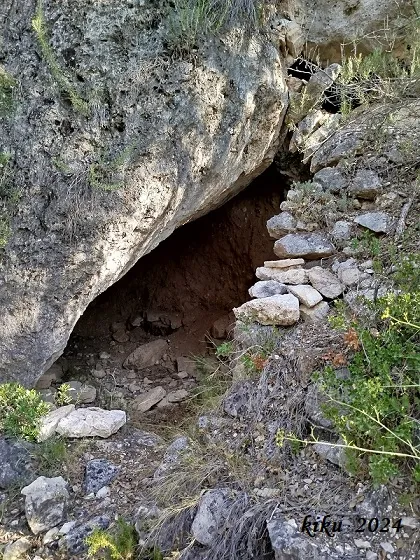
The cave communicates with the outside through three entrances opened between the large blocks and is formed by two levels made up of chambers of regular dimensions, which are occupied over their entire extent by blocks from the major clastic process it has undergone.
Its genesis is due to a major clastic collapse caused by the displacement of the limestone mass of the area of the Penya Roja and adjacent reliefs.
Progression
Another access, which is usually more used than the previous one, is from the parking area before the refugi dels Masets, next to the football field; on this route you must go down to the Brugent river and cross the Toll dels Paperers, from here a small path starts off first heading NE and then continues heading NW; at a given point you must leave the path and follow to the right along a small path that leads us to the main entrance of the cova Cartanyà; this last stretch must be done climbing among the vegetation. This route is longer and with more elevation gain than the previous route described.
Other details
A well-known cave of about 212 m of passage in the Brugent valley (Conca de Barberà).
History
Known since remote times. The first exploration of which we have record is the one carried out by the Reus scholars Josep Iglésies and Joaquim Santasugsana in the year 1924. On this visit they were already able to observe remains of pottery and very soon the archaeological excavations directed by Dr. Salvador Vilaseca began.
Despite its relative speleological interest and its lack of showiness, it has been a cave that over the years has undergone a multitude of visits, which makes its state of conservation quite lamentable.
Among the different surveys carried out, the one made in the year 2004 by members of the Grup d'Espeleologia de Badalona stands out and which had remained unpublished until now, when it has been provided to us by our colleague Enric Porcel (August 2024)
Joan Pallisé (GIEM) provides us with the following note:
"...Apart from its archaeological importance, the cavity was the setting of an unusual and curious experience in the year 1969 by members of the speleology group of the Creu Roja de Tarragona, as it was a long test of underground permanence, supposedly without contact with the outside, which lasted for some days and whose protagonists were the speleologists of the Creu Roja de Tarragona, almost in parallel with those of Emilio Reyes, who in those years carried out various permanences in underground cavities such as the one carried out in la Cova de Chaves, near Barbastro, with the aim of analysing human behaviour in a situation of isolation.
In the deepest part of the cavity, there is almost no news of prehistoric finds, while it is worth noting the filth of graffiti left by a good handful of vandals with a long continuity of generations who have wanted to pass into posterity by making the main wall disgusting with lamentable inscriptions"
User Comments (0)
No comments yet.
Be the first to share your experience!
Registered Explorations (0)
No explorations registered yet.
Register your visit to this cave!
Bibliography
- Borràs, J.; Miñarro,JM.; Talavera, F. (1978).-Catàleg Espeleològic de Catalunya. Vol. 2 (l'Alt Camp, la Conca de Barberà,el Baix Penedès i el Tarragonès):246 pp. Ed. Poliglota. Barcelona.
- Iglésies, Josep (1927).- “Catalogació de coves i avencs de la vall del riu Brugent”. Revista del Centre de Lectura de Reus (3ª època) (173): 212-226
- SES – Talps (1969)-. “Operació Serra de Prades”. Butlletí Talps (1): 1-12. SES – Centre Excursionista del Vallès. Sabadell
- SIRE – UEC (1971).- “Cova-avenc Cartanyà”. Senderos (152): 24-27. Unió Excursionista de Catalunya. Barcelona.
- Vilaseca, S. (1928).- “La cova de Cartanyà” Butlletí de l'Associació Catalana d'Antropologia, Etnologia i Prehistòria (4): 37-71
- Actualització de dades, coordenades i fotografies facilitades per Juli Serrano i Montse Roca (SIE-CEA) i Francesc Rubinat (ERE-CEC). Juliol de 2024.
- Topografia 2004 facilitada per Enric Porcel (GE Badalona) (agost 2024)
Nearby caves


Source: Espeleoindex (espeleoindex.com), modified. CC BY-NC 4.0, https://creativecommons.org/licenses/by-nc/4.0/