
Cova del Camí de la Riba
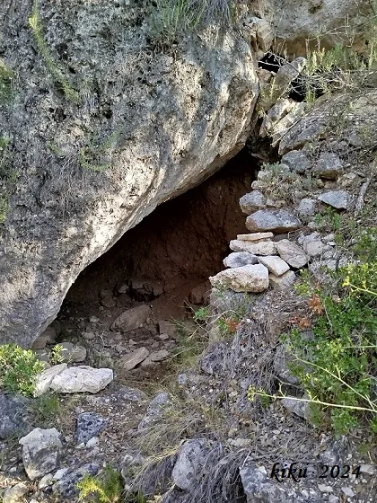
Small shelter in the lower area of the Penya Roja, Vilaverd, just over 6 metres long, 2.5 metres average width and just over 2 metres high.
EspeleoWorld
Cova del Camí de la Riba
Small shelter in the lower area of the Penya Roja, Vilaverd, just over 6 metres long, 2.5 metres average width and just over 2 metres high.
Vilaverd · Conca de Barberà
Length: 6 m
Updated record
https://espeleoworld.com/en/c/cova-del-cami-de-la-riba
Information can change. Always verify coordinates, access, weather, and cave conditions before setting out.
Small shelter in the lower area of the Penya Roja, Vilaverd, just over 6 metres long, 2.5 metres average width and just over 2 metres high.
Topographic
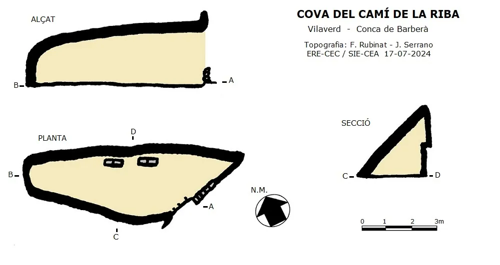
Espeleoindex · CC BY-NC 4.0, https://creativecommons.org/licenses/by-nc/4.0/ · Image © its author.
Photos
Espeleoindex · CC BY-NC 4.0, https://creativecommons.org/licenses/by-nc/4.0/ · Image © its author.
Description
Morphology
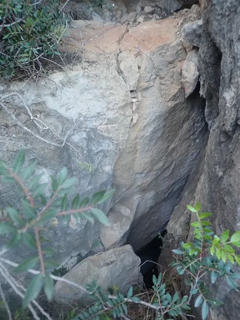
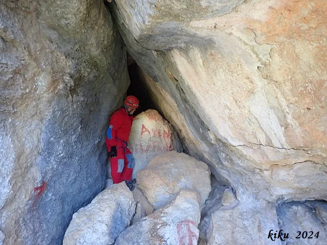
It is a small cavity just over 6 metres long, 2.5 metres average width and just over 2 metres high. The cavity takes advantage of the space left by a large inclined block, inside which the right wall has been artificially excavated to gain space and at the entrance a small wall has been built.
History
Cavity unpublished speleologically, no publication has been found that refers to it. It is quite evident that it is known locally and by some hikers as well as used as a shelter by climbers. It was possibly already used as a hut by the old farmers who cultivated the terraces of the area, currently abandoned. Not having record of the name of the cavity, provisionally we cite it with the name of the path that passes by the mouth.
User Comments (0)
No comments yet.
Be the first to share your experience!
Registered Explorations (0)
No explorations registered yet.
Register your visit to this cave!
Bibliography
- Totes les dades, coordenades, topografia i fotografies han estat facilitades per Juli Serrano (SIE-CEA) i Francesc Rubinat (ERE-CEC).
Nearby caves


Source: Espeleoindex (espeleoindex.com), modified. CC BY-NC 4.0, https://creativecommons.org/licenses/by-nc/4.0/