
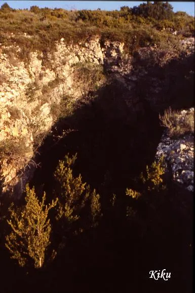
Cova del Cambrot
Cave with 80 metres of passage in the municipality of Sant Esteve de la Sarga, with an entrance of 8 x 15 metres and a vertical extent of 19.40 m (+7.70; -11.70).
EspeleoWorld
Cova del Cambrot
Cave with 80 metres of passage in the municipality of Sant Esteve de la Sarga, with an entrance of 8 x 15 metres and a vertical extent of 19.40 m (+7.70; -11.70).
Sant Esteve de la Sarga · Pallars Jussà
Length: 80 m · Depth: 19 m
Updated record
https://espeleoworld.com/en/c/cova-del-cambrot
Information can change. Always verify coordinates, access, weather, and cave conditions before setting out.
Cave with 80 metres of passage in the municipality of Sant Esteve de la Sarga, with an entrance of 8 x 15 metres and a vertical extent of 19.40 m (+7.70; -11.70).
Topographic
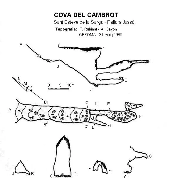

Espeleoindex · CC BY-NC 4.0, https://creativecommons.org/licenses/by-nc/4.0/ · Image © its author.
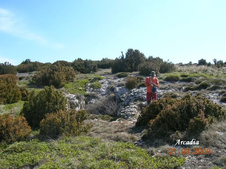
Photos

Espeleoindex · CC BY-NC 4.0, https://creativecommons.org/licenses/by-nc/4.0/ · Image © its author.
Description
Morphology
The entrance, 8 x 15 metres and open due to the collapse of a bedding plane, has characteristics similar to those of the lower entrance of the Graller del Boixeguer. Once past the porch of the cave, we find a steep descent until reaching -18 metres, at which point we find the most spectacular part of the cave as regards dimensions, 8 x 20 metres. From this point the cavity changes completely in appearance, dividing into several conduits at different levels.
Other details
On the unpublished survey (j. Castell, 1976) that we now include (April 2016) the vertical extent continues to be practically the same, although the elevations differ somewhat. Vertical extent: 19.40 m. (+7.70; -11.70).
History
The first news we have of a speleological exploration is that carried out by members of the speleology section of the Centre Gimnàstic Barcelonès (years later SAS – CGB) during their campaigns in the Montsec at the end of the 1950's. Later it was visited by the ERE of the CEC on 27 March 1970.
The only survey known until now was the one published by GEFOMA in 1980. We now update the record (April 2016), including an unpublished survey by Josep Castell made on 3 July 1976 and which we have located in the archive of the ERE – CEC.
User Comments (0)
No comments yet.
Be the first to share your experience!
Registered Explorations (0)
No explorations registered yet.
Register your visit to this cave!
Bibliography
- Escolà, O. (1970).- “Catálogo espeleológico del Montsec” Espeleòleg (11-12): 453-538. ERE – Centre Excursionista de Catalunya. Barcelona.
- Rubinat, F. (1980).- “Nuevos datos sobre la Sierra del Montsec” GOURS (7) 30-42. GEFOMA. Barcelona.
- SAS – CGB (1968).- Campañas espeleológicas de la Sierra del Montsec (1958-1967): 64 pp. SAS del Centre Gimnàstic Barcelonès. (edició especial del Cavernas nº 9 - GE Badalona)
Nearby caves
Grallera d'Alsamora
0.3 km · SW
Sant Esteve de la Sarga (Pallars Jussà)
1 topo.1 photos
Grallera Petita d'Alsamora
0.3 km · W
Sant Esteve de la Sarga (Pallars Jussà)
1 topo.6 photos
Grallera de Corona
0.4 km · SW
Sant Esteve de la Sarga (Pallars Jussà)
4 topo.7 photos

Forat de les Feixanes
0.7 km · SW
Àger (Noguera)
1 topo.
Source: Espeleoindex (espeleoindex.com), modified. CC BY-NC 4.0, https://creativecommons.org/licenses/by-nc/4.0/