
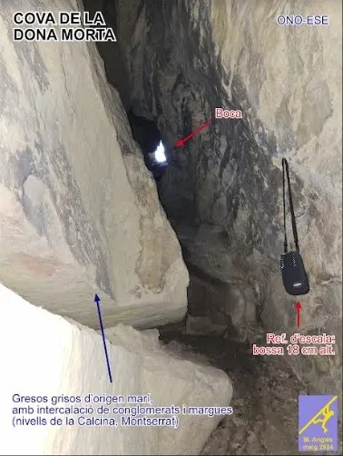
Cova de la Dona Morta
Cavitat subvertical de 14 m. de fondària i 104 m. de recorregut a Montserrat
EspeleoWorld
Cova de la Dona Morta
Cavitat subvertical de 14 m. de fondària i 104 m. de recorregut a Montserrat
Monistrol de Montserrat · Bages
Length: 104 m · Depth: 14 m
Updated record
https://espeleoworld.com/en/c/cova-de-la-dona-morta
Information can change. Always verify coordinates, access, weather, and cave conditions before setting out.
A subvertical cavity 14 m deep and 104 m long in Montserrat, on the south slope of the Piteus ridge. Developed in marine sandstones, with an entrance ramp, a 41 m main gallery and a final stalagmitic formation.
Topographic
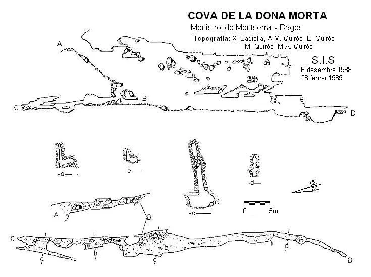

Espeleoindex · CC BY-NC 4.0, https://creativecommons.org/licenses/by-nc/4.0/ · Image © its author.
Photos

Espeleoindex · CC BY-NC 4.0, https://creativecommons.org/licenses/by-nc/4.0/ · Image © its author.
Description
Morphology
The cavity develops along a NNE-SSW joint that cuts a series of grey sandstones of marine origin, corresponding to the Calcina levels identified in the geological mapping (Berástegui & Losantos, 2003). In the first metres of vertical drop there is an intercalation of conglomerates and at the base of the cavity there is a level of marls. In the main chamber a small step of cm-dm order can be seen (sunken east block).
The entrance, a couple of metres high by one metre wide, gives access to a pronounced ramp almost 20 metres long. The inclination exceeds 40º and the floor is of sand and small pebbles, which makes the descent quite entertaining. The ceiling of the ramp remains horizontal from the entrance, which makes it gain height as we descend. Shortly before reaching the main chamber, we find on the left a small hollow through which one accesses the lower crawls of the North.
The large conduit of the main gallery is 41 metres long and develops towards the South, but turning slightly towards the West. The initial width is a good size, for it reaches 4 metres, although this lasts very little; as we advance it narrows rapidly to barely 2 metres, just where we find a large trunk placed expressly to access the upper level. If until now the ceiling seemed almost imperceptible to us, from this point we can follow it with ease.
For 16 metres, both the height of 2.5 metres and the width of 1.5 metres are almost constant. One can observe on the ceiling several holes that connect with the upper level, while the floor becomes flat, except for a small pit located at the end of the gallery, on the left side.
A right-angled fissure suddenly narrows the passage, at the same time as it reduces its height. The ceiling rises again until reaching 4 metres and 6 metres further on a pile of stones narrows the passage again. This time, the ceiling remains at the same level and it is the floor that drops one metre more suddenly, leaving us to continue for about 5 metres of gallery.
Speleothems
A stalagmitic formation in the form of a flowstone, which collects a 2 metre long pool where the main gallery ends.
Hydrology
It seems to be an ancient spring excavated following a marl stratum, like the Mentirosa de Monistrol, and which became dead when the torrent del Tortuguer was excavated.
Progression
Following the ramp down one must pass a short step to reach the main gallery. One must descend a half-metre step to continue the exploration.
History
The first reference we have of an exploration is the one carried out by the GES del CMB in October 1956.
User Comments (0)
No comments yet.
Be the first to share your experience!
Registered Explorations (0)
No explorations registered yet.
Register your visit to this cave!
Bibliography
- Badiella, Xavier et al. (1992).- “La influència dels relleus epigeus en la gènesi de certes cavitats montserratines”. SIS (12): 4-22 / Arxiu del Centre Excursionista de Terrassa (75): 140-158, Terrassa.
- Berástegui, X.; Losantos, M. (2003): Mapa Geològic de Catalunya 1:25.000, Monistrol de Montserrat 392-1-1 (71-29). Institut Cartogràfic de Catalunya, Servei Geològic de Catalunya, Barcelona.
- Fotografies facilitades per Antoni Ferro i Rosa González.
- Revisió coordenades facilitades per Jordi Navarro, (Centre Excursionista de Castellar del Vallès).
- Nota geològica i fotografia del detall facilitat per Marc Anglés. (actualització setembre de 2024).
Nearby caves
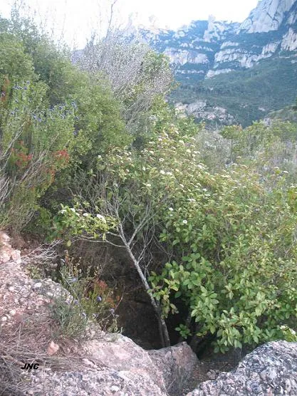
Pouetó de la Carena dels Piteus
0.3 km · S
Monistrol de Montserrat (Bages)
1 topo.4 photos
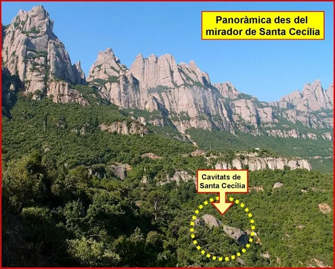
Coves de Santa Cecília
1.1 km · SW
Marganell (Bages)
4 topo.8 photos
Mentirosa de Coll de Vaca
1.5 km · SE
Monistrol de Montserrat (Bages)
1 topo.
Cova de Sant Jeroni
1.5 km · SW
Marganell (Bages)
1 topo.7 photos
Source: Espeleoindex (espeleoindex.com), modified. CC BY-NC 4.0, https://creativecommons.org/licenses/by-nc/4.0/