
Cova de Cal Magí Rossell
Interessant cavitat de 30 m de desnivell i 102 m de recorregut a Torrelles de Foix.
EspeleoWorld
Cova de Cal Magí Rossell
Interessant cavitat de 30 m de desnivell i 102 m de recorregut a Torrelles de Foix.
Torrelles de Foix · Alt Penedès
Length: 102 m · Depth: 30 m
Updated record
https://espeleoworld.com/en/c/cova-de-cal-magi-rossell
Information can change. Always verify coordinates, access, weather, and cave conditions before setting out.
A cavity with 30 m of vertical drop and 102 m of passage in Torrelles de Foix, discovered in 1951 and excavated from 1952. Catalogued as a natural inhumation burial cave of the Middle Bronze Age.
Topographic
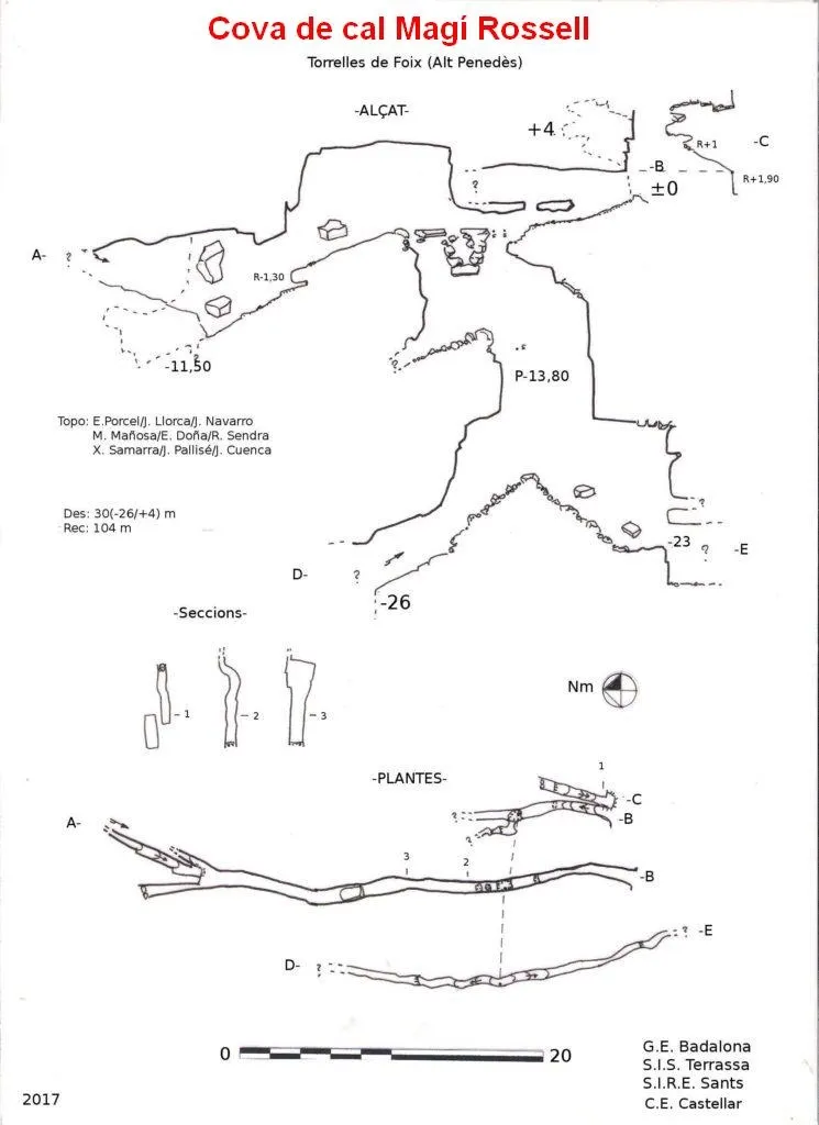
Espeleoindex · CC BY-NC 4.0, https://creativecommons.org/licenses/by-nc/4.0/ · Image © its author.
Photos
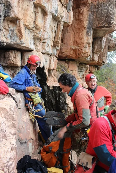
Espeleoindex · CC BY-NC 4.0, https://creativecommons.org/licenses/by-nc/4.0/ · Image © its author.
Description
Morphology
A spacious mouth 2.20 metres high by 0.80 wide will lead us into the main cave. Main, because on the right and under the same overhanging visor we find another secondary mouth. After overcoming an r+1.90 we reach this mouth of 3.50 metres high by 0.50 wide. It is an ascending gallery of about 3 metres with an r+1 and which ends 1.50 metres further on. Here we find the highest point of the cavity: +4.
We return to the main mouth and descend a ramp about 3.80 metres; here we find two levels. If we continue descending, 3 metres further we will reach some small steps that drop us into a P-13.80. If we go along the top, after overcoming an r+1 and advancing 2.60 metres we reach the upper part of the same aforementioned pit. On the other side of the pit, the gallery divides in two; the right one becomes impenetrable at 2.70 metres and the left one does the same at 2 metres. If we return to the head of the P-13.80 the gallery continues in a N direction; we will climb about 5 metres, above unstable ground where a couple of pits can be seen that connect with the main one. A couple of rotten planks would facilitate the passage for the old prospectors of archaeological remains. We continue 7.60 metres along a dusty descending ramp, and below a wedged block. The dimensions are 5.70 metres high and 0.90 wide. We pass an r-1; 5 metres further we find more wedged blocks. The left gallery ends 6 metres further on, a large block acts as a partition; the right one becomes very narrow and impenetrable (0.26 m) but a small pit can be seen and it continues with a faint air current. Above we can advance about 8 metres more to end in a closure of large blocks. Returning to the pit, we rappel 6.50 metres to a landing. In a N direction there is a descending ramp that closes after about 5 metres, but the continuation of the joint and the pit can be seen. On the ceiling we see the small pits we mentioned before and the precariousness of the blocks.
Continuing the rappel, 7 metres further down and after passing a selective narrow section, we land on a debris cone. If we go towards the S we descend about 11 metres passing under two blocks and reaching a meandering fissure, with an r-2.60 where the continuation can be seen but not the possibility of passage. Up to here the gallery was about 8 m high by 0.40 metres wide, descending to 1.20 metres high at this point. We are at -23 metres of depth.
Returning to the base of the pit, we descend about 7 metres to a small step; here we already have a selective narrow passage, we can still advance about 6 metres more to almost the head of a pit. Here we notice that a small air current comes out. We are at -26 metres. The continuation is quite obvious.
Vertical drop: 30 m. (+4/-26).
History
Cavity discovered by Josep Maria Masachs, collaborator of the Archaeology Section of the Museum of Vilafranca del Penedès, in 1951. From 1952, the excavation works begin by the well-known local archaeologist Pere Giró i Romeu, of the aforementioned Museum.
The cavity is catalogued as a Cova natural d'enterrament Inhumació with a chronological dating of: -1500 / -1200 / 07.02. Middle Bronze.
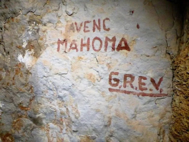
In 1958 a note appears in the magazine Cordada informing that members of the ERE – AEC (Vilafranca) have managed to reach 57 metres of depth in an already known cavity and that it is the deepest in the Penedès. They call it Avenc del Foc. For a long time there was speculation about which pit this was, without solving the mystery. In 1978, Joan Virella, in his collection of cavities of the Penedès, already points out that the avenc del Foc is none other than the Cova de Cal Magí Rossell.
In 1972, A. Lagar, in an article in Senderos, says that in 1959 he had been at the avenc (sic) de Cal Magí Rossell, visiting only the upper horizontal zone and leaving aside the descending conduits for lack of equipment. He returns in the summer of 1972 with his colleagues from the SIRE – UEC Gràcia and they are able to explore the whole lower zone, publishing a sketch of the cavity.
It will not be until 2017 that a large team of speleologists from four clubs (GEB, SIS, SIRE and CE Castellar) locate and survey the cavity, reaching the level of -26 metres of depth.
User Comments (0)
No comments yet.
Be the first to share your experience!
Registered Explorations (0)
No explorations registered yet.
Register your visit to this cave!
Bibliography
- Lagar, A. (1972).- “Dos nuevos 'avencs' en el Penedès”. Senderos (168): 24-26. Unió Excursionista de Catalunya. Barcelona.
- Poyo, A. (1958) “Exploraciones subterráneas en el Panadés”. Cordada (42): 11 Editor J.Mª Armengou. Barcelona.
- Virella, Joan (1978).- “Experiències a l’entorn de la localització d’estacions prehistòriques Apèndix. Catalogació de cavitats de les comarques penedesenques i encontorns”. Miscel·lània Penedesenca 1: 241-269. Institut d’Estudis Penedesencs. Vilafranca del Penedès
- Actualització de dades, topografia (2017) i fotografies, extretes del web: geb.cat. Apunt del dia 27 de febrer del 2017. Text fitxa: Enric Porcel (GEB). Fotografies: Jordi Navarro (CE Castellar) i Xavier Samarra (GEB)
Nearby caves
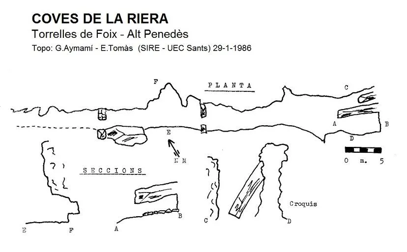


Source: Espeleoindex (espeleoindex.com), modified. CC BY-NC 4.0, https://creativecommons.org/licenses/by-nc/4.0/