
Cova d'en Joan Falgàs
A pit about 4 metres deep in the Montgrí, long known to the local people.
EspeleoWorld
Cova d'en Joan Falgàs
A pit about 4 metres deep in the Montgrí, long known to the local people.
Torroella de Montgrí · Baix Empordà
Length: 15 m · Depth: 4 m
Updated record
https://espeleoworld.com/en/c/cova-d-en-joan-falgas
Information can change. Always verify coordinates, access, weather, and cave conditions before setting out.
A pit about 4 metres deep in the Montgrí, long known to the local people.
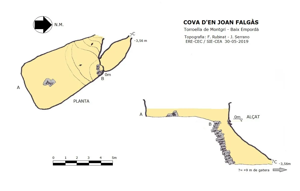
Topographic

Espeleoindex · CC BY-NC 4.0, https://creativecommons.org/licenses/by-nc/4.0/ · Image © its author.
Photos

Espeleoindex · CC BY-NC 4.0, https://creativecommons.org/licenses/by-nc/4.0/ · Image © its author.
Description
Morphology
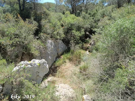
It opens in a depression of 8.5x4 metres; on its NE side and among some blocks a stepped shaft of -3.5 metres opens; at the base of the shaft we find a small chamber of 3.2x1.65 metres; on its NW side a crawlway continues which, according to reports, is about 9 metres long, where it becomes impenetrable.
Progression
On the visit during which the survey was made (05-2019), it was not possible to get past the chamber due to the presence of an enormous dead wild boar, which gave off an unbreathable stench.
History
Long known to the local people; in fact the depression is artificial, since the stone for the lime kiln was taken from here; most probably the opening of the mouth was a consequence of this extraction.
It was explored by the SIE-CEA during the course of the campaign carried out in the Montgrí in the years 2006-2007.
User Comments (0)
No comments yet.
Be the first to share your experience!
Registered Explorations (0)
No explorations registered yet.
Register your visit to this cave!
Bibliography
- Arbusé Bellapart, Narcís (2005).-El Montgrí pas a pas. 174 pp. Cossetània Edicions. Valls
- Valles, Jordi de (2010).-”Alt Empordà, Baix Empordà, Gironès, Osona, Pla de l'Estany, Selva”. Catàleg Espeleològic de Catalunya. (Vol.4):1-397. Espeleo Club de Gràcia / Federació Catalana d'Espeleologia.
- Dades, coordenades, topografia i fotos aportades per Juli Serrano (SIE-CEA) i Francesc Rubinat (ERE-CEC)
Nearby caves

Cau Petit de la Carnisseria
0.1 km · NW
Torroella de Montgrí (Baix Empordà)
1 topo.5 photos
Cau Gran de la Carnisseria
0.5 km · NW
Torroella de Montgrí (Baix Empordà)
1 topo.9 photos

Cau dels Hereus
0.5 km · N
Torroella de Montgrí (Baix Empordà)
4 photos
Cau Petit dels Cisternons
0.7 km · NW
Torroella de Montgrí (Baix Empordà)
Source: Espeleoindex (espeleoindex.com), modified. CC BY-NC 4.0, https://creativecommons.org/licenses/by-nc/4.0/