
Cova d'Anes
Interessant cova de 360 m. de recorregut a Prullans (la Cerdanya)
EspeleoWorld
Cova d'Anes
Interessant cova de 360 m. de recorregut a Prullans (la Cerdanya)
Prullans · Cerdanya
Length: 360 m · Depth: 12 m
Updated record
https://espeleoworld.com/en/c/cova-d-anes
Information can change. Always verify coordinates, access, weather, and cave conditions before setting out.
Cova d'Anes, in Prullans (la Cerdanya), with 360 m of passage, a meandering gallery, lithogenic formations and the Xarxa de Pous.
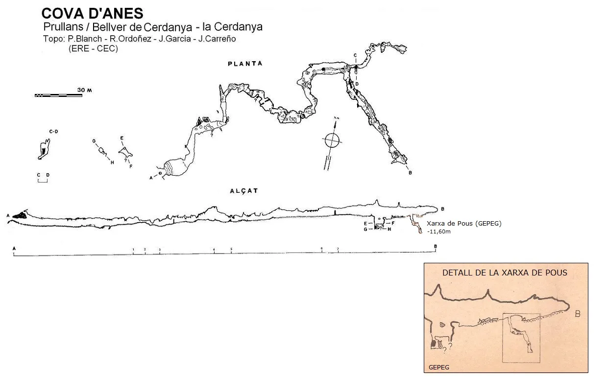
Topographic
Espeleoindex · CC BY-NC 4.0, https://creativecommons.org/licenses/by-nc/4.0/ · Image © its author.
Photos
Espeleoindex · CC BY-NC 4.0, https://creativecommons.org/licenses/by-nc/4.0/ · Image © its author.
Description
Morphology
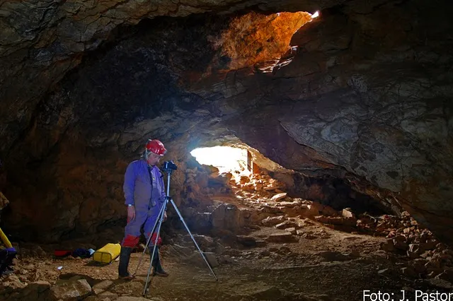
Through an entrance of moderate dimensions one enters a first chamber which has another opening to the outside in its ceiling. The cavity consists practically of a single gallery, of meandering layout and generally ample dimensions, comfortable to traverse.
In the last stretch of the gallery, on the right, a branch appears, slightly ascending and about 50 metres long. Halfway along it there is a small shaft developed among the sediments.
Halfway along the main gallery, at a point of smaller dimensions, there is an open iron grille which, so they say, marks the boundary between the municipalities of Prullans and Bellver de Cerdanya.
The Xarxa de Pous is located in the main gallery, once past the shaft that opens in the middle of the gallery. After 22 metres from the aforementioned shaft, on the right-hand side of the gallery following the entrance-to-end direction, we find a small opening that gives access to a little 4-metre shaft, with a narrow passage that leads to a small chamber where the openings to three new shafts open. The one of larger dimensions, which is situated to the W, by means of a short ramp gives access to a second chamber with a fairly steep floor, where the openings to three more shafts open.
All these shafts are of minimal dimensions, with depths ranging between 3 and four metres and are totally independent of one another.
Speleothems
The walls are covered by beautiful lithogenic formations.
The formations in this sector are found grouped in very specific zones and of reduced size; in the rest of the sector a rather corrosive morphology predominates.
History
Known since ancient times by the people of the area, it is not until the year 1950 that the first speleological report occurs, following the visit of members of the GES-CMB (Montoriol, Español i Vicens). They sense a possible continuation and inform the municipal authorities, who have a passage enlarged and new galleries found.
There are reports of other visits, the most relevant perhaps being the one carried out by members of the GIE-CE Gràcia around the year 1960 or 1961, who claim to discover new branches and produce the first known survey of the cavity (published in Ampurias nº 24, 1962).
Towards the middle of the 1960s, members of the ERE-CEC, within the speleological campaign in the Cerdanya, carry out a new survey.
In 1978, members of the GEPEG (Grup Espeleològic de la Penya Excursionista Guimerà), explore the Xarxa de Pous, situated almost at the end of the main gallery; the data from this exploration remained unpublished for almost 40 years.
Even if only as an anecdote, it should be remembered that the Cova d'Anes was the place chosen by Emilio Reyes to carry out his last “underground endurance test” in the year 1990.
It should also be recorded that important archaeological finds have been located in the cavity in different campaigns.
Toponymy: Over the years the cavity has been called by different forms: Cova d'Anas, d'Annas, d'Annes. But it seems that the correct toponym is that of Anes, which corresponds to that of the house near the cave.
User Comments (0)
No comments yet.
Be the first to share your experience!
Registered Explorations (0)
No explorations registered yet.
Register your visit to this cave!
Bibliography
- AA. (1950).- “Sección de exploraciones”. Speleon I (3-4): 233-234. Universidad de Oviedo.
- Borràs, J.; Miñarro,JM.; Talavera, F: (1978).-”l'Alt Urgell i la Cerdanya”. Catàleg espeleològic de Catalunya. (Vol.1): 166. Ed. Políglota. Barcelona.
- Canals, M.; Ribera, C. Viñas, R. (1970).-La Fou de Bor i cavitats de l'alta vall del Segre., 98 pp. Centre Excursionista de Catalunya – Ed. Montblanch.
- Ripoll, E. (1962).- “Notas de arqueología de Cataluña y Baleares (Lérida)”. Ampurias (24): 329-330. Museo de Arqueología de Cataluña.
- Sas, F. (1963).- “El secreto de Cueva Annas”. Boletin Club Excursionista de Gràcia (octubre): 203-204. CE de Gràcia. Barcelona.
- Viñas, R.; Ribera, C. (1969).- “Espeleología en la Cerdanya”. Montaña (120-124): 332-338. Centre Excursionista de Catalunya. Barcelona.
- Coordenades, fotografies i altres dades extretes del blog: Espeleobloc (post del 8 març 2011).
- Fitxa actualitzada el 3-9-2017 amb dades inèdites de la Xarxa de Pous, facilitades per Alex Martin Alcalde.
Nearby caves

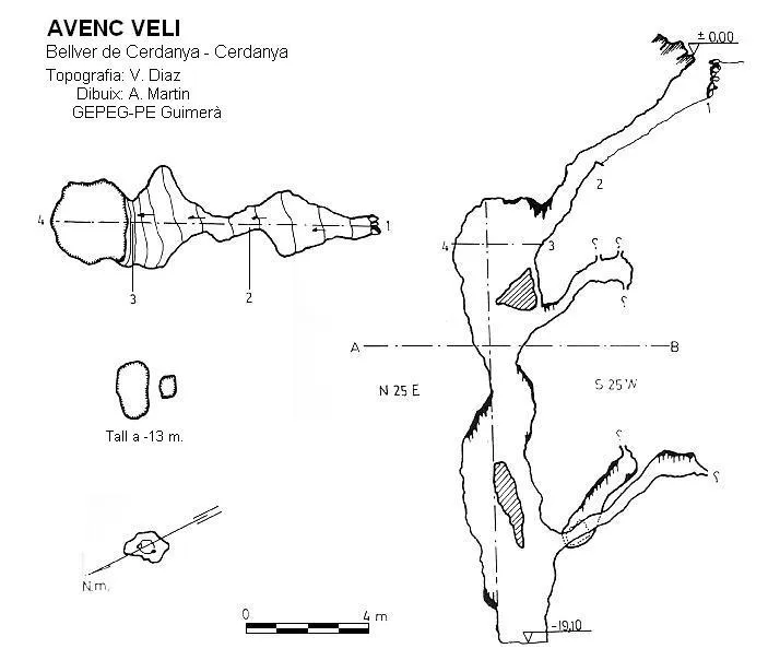
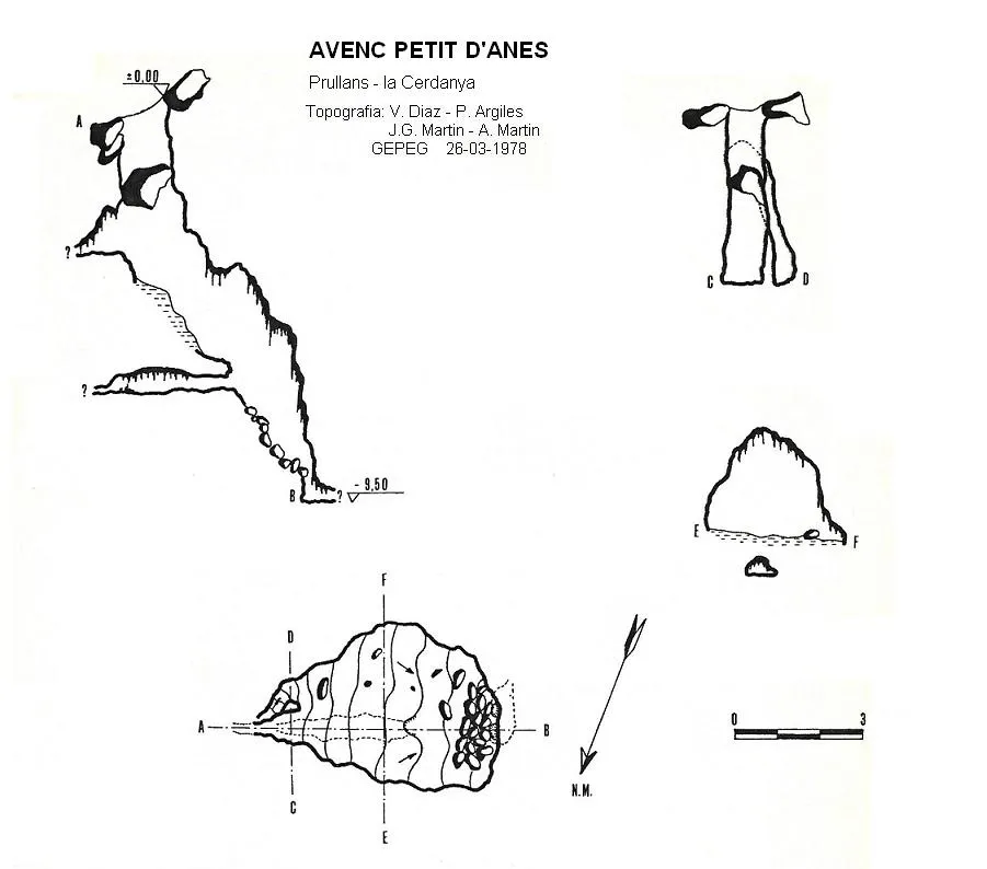


Source: Espeleoindex (espeleoindex.com), modified. CC BY-NC 4.0, https://creativecommons.org/licenses/by-nc/4.0/