
Cauva Dera Hònt Hereda
Interessant cova de 150 m. de recorregut a la Vall d'Aran
EspeleoWorld
Cauva Dera Hònt Hereda
Interessant cova de 150 m. de recorregut a la Vall d'Aran
Vielha e Mijaran · Val d'Aran
Length: 150 m · Depth: 21 m
Updated record
https://espeleoworld.com/en/c/cauva-dera-hont-hereda
Information can change. Always verify coordinates, access, weather, and cave conditions before setting out.
A 150 m long cave in the Vall d'Aran, with a total elevation difference of 21.2 m (-11.4; +9.8), located by members of SIRE – UEC Sants in August 1982.
Topographic
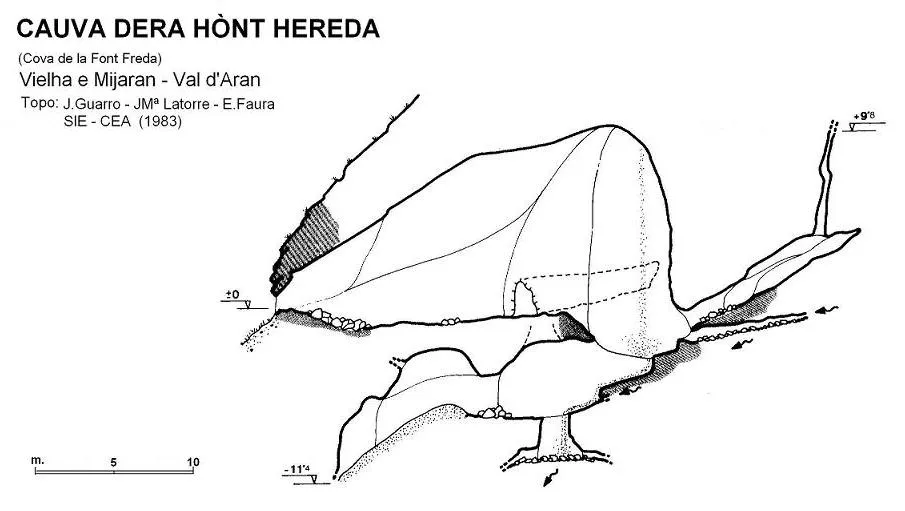
Espeleoindex · CC BY-NC 4.0, https://creativecommons.org/licenses/by-nc/4.0/ · Image © its author.
Description
Morphology
Wide entrance portal with a main gallery of notable dimensions. Shortly after entering, on the right, a gallery branches off, subdivided into several chambers by different sections of partition that separate them.
Halfway along the main gallery, a narrow gallery about 15 metres long branches off to the left and ends in a narrowing. Continuing to the end of the main gallery, a low-ceilinged gallery appears through which a small watercourse flows that, after a short passage along a descending gallery, disappears among blocks; this descending gallery continues a few more metres until reaching, among sediments, the deepest point of the cave.
Beside the gallery through which the water emerges, an ascending ramp conduit originates, about 10 metres long, which ends in a narrow chimney that rises to almost 10 metres of elevation difference above the entrance mouth.
Total elevation difference 21.2 m. (- 11.4; + 9.8).
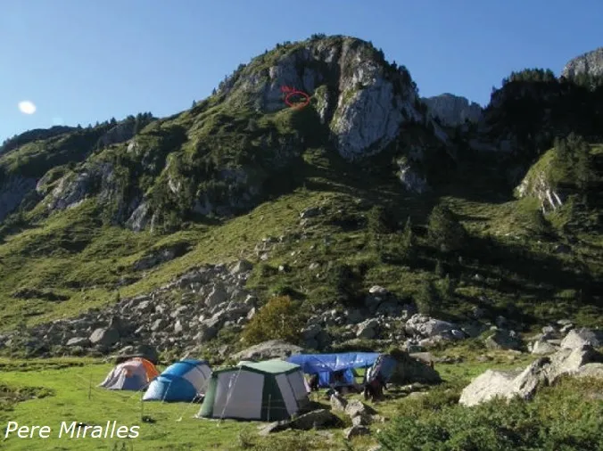
About 50 metres above the cave there is a doline-funnel about 15 metres deep.
Hydrology
The watercourse that comes from the estany is lost in a doline-funnel about 15 metres deep located about 50 metres above the cave, and re-emerges outside through springs located about 30 metres below the cave.
History
Located by members of SIRE – UEC Sants in August 1982, who did not visit it until the spring of 1983, then as members of SIE-CEA, a time when the mouth was covered by a large amount of snow.
User Comments (0)
No comments yet.
Be the first to share your experience!
Registered Explorations (0)
No explorations registered yet.
Register your visit to this cave!
Bibliography
Guarro, J. (1986).- “Exploracions a la Val d'Aran” EspeleoSie (28): 12-18. SIE del CE Àliga. Barcelona.
Nearby caves

Source: Espeleoindex (espeleoindex.com), modified. CC BY-NC 4.0, https://creativecommons.org/licenses/by-nc/4.0/