
Balma de Sovelles
Interesting cavity at the Serrat del Bou (les Llosses, Ripollès)
EspeleoWorld
Balma de Sovelles
Interesting cavity at the Serrat del Bou (les Llosses, Ripollès)
Llosses, Les · Ripollès
Length: 19 m · Depth: 5 m
Updated record
https://espeleoworld.com/en/c/balma-de-sovelles
Information can change. Always verify coordinates, access, weather, and cave conditions before setting out.
Interesting cavity at the Serrat del Bou (les Llosses, Ripollès)
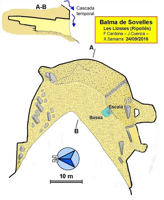
Topographic

Espeleoindex · CC BY-NC 4.0, https://creativecommons.org/licenses/by-nc/4.0/ · Image © its author.
Photos

Espeleoindex · CC BY-NC 4.0, https://creativecommons.org/licenses/by-nc/4.0/ · Image © its author.
Description
Morphology
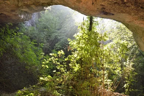
Rock shelter of good dimensions and semicircular shape located right in the middle of a torrent, so in rainy periods a waterfall plunges down its central sector. The floor has a couple of steps, with some relatively flat sectors that facilitate its habitability, where some human constructions can be observed. The rock shelter drops steeply on the N side, so this side is at a noticeably lower elevation than the S side. The height of the roof, although variable, remains largely above three metres and decreases towards the interior. The depth of the rock shelter is 19 metres.
History
Known by the people of the area and by hikers who go to visit it. It had never been speleologically catalogued. The rock shelter has been used by man. We find low stone walls and some sections of the roof are blackened from having made fires. Notable is an excavation, like a small pool, intended to collect water from the drips and accessed by some steps made with stones.
User Comments (0)
No comments yet.
Be the first to share your experience!
Registered Explorations (0)
No explorations registered yet.
Register your visit to this cave!
Bibliography
- Totes les dades, topografia i fotografies han estat extretes del web: geb.cat (GE Badalona). Apunt del dia 1 de novembre del 2016. Autors fitxa: F. Cardona (ECG), J. Cuenca i F.X. Samarra (GEB).
Nearby caves
Cova les Tofaroques de les Pinoses
2.1 km · W
Llosses, Les (Ripollès)
1 topo.5 photos
Bauma les Tofaroques de les Pinoses
2.1 km · W
Llosses, Les (Ripollès)
1 topo.4 photos
Cova de Tofaroques
2.5 km · W
Llosses, Les (Ripollès)
1 topo.5 photos
Forat del Castell de Boixader
2.8 km · S
Sora (Osona)
1 topo.6 photos
Source: Espeleoindex (espeleoindex.com), modified. CC BY-NC 4.0, https://creativecommons.org/licenses/by-nc/4.0/