

Balma de la Font del Bassi
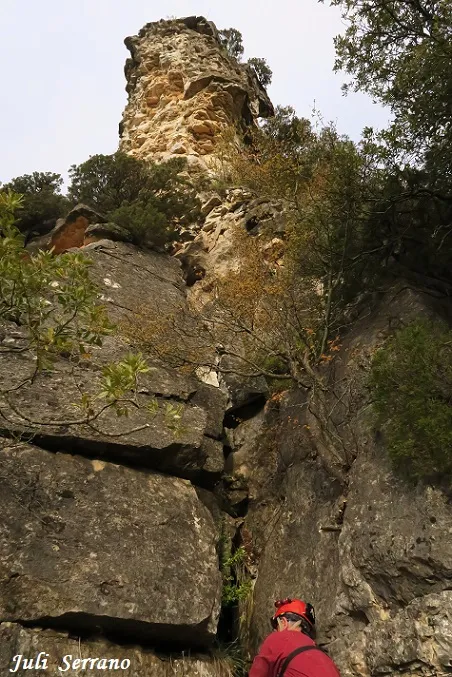
A rock shelter at the base of the cingle de la serra Plana (La Febró), known since ancient times, with the Font del Bassi and a nearby pothole.
EspeleoWorld
Balma de la Font del Bassi
A rock shelter at the base of the cingle de la serra Plana (La Febró), known since ancient times, with the Font del Bassi and a nearby pothole.
Febró, La · Baix Camp
Length: 6 m
Updated record
https://espeleoworld.com/en/c/balma-de-la-font-del-bassi
Information can change. Always verify coordinates, access, weather, and cave conditions before setting out.
A rock shelter at the base of the cingle de la serra Plana (La Febró), known since ancient times, with the Font del Bassi and a nearby pothole.
Topographic

Espeleoindex · CC BY-NC 4.0, https://creativecommons.org/licenses/by-nc/4.0/ · Image © its author.
Photos
Espeleoindex · CC BY-NC 4.0, https://creativecommons.org/licenses/by-nc/4.0/ · Image © its author.
Description
Morphology
It is an interesting place with some rather curious karst features. The rock shelter is 6.5 metres deep and is opened in marly limestones. 5 metres to the E side we find some tiny rock shelters, and just 5 metres above there is an enormous pothole of 3.5x3.5x2.1 metres.
Speleothems
The water of the font del Bassi comes from the drip of a stalagmitic flow on the wall.
Hydrology
The font del Bassi is 5 metres to the E of the rock shelter. In the pothole located 5 metres above the tiny rock shelters, up to 25 cubic metres of water can pool; we do not rule out that this pothole has some relation to the spring.
History
Rock shelter known since ancient times.
User Comments (0)
No comments yet.
Be the first to share your experience!
Registered Explorations (0)
No explorations registered yet.
Register your visit to this cave!
Bibliography
- Totes les dades, coordenades, situació, topografia i fotografies ha estat facilitades per Francesc Rubinat (ERE-CEC) i Juli Serrano (SIE-CEA).
Nearby caves




Source: Espeleoindex (espeleoindex.com), modified. CC BY-NC 4.0, https://creativecommons.org/licenses/by-nc/4.0/