
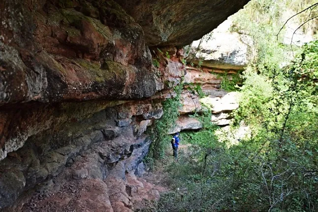
Balma de la Blanquera
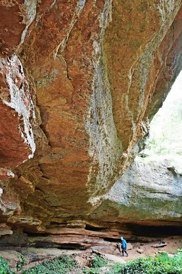
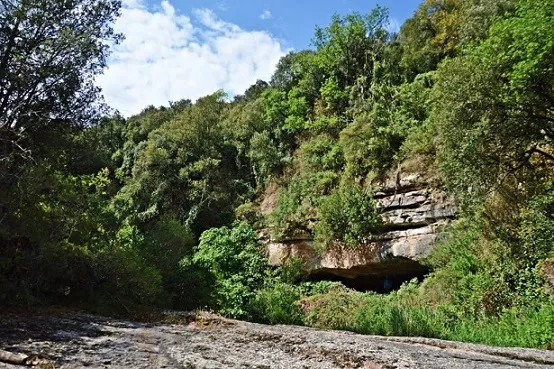
Wide shelter south of Mura, 42 m long, 6 m deep and 10 m maximum height, with remains of dry-stone walls.
EspeleoWorld
Balma de la Blanquera
Wide shelter south of Mura, 42 m long, 6 m deep and 10 m maximum height, with remains of dry-stone walls.
Mura · Bages
Length: 6 m
Updated record
https://espeleoworld.com/en/c/balma-de-la-blanquera
Information can change. Always verify coordinates, access, weather, and cave conditions before setting out.
Wide shelter south of Mura, 42 m long, 6 m deep and 10 m maximum height, with remains of dry-stone walls.
Topographic
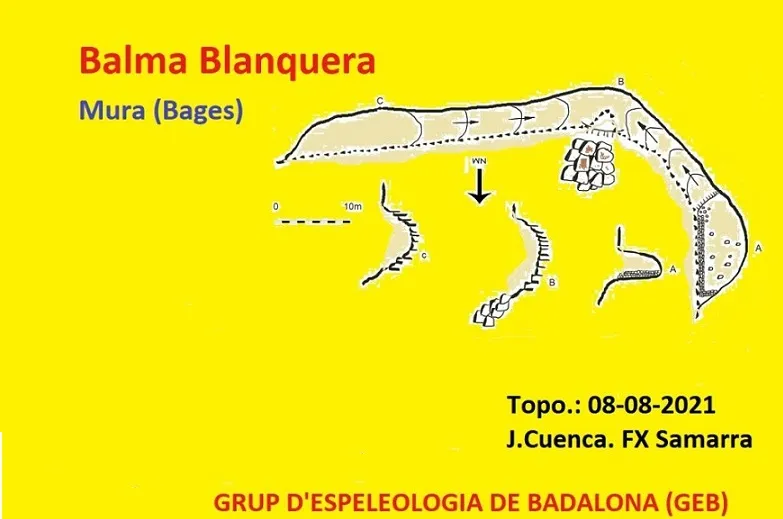
Espeleoindex · CC BY-NC 4.0, https://creativecommons.org/licenses/by-nc/4.0/ · Image © its author.
Photos
Espeleoindex · CC BY-NC 4.0, https://creativecommons.org/licenses/by-nc/4.0/ · Image © its author.
Description
Morphology
The Balma de la Blanquera has dimensions of 42 m in length by about 6 m in depth and a maximum height of 10 m.
Other details
In the western sector, remains of old dry-stone walls are still preserved that would serve as a refuge, possibly, for the workers of the nearby lime kiln.
User Comments (0)
No comments yet.
Be the first to share your experience!
Registered Explorations (0)
No explorations registered yet.
Register your visit to this cave!
Bibliography
- Totes les dades, topografia i fotografies han estat extretes del web: geb.cat (del Grup d'Espeleologia de Badalona). Apunt del 7-2-2022. Dades: Josep Cuenca i Xavier Samarra (GEB)
Nearby caves


Source: Espeleoindex (espeleoindex.com), modified. CC BY-NC 4.0, https://creativecommons.org/licenses/by-nc/4.0/