
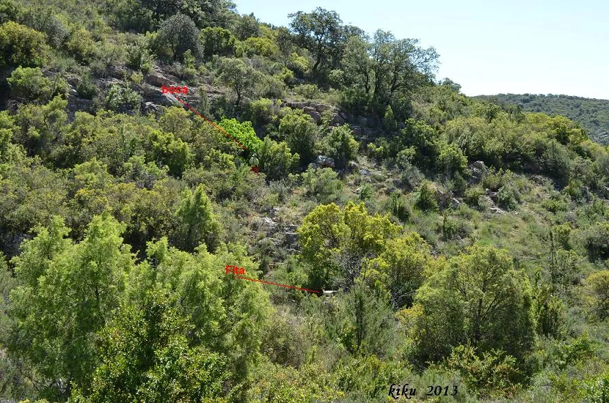
Baborell de la Dona Morta
Avenc de 66 metres de fondària a la serra de Sant Mamet, Alòs de Balaguer.
EspeleoWorld
Baborell de la Dona Morta
Avenc de 66 metres de fondària a la serra de Sant Mamet, Alòs de Balaguer.
Alòs de Balaguer · Noguera
Length: 155 m · Depth: 66 m
Updated record
https://espeleoworld.com/en/c/baborell-de-la-dona-morta
Information can change. Always verify coordinates, access, weather, and cave conditions before setting out.
A 66-metre-deep pit in the serra de Sant Mamet, Alòs de Balaguer, known since ancient times and explored on 26 January 1969.
Topographic
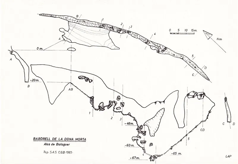

Espeleoindex · CC BY-NC 4.0, https://creativecommons.org/licenses/by-nc/4.0/ · Image © its author.
Photos

Espeleoindex · CC BY-NC 4.0, https://creativecommons.org/licenses/by-nc/4.0/ · Image © its author.
Description
Morphology
The mouth gives access to a small 4-metre pit that places us on a wide ledge. Here a ramp of about 50 degrees with a 13-metre traverse begins, which pours us into a 9-metre vertical, at whose base it places us at the -22 metres level. On the NW side the cavity continues along a ramp and continues through a narrow joint until -35 metres where it becomes impassable due to its narrowness. On the SE side the gallery continues wide, with large blocks that can be passed underneath until reaching a passage between blocks at -31 metres depth. One must descend -9 metres between the blocks to place ourselves again in the gallery. A new passage between blocks places us at the -47 metres level at the start of a -11.5 metre pit at whose base we find a sediment ramp that leads us to the centre of a large joint; on the other side from where we entered, a good part of this joint can be climbed back up. At the base situated at -63 metres, we find a passage between blocks that allows us to descend -3 metres more, ending the cavity at the -66 metres level. In the main gallery, before passing the blocks at the -31 metres level, the joint can be climbed back up to the upper part; here, after passing a narrow passage, there is a pit of about 28 metres that ends at the same final point as the previous access.
Progression
Given that the two known surveys of this cavity presented a difference in their depth of 19 metres, we considered it appropriate to make a mouth-to-bottom traverse to check which was the more correct, since the first (SAS, 1969) gave a depth of 67 m and the second (GERS, 1977) instead had a depth of 48 m. On the survey of this one we have recorded the level of the original version and the real one, recalculated from the aforementioned traverse, although to the -63 m level one must add the final small pit between blocks that is not represented.
History
Known since ancient times by the local people and used as a hiding place and refuge during the 1936 war. It was explored on 26 January 1969 by Auroux, Meseguer, Pallarès of the SAS of the CGB and Oleguer Escolà of the ERE of the CEC.
Toponymy: The word baborell is a very infrequent toponym; in fact we only know of three cases, this one of the Dona Morta, that of en Remigio, both in the same area of the Noguera, and a more distant one, the Baborell de Montsec de Tost, in the Alt Urgell.
The oldest description that we have found is in the Diccionari Català-Valencià-Balear (Alcover – Moll, 1930-1962) which says: Forat per on passa l'aire acanalat i fred. Escolà (1970) says that baborell comes from the condensation that in winter the warm air coming out of the mouth of the cavity suffers, which contrasts with the previous definition that speaks of cold air. Nevertheless, in the same Alcover – Moll dictionary they include the word bavor (formerly, babor) defining it as warm breath, sultriness. This already comes closer to what Escolà says. Later, in the Gran Enciclopèdia Catalana, they include the words bavor and bavorell, defining the latter as: Forat per on passa l'aire acanalat (they omit whether cold or warm). The truth is that both at the Baborell de la Dona Morta and at the Baborell de Montsec, on cold winter days a column of vapour usually comes out of their mouths. We do not know whether the same happens at that of en Remigio.
Bio
Speonomus puncticollis. 45 specimens collected by Lluís Auroux and Oleguer Escolà on 26 January 1969.
User Comments (0)
No comments yet.
Be the first to share your experience!
Registered Explorations (0)
No explorations registered yet.
Register your visit to this cave!
Bibliography
- AA.(1971).-”Relación de cavidades”. Memoria 5º Campamento Regional de Espeleólogos-Montsec. pp. 8-12. SAS-CGB.Barcelona.
- Escolà i Boada, Oleguer (1970).- “Catálogo Espeleológico del Montsec”. Espeleòleg (11-12):453-541. ERE del CEC. Barcelona.
- Garcia, Domingo;Gascó,J.(1979).-“Estudio del Baborell de la Dona Morta”.Carbonato (1):24-27. GERS-AEM. Barcelona.
- Gàzquez i Pons, Josep Lluís.(1995).-”Catàleg Espeleològic de la Noguera” Grallera (3-4):1-90. GELL – CE Lleida.
- Actualització de fitxa maig de 2018, situació, descripció, revisió topogràfica i fotografies facilitades per Juli Serrano (SIE-CEA) i Francesc Rubinat (ERE-CEC).
Nearby caves
Baborell d'en Remigio
0.8 km · SE
Alòs de Balaguer (Noguera)
1 topo.5 photos
Avenc del Fusell
3.2 km · NE
Artesa de Segre (Noguera)
1 topo.
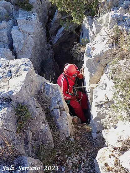
Forat del Barranc de la Clua
3.4 km · NE
Artesa de Segre (Noguera)
1 topo.8 photos
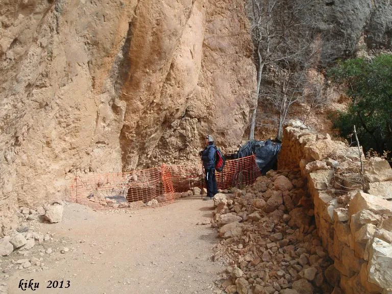
Cova del Parco
3.6 km · SW
Alòs de Balaguer (Noguera)
1 topo.5 photos
Source: Espeleoindex (espeleoindex.com), modified. CC BY-NC 4.0, https://creativecommons.org/licenses/by-nc/4.0/