
Avenc de Pratdip
Avenc de 68 metres de desnivell a la Muntanya Blanca de Pratdip.
EspeleoWorld
Avenc de Pratdip
Avenc de 68 metres de desnivell a la Muntanya Blanca de Pratdip.
Pratdip · Baix Camp
Length: 220 m · Depth: 68 m
Updated record
https://espeleoworld.com/en/c/avenc-de-pratdip
Information can change. Always verify coordinates, access, weather, and cave conditions before setting out.
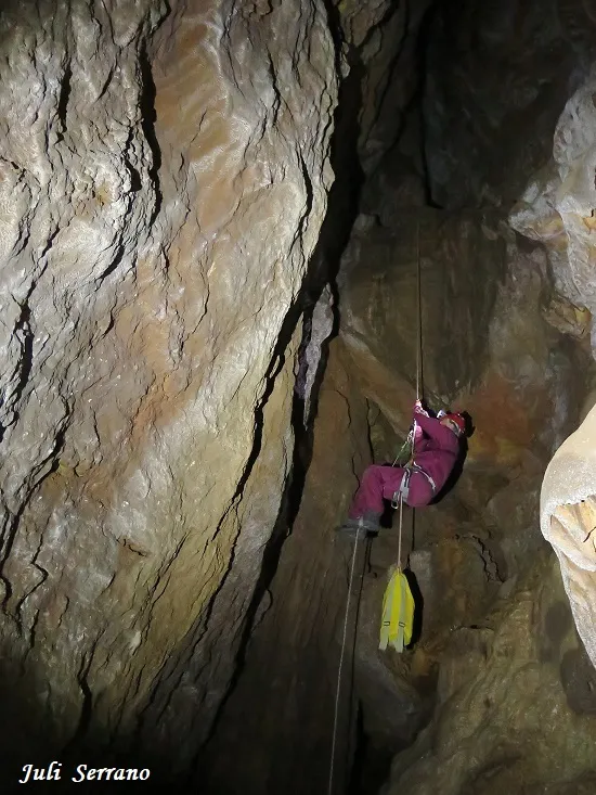
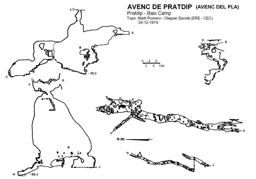
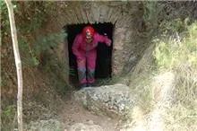
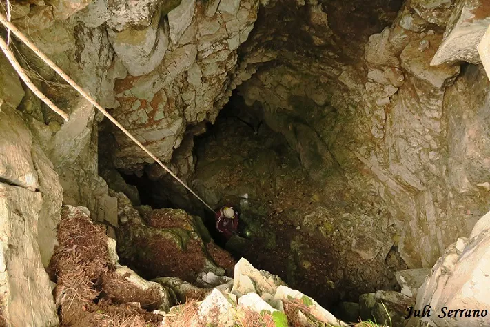
A pit with a vertical drop of 68 metres on the Muntanya Blanca de Pratdip, with an entrance shaft of 21 metres and a lower gallery that reaches the 68.4 level.
Topographic
Espeleoindex · CC BY-NC 4.0, https://creativecommons.org/licenses/by-nc/4.0/ · Image © its author.
Photos
Espeleoindex · CC BY-NC 4.0, https://creativecommons.org/licenses/by-nc/4.0/ · Image © its author.
Description
Morphology
The small entrance gives way to a shaft of 21 metres and its base is nothing more than a platform full of blocks. In a S direction the joint can still be followed, in an ascending direction, until it becomes impenetrable. At the foot of the vertical of the entrance shaft, the shaft continues for a further 10 metres and at its bottom an uneven gallery begins in a N direction, of considerable height, with small steps between blocks and with widths that oscillate between 3 and 7 metres. In its widest part and a few metres before being blocked by the blocks, on its E wall there is a conduit that, between blocks, reaches the -50 level. A little further on from the central zone of this gallery and on the W wall, there exists, between the blocks, the entrance to a small chamber that descends a few metres until reaching the mouth of a new vertical, this one of 30 metres of drop and which descends along a new fissure, considerably narrower than that of the upper zone. At its bottom it can still be followed in both directions of the base of the shaft, along a narrow floor made uneven by numerous blocks. In a N direction it descends slowly until closing at the point of maximum depth (68.4 level).
Other details
The cavity is structured on a S – N joint, which has developed through infiltrations coming from the upper platform. The clastic process was very important, alternating with two lithogenic phases, which have a great development in the northern end of the main gallery.
History
Puig y Larraz (1896) mentions an “Avench de Pratdip”, taking the data from a report on earthquakes (Bayo, 1845). From the brief description he gives, we understand that he is not referring to the avenc de Pratdip (Avenc del Pla), but to the cave of the same name. According to Joan Ferraté (1918) the first exploration took place on 12 March 1911 by members of the Agrupació Excursionista de Reus, who did not go beyond the zone of the first shaft. The second exploration was carried out on 27 October 1935 by a large group of members of the Club Muntanyenc Barcelonès and although they make an exhaustive reconnaissance of all the galleries of the lower zone of the entrance shaft, they do not find the access to the lower zone of the cavity. We have practically no further documented news, we only know by hearsay that speleologists from Reus visited it often around the decade of the 1960s and that they had discovered a new shaft that gained depth for the pit. It also seems that the people of Reus began to call it Avenc del Pla, because it is located in the Pla de l'Avenc. These data are confirmed and documented after the exploration by the SIE – CEA at the end of 1972. It should be said that according to the most current geo-references, the pit is located in the municipality of Pratdip, contrary to the data of the most “recent” surveys: SIE (1972) and ERE-CEC (1974) which placed it in the municipality of Colldejou. Toponymy: We have had a certain dilemma when choosing the name of the cavity for its cataloguing. Since ancient times its explorers have called it Avenc de Pratdip, but for some years now the most common name for it is Avenc del Pla. Finally we have opted for the first in consideration of the history of the pit. Unlike its neighbour, the Cova d'en Blai, d'en Xoles or del Mas Monet, which the first speleologists who studied it called Cova de Pratdip, it should be said that the previous names (Blai and Xoles) were in common use in the area to name it before the speleological explorations.
User Comments (0)
No comments yet.
Be the first to share your experience!
Registered Explorations (0)
No explorations registered yet.
Register your visit to this cave!
Bibliography
- Ferraté, J. (1918).- Espeleologia de les comarques tarragonines. 133 pp. Agrupació Excursionista de Reus.
- Llopis Lladó, N. (1935).- “ Els fenòmens càrstics de la Muntanya Blanca de Pratdip” Sota Terra (II): 91-101. Club Muntanyenc Barcelonès.
- Miñarro, JM.; Lázaro, P. (1977).- “Breves notas descriptivas sobre algunas cavidades de la Serra de Llaberia (Baix Camp, T).” EspeleoSie (20): 45-63. SIE del CE Àliga. Barcelona.
- Montserrat, A. (1979).- “Sobre algunes cavitats de les comarques del Baix Camp i Priorat”. Espeleòleg (28): 489-530. ERE del CEC. Barcelona.
- Coordenades i fotografies extretes del blog de la SIS – CE Terrassa
- Actualització de fitxa novembre de 2017. Situació i fotografies facilitades per Juli Serrano (SIE-CEA) i Francesc Rubinat (ERE-CEC).
Nearby caves


Source: Espeleoindex (espeleoindex.com), modified. CC BY-NC 4.0, https://creativecommons.org/licenses/by-nc/4.0/