
Avenc de la Solana de Ca la Torre
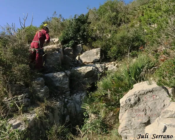
A 31-metre-deep pit in Pratdip, located at the Solana de Ca la Torre, on the lower part of the S slope of the Puig del Marquès.
EspeleoWorld
Avenc de la Solana de Ca la Torre
A 31-metre-deep pit in Pratdip, located at the Solana de Ca la Torre, on the lower part of the S slope of the Puig del Marquès.
Pratdip · Baix Camp
Length: 72 m · Depth: 31 m
Updated record
https://espeleoworld.com/en/c/avenc-de-la-solana-de-ca-la-torre
Information can change. Always verify coordinates, access, weather, and cave conditions before setting out.
A 31-metre-deep pit in Pratdip, located at the Solana de Ca la Torre, on the lower part of the S slope of the Puig del Marquès.
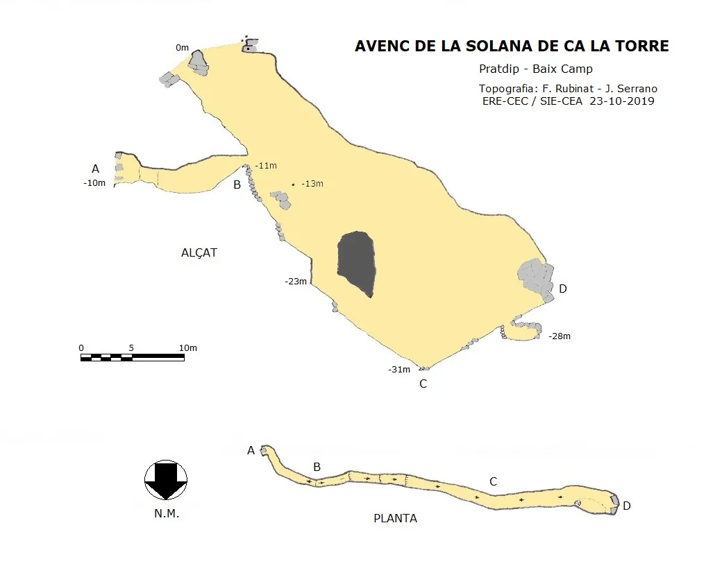
Topographic

Espeleoindex · CC BY-NC 4.0, https://creativecommons.org/licenses/by-nc/4.0/ · Image © its author.
Photos

Espeleoindex · CC BY-NC 4.0, https://creativecommons.org/licenses/by-nc/4.0/ · Image © its author.
Description
Morphology
A long fissure full of vegetation gives access through the highest part of the fissure to a 13-metre shaft, followed by a further 6-metre drop that leaves us at the start of a short ramp that leads us to a further 3-metre drop, followed by a new ramp and another drop of just over one metre, a new ramp leads us to the lowest point of the cavity, here an ascending ramp begins that ends in a chaos of large blocks, shortly before reaching the end of this ascending ramp, we find on the ground a small pit of just over one metre that forms a small chamber among the blocks.
Once at the base of the entrance shaft, we find a gallery that, following the fissure in an easterly direction, leads us through a narrow passage between blocks and vegetation to the outside, on the cliffy part of the ravine.
Progression
The cavity was rigged with 2 fixed 8mm parabolt anchors at the head and 2 multimontis at the shafts, which have been removed.
History
Explored by the SIE – CE Àliga in November 1972. A survey was made but it was never drawn up and was lost.
Some 30 years later, our friend Floren Fadrique (SIE – CEA), on one of his biospeleological research outings, was able to locate it and visit it, providing fairly approximate location data.
In October 2019 members of the SIE of the CEA and of the ERE of the CEC located and surveyed it.
User Comments (0)
No comments yet.
Be the first to share your experience!
Registered Explorations (0)
No explorations registered yet.
Register your visit to this cave!
Bibliography
- Borràs, J.; Miñarro, JM.; Talavera, F. (1984).-”el Baix Camp, el Priorat i la Ribera d'Ebre”. Catàleg espeleològic de Catalunya. (Vol.7):283 pp. Ed. Políglota. Barcelona.
- Miñarro, JM.; Lázaro, P. (1977).- “Breves notas descriptivas sobre algunas cavidades de la Serra de Llaberia (Baix Camp, T).” EspeleoSie (20): 45-63. SIE del CE Àliga. Barcelona.
- Dades, coordenades, situació, topografia i fotografies han estat facilitades per Francesc Rubinat (ERE-CEC) i Juli Serrano (SIE-CEA).
Nearby caves
Cova de la Solana de Ca la Torre
0.1 km · NE
Pratdip (Baix Camp)
1 topo.4 photos
Avenc del Marquès
1.0 km · NW
Pratdip (Baix Camp)
1 topo.
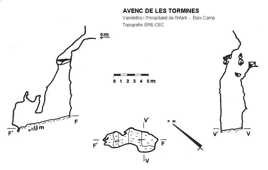
Avenc de les Tormines
1.1 km · SW
Vandellòs i l'Hospitalet de l'Infant (Baix Camp)
1 topo.
Avenc de la Bassa
1.3 km · NE
Pratdip (Baix Camp)
1 topo.3 photos
Source: Espeleoindex (espeleoindex.com), modified. CC BY-NC 4.0, https://creativecommons.org/licenses/by-nc/4.0/