
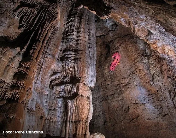
Avenc de la Codoleda
A cavity 32 m deep and 145 m long in Matadepera, in the Sant Llorenç del Munt massif. First explored in 1918 by the Centre Excursionista de Terrassa; in 1981 a new entrance was opened.
EspeleoWorld
Avenc de la Codoleda
A cavity 32 m deep and 145 m long in Matadepera, in the Sant Llorenç del Munt massif. First explored in 1918 by the Centre Excursionista de Terrassa; in 1981 a new entrance was opened.
Matadepera · Vallès Occidental
Length: 145 m · Depth: 32 m
Updated record
https://espeleoworld.com/en/c/avenc-de-la-codoleda
Information can change. Always verify coordinates, access, weather, and cave conditions before setting out.
A cavity 32 m deep and 145 m long in Matadepera, in the Sant Llorenç del Munt massif. First explored in 1918 by the Centre Excursionista de Terrassa; in 1981 a new entrance was opened.
Topographic
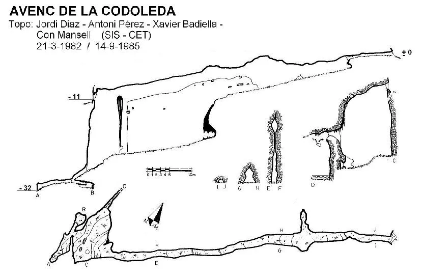

Espeleoindex · CC BY-NC 4.0, https://creativecommons.org/licenses/by-nc/4.0/ · Image © its author.
Photos

Espeleoindex · CC BY-NC 4.0, https://creativecommons.org/licenses/by-nc/4.0/ · Image © its author.
Description
Morphology
The entrance opens at the intersection of two joints forming a 15-metre shaft. The entrance is rather awkward, but the descent is made without touching the wall.
At the foot of the shaft, towards the West, there is a slope of unstable pebbles that leads to a narrow conduit. To the South, a descending gallery ends abruptly at 5 metres (level -32). Towards the North one descends a small step and reaches a small, heavily decorated chamber.
Above the corner of the plunge pool, climbing up with a not very complicated scramble, one reaches a hole that communicates with a shaft. A first very narrow passage allows one to approach it. The descent has been attempted on various occasions, though none has been successful, given the narrowness of the entrance. Various measurements have been taken that give the depth of 9 metres. The joint narrows in a Northerly direction and it seems very unlikely that, once this shaft is descended, it could continue much further.
The most important part of the cavity is in an Easterly direction. Starting from the base of the entrance shaft, a gallery 18 metres long and very high follows. This ends in a large flowstone that must be climbed about 8 metres with a not very difficult scramble, to continue through a conduit. Here, after climbing about 8 metres, we reach the main gallery, 23 metres long, much wider than the previous ones and quite high. At the beginning of this gallery and climbing about 4 metres in a Westerly direction, one can continue along a pressure conduit, guided by a fissure in its floor that is nothing more than a prolongation of the aforementioned 18-metre gallery from the beginning. One can reach to within barely 6 metres of the entrance and at its same level.
At the Eastern end it finishes with some formations that must be climbed and, through a narrow passage between stalagmites, continue along a corridor until emerging through the upper entrance, at the opposite end from the one we entered, in the Plecs del Llibre.
Speleothems
The chamber to the North is heavily decorated. At the Eastern end there are formations that must be climbed and a narrow passage between stalagmites.
Hydrology
There is a small corner with a plunge pool almost always full of water. The bottom of the shaft is full of water forming a gour. It seems evident that we are faced with an ancient watercourse that circulated in a forced conduit along the upper part of the joint until reaching the crossing with the other joint (N-S) and originating the entrance shaft.
Progression
The entrance opens at the intersection of two joints forming a 15-metre shaft. The entrance is rather awkward, but the descent is made without touching the wall; at the foot of it we can continue towards the West, climbing down and descending a slope of unstable pebbles that leads us to a narrow conduit. Once past it, two directions can be taken: to the South a descending gallery follows where one progresses climbing down and which ends abruptly at 5 metres (level -32). Towards the North one descends a small step and reaches a heavily decorated small chamber.
Returning to the base of the entrance shaft and continuing in a Northerly direction, we will observe that there is a small corner with a plunge pool almost always full of water. Above this very corner, climbing up with a not very complicated scramble, one reaches a hole through which one communicates with a shaft. A first very narrow passage allows us to approach it. The descent has been attempted on various occasions, though none has been successful, given the narrowness of the entrance. Nevertheless, various measurements have been taken that give the depth of 9 metres. The bottom of the shaft is full of water forming a gour; the joint narrows in a Northerly direction and it seems very unlikely that, once this shaft is descended, it could continue much further.
The most important part of the cavity is in an Easterly direction. Starting from the base of the entrance shaft, a gallery 18 metres long and very high follows. This ends in a large flowstone that must be climbed about 8 metres with a not very difficult scramble, to continue through a conduit. Here, after climbing about 8 metres, we reach the main gallery, 23 metres long, much wider than the previous ones and quite high. At the beginning of this gallery and climbing about 4 metres in a Westerly direction, one can continue along a pressure conduit, guided by a fissure in its floor that is nothing more than a prolongation of the aforementioned 18-metre gallery from the beginning. One can reach to within barely 6 metres of the entrance and at its same level.
At the Eastern end it finishes with some formations that must be climbed and, through a narrow passage between stalagmites, continue along a corridor until emerging through the upper entrance, at the opposite end from the one we entered, in the Plecs del Llibre.
History
This is one of the most visited cavities of the massif. The first exploration was carried out in 1918 by members of the Centre Excursionista de Terrassa.
On one of the many visits made by members of the GES-CMB, specifically that of 8 November 1953, they managed to climb the terminal flowstone and explore the upper gallery for the first time.
On 7 June 1980 members of the SIS del CET noticed a slight draught at the end of the upper gallery and began to dig, then observing a light at the back. After five days of rather intermittent digging, on 1 January 1981 they were able to emerge through the new entrance of the cavity.
Bio
Arachnida – Araneae – Linyphiidae
- Palliduphantes margaritae (Denis, 1934)
- Tenuiphantes sp.
Arachnida – Araneae – Phrurolithidae
- Liophruillus flavitarsis (Lucas, 1846)
Insecta – Coleoptera – Carabidae
- Laemostenus (Pristonychus) terricola (Herbst, 1783)
Insecta – Coleoptera – Leiodidae
- Troglocharinus kiesenwetteri sanllorensi (Zariquiey, 1924)
Insecta – Coleoptera – Staphylinidae
- Linderia armata (Schaufuss, 1863)
Insecta – Diptera – Limoniidae
- Elliptera hungarica (Madarassy, 1881)
- Limonia nubeculosa (Meigen, 1804)
(Data source: Dept. Artròpodes del Museu de Ciències Naturals de Barcelona)
User Comments (0)
No comments yet.
Be the first to share your experience!
Registered Explorations (0)
No explorations registered yet.
Register your visit to this cave!
Bibliography
- Andrés, O.; Muntan, L. (1958).- “Los fenómenos cársticos de la falda SE de la Mola. Sant Llorenç del Munt (provincia de Barcelona)” Speleon IX (1-2): 3-22. Universidad de Oviedo.
- Badiella, X. i Mansell, C. (1986).- “Noves troballes a cavitats de Sant Llorenç del Munt i Serra de l'Obac” Arxiu del Centre Excursionista de Terrassa (44): 1068-1074 / SIS (10): 42-48. CE de Terrassa.
- GES-CMB (1974).- Catálogo espeleológico de la provincia de Barcelona. 198 pp. Club Montañés Barcelonés /Diputación Provincial de Barcelona.
- Fotografies facilitades per membres del grup de l'Espeleodijous que han visitat la cavitat diferents vegades.
- Dades de fauna facilitades pel Departament d'artròpodes del Museu de Ciències Naturals de Barcelona.
Nearby caves
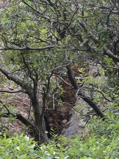
Cova de la Codoleda
0.0 km · S
Matadepera (Vallès Occidental)
1 photos
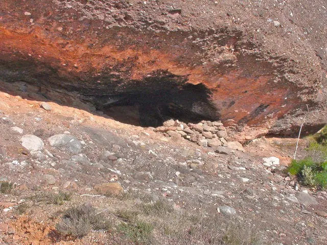
Cova de la Dona Morta
0.1 km · NW
Matadepera (Vallès Occidental)
1 photos
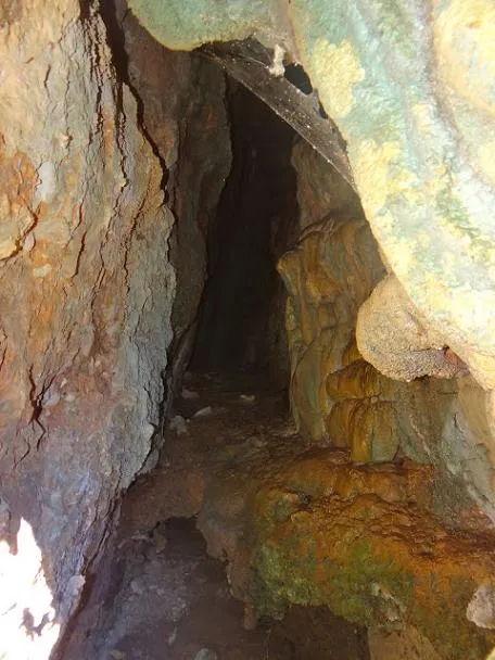
Cova de les Bardisses
0.5 km · W
Matadepera (Vallès Occidental)
1 topo.1 photos
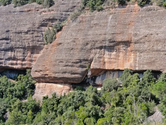
Balma del Sot de la Carda
0.6 km · NE
Castellar del Vallès (Vallès Occidental)
2 photos
Source: Espeleoindex (espeleoindex.com), modified. CC BY-NC 4.0, https://creativecommons.org/licenses/by-nc/4.0/