
Aven du Lierre
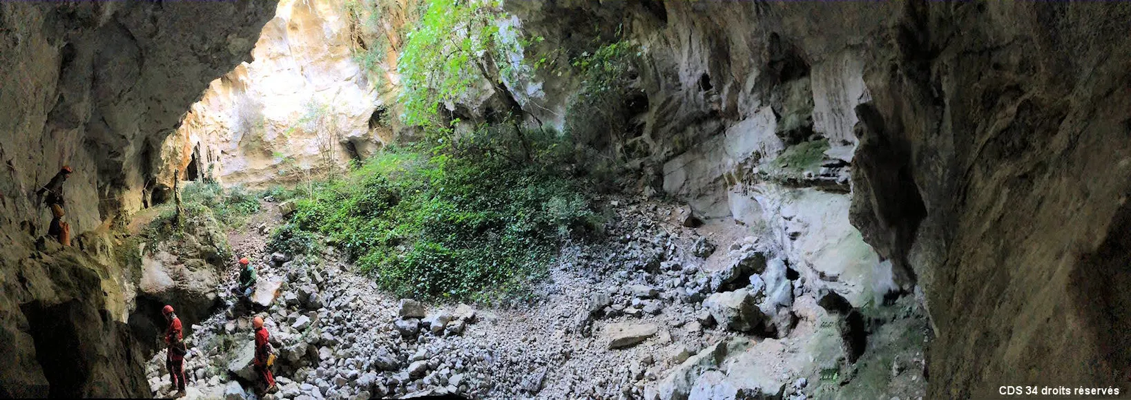
A cave whose large mouth opens onto the trail of the Thaurac plateau, with a steep scree slope and chambers and galleries down to -28 m for 198 m of development.
EspeleoWorld
Aven du Lierre
A cave whose large mouth opens onto the trail of the Thaurac plateau, with a steep scree slope and chambers and galleries down to -28 m for 198 m of development.
Saint-Bauzille-de-Putois
Length: 53 m · Depth: 24 m
Updated record
https://espeleoworld.com/en/c/aven-du-lierre-saint-bauzille-de-putois
Information can change. Always verify coordinates, access, weather, and cave conditions before setting out.
A cave whose large mouth opens onto the trail of the Thaurac plateau, with a steep scree slope and chambers and galleries down to -28 m for 198 m of development.
Photos

© C.D.S. HÉRAULT · CC BY-SA 3.0, https://creativecommons.org/licenses/by-sa/3.0/ · Grottocenter: Aven de l'Eurre (Lierre, Eure) · https://grottocenter.org/ui/documents/233846
Description
Morphology
The large mouth of the cave opens onto a scree slope partly overgrown with vegetation, whose slope descends to the north-east down to -21 m. Three openings in the ground between blocks lead into a chamber of 15 m x 15 m x 11 m with a low point at -28. To the north-east, a small passage at -23 precedes a chamber of 7 m x 5 m x 4 m, followed by a 6-metre climb and a chamber of 8.5 m x 4 m x 1 m. Depth: 33 m; development: 198 m.
Speleothems
To the north, a 36 m long decorated gallery. Towards the south-east, after a 3-metre climb, a 10-metre gallery leads to a chamber of 6 m x 4 m x 6 m that is well decorated.
Progression
The large mouth of the cave can be descended and ascended by at least three different routes (more or less equipped). From the top, via the most frequented route: 2 AN (trees) + 2 Spits + 1 AN for a handline on the ledge + R6 (25-metre rope). Towards the south-east, there is then a short flat-out passage and a gallery of about 10 metres.
User Comments (0)
No comments yet.
Be the first to share your experience!
Registered Explorations (0)
No explorations registered yet.
Register your visit to this cave!
Nearby caves
Source: BRGM BDCavité (inventaire des cavités souterraines), via Géorisques (www.georisques.gouv.fr), modified. Licence Ouverte 2.0, https://www.etalab.gouv.fr/licence-ouverte-open-licence/ Ministère de la Transition écologique, de la Biodiversité et des Négociations Internationales sur le Climat et la Nature – données Géorisques (BRGM), mise à jour du 2026-10-16 · data as of 2026 · Contains information from Grottocenter (Wikicaves), grottocenter.org, made available under the Open Database License (ODbL 1.0, https://opendatacommons.org/licenses/odbl/1-0/), modified. · depth, length, names · obtained 2026-10-19 · https://grottocenter.org/ui/entrances/1907 · data as of 2026 · Source: Grottocenter (Association Wikicaves), worldwide collaborative cave database (grottocenter.org), modified. CC BY-SA 3.0, https://creativecommons.org/licenses/by-sa/3.0/ Grottocenter (Wikicaves) · Text by Didier Borg (Description générale), Didier Borg (Situation et accès) · adapted by Espeleoworld (normalized, translated); the adaptation is licensed CC BY-SA 3.0, https://creativecommons.org/licenses/by-sa/3.0/ · description, access · obtained 2026-10-16 · https://grottocenter.org/ui/entrances/1907 · data as of 2026 · The derived data is available on request under the ODbL: [email protected]