
Graller del Boixeguer
A 148-metre-deep pit in Montsec d'Ares, Sant Esteve de la Sarga, with two entrances, a large chamber, galleries and a final lake.
EspeleoWorld
Graller del Boixeguer
A 148-metre-deep pit in Montsec d'Ares, Sant Esteve de la Sarga, with two entrances, a large chamber, galleries and a final lake.
Sant Esteve de la Sarga · Pallars Jussà
Sviluppo: 870 m · Profondità: 148 m
Scheda aggiornata
https://espeleoworld.com/it/c/graller-del-boixeguer
Le informazioni possono cambiare. Verifica sempre coordinate, accesso, meteo e condizioni della cavità prima di partire.
A 148-metre-deep pit in Montsec d'Ares, Sant Esteve de la Sarga, with two entrances, a large chamber, galleries and a final lake.
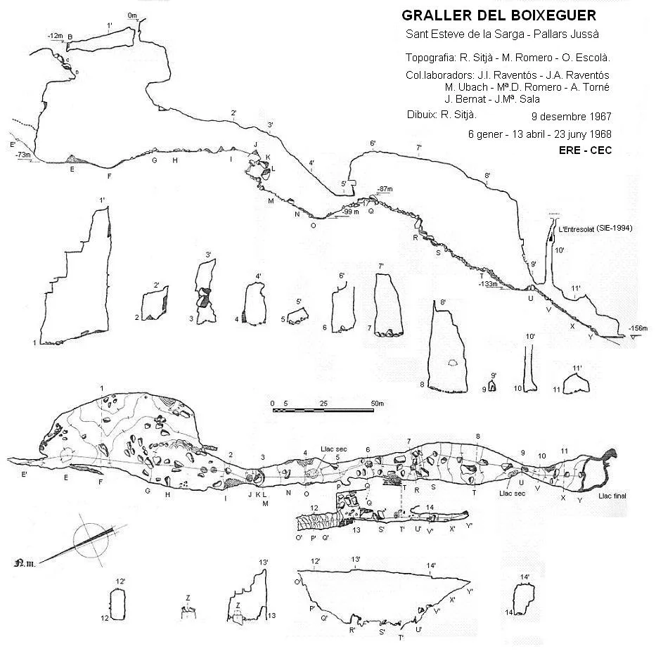
Topografia

Espeleoindex · CC BY-NC 4.0, https://creativecommons.org/licenses/by-nc/4.0/ · Immagine © del suo autore.
Foto

Espeleoindex · CC BY-NC 4.0, https://creativecommons.org/licenses/by-nc/4.0/ · Immagine © del suo autore.
Descrizione
Morfologia
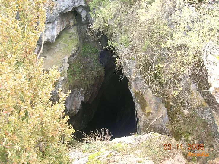
It has two entrances, separated by about 40 metres of distance and a height difference of 12 metres; both meet inside the large chamber. The upper entrance is a cylindrical shaft that drops into the upper part of the chamber, forming a 68-metre shaft that is totally aerial from -10 metres. The lower entrance, of respectable dimensions, begins with a steep ramp that opens like a window in the roof of the chamber, giving rise to a 45-metre drop that is almost entirely aerial. The large chamber has maximum dimensions of 85x45 metres and a height of 60 metres. The floor is covered with large blocks, with a dominant slope towards the E; on this side, 30 metres of height difference can be descended through the labyrinthine passages formed between the wall and the blocks. From the SW end of the chamber, a large descending gallery leads to a height difference of 18 metres, easily overcome with a few metres of rope, which places you on a ledge from which you can scramble down to the base; this slopes down to the lowest part, where a dry lake is found. Next, climb up among blocks to a maximum; if instead of following the normal gallery you climb back up over the blocks, you reach a parallel gallery, hanging above the main one, on the W side; this gallery stands out for its exuberant concretions on the walls and floor, with numerous plunge pools. This gallery is 80 metres long and up to 20 metres wide, with a maximum height difference of 46 metres, and is called the sala de les colades. Continuing again along the main gallery, if you start the descent on the right you will find a long and unstable ramp of blocks; if you do so on the left side you will find some steps between blocks that likewise place you on a ramp of blocks but a much more stable one. At the end of this ramp is the second dry lake, much more modest in size than the previous one. A passage of dimensions more reduced than the rest places you in a new chamber that slopes down to the final lake. Halfway down the slope, in the roof of the gallery, there is an ascending shaft of +39 metres (L'Entresolat), which ends in a narrow joint. The lake has approximate dimensions of 16x14 metres and a fluctuating depth of about 6 metres, although it can become dry in some extreme drought circumstances. The total height difference to the bottom of the lake is -148 metres. GALERIA INMA: Accessed from the vertical of the -68-metre shaft (upper entrance). It is a gallery with 84 metres of passage where a spectacular lithogenic process is found, with large columns and a great deal of formation everywhere. VIA DANIELO A1 – SALA SANTAFE It is located in the large chamber or gallery before the lake chamber, on its right-hand side (West wall), where a 17-metre climb places you in a chamber of about 25 square metres; above this there is a conduit about 10 metres long that ends up becoming impracticable.
Concrezioni
The parallel gallery stands out for its exuberant concretions on the walls and floor, with numerous plunge pools. The Galeria Inma presents a spectacular lithogenic process, with large columns and a great deal of formation everywhere.
Idrologia
There is a dry lake in the lowest part of the descending gallery. At the end of a ramp of blocks is the second dry lake, much more modest in size than the previous one. The final lake has approximate dimensions of 16x14 metres and a fluctuating depth of about 6 metres, although it can become dry in some extreme drought circumstances.
Progressione
The lower entrance begins with a steep ramp that gives rise to a 45-metre drop that is almost entirely aerial. From the SW end of the chamber, a descending gallery leads to a height difference of 18 metres, overcome with a few metres of rope, which places you on a ledge from which you can scramble down to the base. If you climb back up over the blocks you reach a parallel gallery. Continuing along the main gallery, the descent on the right is a long and unstable ramp of blocks; on the left, steps between blocks lead to a more stable ramp. A narrow passage places you in a new sloping chamber down to the final lake. Halfway down the slope, in the roof, there is an ascending shaft of +39 metres (L'Entresolat). The Galeria Inma is accessed from the vertical of the -68-metre shaft (upper entrance). The Via Danielo A1 – Sala Santafe requires a 17-metre climb.
Storia
The first exploration was carried out by F. Chavarria and A. Santgenís of the GES-CMB at Easter 1963, although the GES activity book records that it was in 1962, together with the Graller d'Alsamora and the one at Costa d'Alzina. The SAS of the CGB, in 1968, made the first known survey of the cavity, assigning it -145.5 metres of depth to the lake; according to the information available to us, this survey was made with a theodolite. In 1968 the ERE of the CEC, over several days, made a new survey, assigning it -156 metres of height difference. In 1988 the ECG made a new survey in which it was assigned -148 metres to the bottom of the lake. In 1984, the SIE made an attempt to reach an ascending shaft located near the final lake; for this attempt they used a 10-metre extension ladder but could only confirm that the shaft continued upwards. In 1994 the SIE made a new attempt and, by climbing using a drill, they managed to ascend +39 metres, the shaft ending in a narrow joint (L'Entresolat). At around the same time the GES-CMB made a climb to reach a window located above the access to the final gallery but without results. On 3 February 2013, a team from the GE Badalona explored the Galeria Inma, located directly opposite the vertical of the upper entrance shaft. On the last weekend of 2013, a team from the SIS of the CE de Terrassa made a 17-metre climb in the gallery before the lake chamber, on its right-hand side, via Danielo A1, reaching the sala Santafe of 25 square metres. The SIS returned on 23 February 2014 to make a new climb in the upper part of the sala Santafe, where they explored a tube about 10 metres long. Regarding the place name Graller or Grallera, we observe that in all the initial articles of the first explorers, both the SAS in the campaigns of the 1950s and the ERE in those of the 1960s, they cite these cavities with the place name Graller, and the SAS even refers to the fact that they do so respecting the country's toponymy; curiously, in the case of this group, they later end up calling them Avenc de la Grallera del...., and finally Grallera del......, forgetting the initial place names cited by themselves. It should be noted that the people of these Pyrenean districts always call it Lo Graller, and in the Berguedà and Alt Urgell area it is more usual to hear the place name grallera.
Note biospeleologiche
Speonomus zariquieyi
Captures by O.Escolà on 9 December 1967, and on 23/24 June 1968, both in the sala de les colades.
Commenti degli utenti (0)
Nessun commento ancora.
Sii il primo a condividere la tua esperienza!
Esplorazioni registrate (0)
Nessuna esplorazione registrata.
Registra la tua visita a questa grotta!
Bibliografia
- Escolà,O.; Sitjà,R; Romero,M.(1970).-”El Graller del Boixaguer”. Espeleòleg (11-12):574-586. ERE – CE Catalunya. Barcelona.
- Cardona, F. (1989).- Grans cavitats de Catalunya, vol 1. 198 pp. EC Gràcia, Barcelona.
- SAS-CGB.(1967).-”Catálogo de cavidades del macizo del Montsec”. Cavernas (9):319-338. GE Badalona.
- SAS-CGB.(1969).-”Dos importantes cavidades en el Montsec d'Ares: Grallera d'Alçamora i Grallera del Boixaguer”. Cavernas (11):403-414. GE Badalona.
- Topografies i fotos extretes del blog “sisdelcet.blogspot.com.es” post del 7 de març de 2014.
- Fotos extretes del blog “espeleobloc” post del dia 25 de febrer 2010.
- Fotos extretes de “www.geb.cat/?m=201302” post del dia 27 de febrer 2013.
Grotte vicine
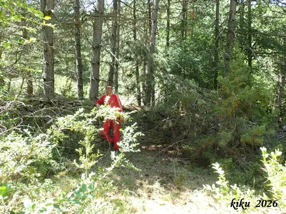
Cova dels Mosquits
0.4 km · N
Sant Esteve de la Sarga (Pallars Jussà)
1 topo.6 foto
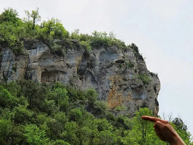
Avenc del Cingle de Roca Alta
0.7 km · E
Sant Esteve de la Sarga (Pallars Jussà)
1 topo.8 foto

Cova-avenc del Padró
0.8 km · SO
Àger (Noguera)
1 topo.8 foto

Cova del Lladre
1.1 km · SO
Àger (Noguera)
1 topo.5 foto
Fonte: Espeleoindex (espeleoindex.com), modificato. CC BY-NC 4.0, https://creativecommons.org/licenses/by-nc/4.0/