
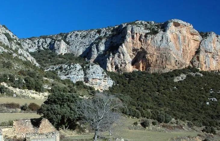
Cova de les Monges
Large rock shelter 31 metres wide by 40 metres high at the mouth, at la Fabregada (Vilanova de Meià), with a sloping floor and three steps at +6, +10 and +16 metres.
EspeleoWorld
Cova de les Monges
Large rock shelter 31 metres wide by 40 metres high at the mouth, at la Fabregada (Vilanova de Meià), with a sloping floor and three steps at +6, +10 and +16 metres.
Vilanova de Meià · Noguera
Sviluppo: 42 m · Profondità: 22 m
Scheda aggiornata
https://espeleoworld.com/it/c/cova-de-les-monges
Le informazioni possono cambiare. Verifica sempre coordinate, accesso, meteo e condizioni della cavità prima di partire.
Large rock shelter 31 metres wide by 40 metres high at the mouth, at la Fabregada (Vilanova de Meià), with a sloping floor and three steps at +6, +10 and +16 metres.
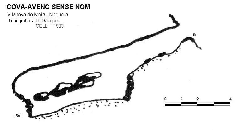
Topografia
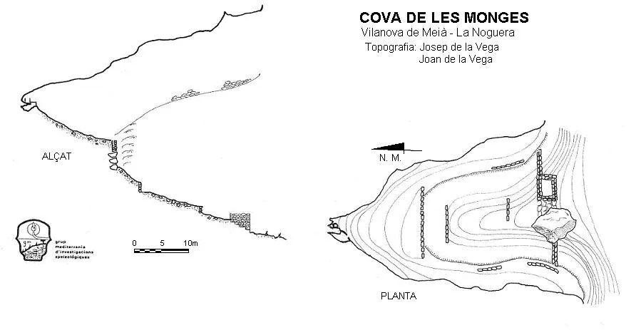
Espeleoindex · CC BY-NC 4.0, https://creativecommons.org/licenses/by-nc/4.0/ · Immagine © del suo autore.
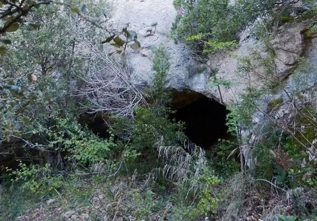
Foto
Espeleoindex · CC BY-NC 4.0, https://creativecommons.org/licenses/by-nc/4.0/ · Immagine © del suo autore.
Descrizione
Morfologia
Large rock shelter 31 metres wide by 40 metres high at the mouth, with the floor on a steep upward slope and cut by three steps that form platforms at +6, +10, and +16 metres. The entrance is built up with a wall 1.2 metres thick and the access door is delimited by an immense rock fallen from the ceiling on the W side, and on the E, a square defence tower 4x5 metres with walls 1 metre thick. Between these two elements we find four steps that allow us to access the interior, which is at a higher level. At the top of the terraces that place us at the highest and deepest part of the cavity +22 metres, we find a dry-stone cistern without mortar, whitewashed with lime.
Idrologia
The dry-stone cistern without mortar, whitewashed with lime, collects the water from the drips that continually trickle from the ceiling.
Progressione
At the small Coll de Cabeces is the Cabana d'en Pubill, part of which is in ruins. One must take a small path that leaves beside the hut in a NE direction. At the start the path is very sunken and surrounded by the vegetation of its edges. At the bottom, almost on the horizon in the direction of travel, the orange rocky part that bounds the imposing rock shelter of the Cova de les Monges can be seen. The path is narrow and flat. Shortly after setting off one finds a spoil heap of stones corresponding to the collapse of an upper field boundary. One can climb up to the upper field and continue towards the cova de les Monges which lies ahead, or continue along the path being followed, also keeping the cave as a visual reference. We reach the remains of an old charcoal kiln; from the charcoal kiln one must leave the path being followed, since it turns towards the east, losing the reference of the cova de les monges. One must climb to the left diagonally, advancing visually with the cova de les Monges ahead.
Storia
Although known forever by the local people, it is not until 1981 that Josep de la Vega makes it known by publishing it for the first time in “Aplec de documents arqueològics de les coves del Montsec i llur projecció a les comarques i serres properes”. It is an archaeological site of not much interest; basically most of the remains are of medieval origin. It is said that a human skull was found there with a nail passing through it.
Commenti degli utenti (0)
Nessun commento ancora.
Sii il primo a condividere la tua esperienza!
Esplorazioni registrate (0)
Nessuna esplorazione registrata.
Registra la tua visita a questa grotta!
Bibliografia
- Gàzquez i Pons, Josep Lluís (1995).-”Catàleg Espeleològic de la Noguera”. Grallera (3-4):1-90.GELL-CE Lleida.
- Cortés i Ribelles, Manuel.(1984).- El Montsec i Muntanyes Veïnes. Centre Excursionista de Lleida.
- Vega, Josep de la. (1981).-”Aplec de documents arqueològics de les coves del Montsec i llur projecció a les comarques i serres properes”. Mediterrània (12): 1-359.
- Lopez Camps, Jordi. Blog Montsec de Meià. Itineraris de muntanya. Post del dia 4 de març de 2009. “montsecdemeia.wordpress.com”
Grotte vicine


Fonte: Espeleoindex (espeleoindex.com), modificato. CC BY-NC 4.0, https://creativecommons.org/licenses/by-nc/4.0/