
Cova de l'Aigua del Pas Nou
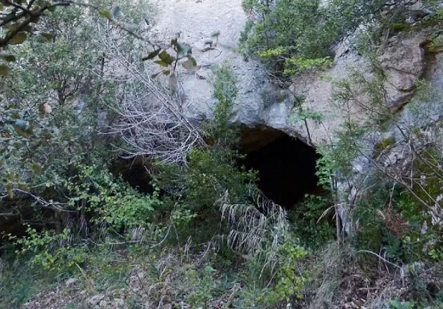
A 27-metre-long cave at Pas Nou, Vilanova de Meià, with a large entrance and a gallery 8-10 metres wide.
EspeleoWorld
Cova de l'Aigua del Pas Nou
A 27-metre-long cave at Pas Nou, Vilanova de Meià, with a large entrance and a gallery 8-10 metres wide.
Vilanova de Meià · Noguera
Sviluppo: 27 m · Profondità: 12 m
Scheda aggiornata
https://espeleoworld.com/it/c/cova-de-l-aigua-del-pas-nou
Le informazioni possono cambiare. Verifica sempre coordinate, accesso, meteo e condizioni della cavità prima di partire.
A 27-metre-long cave at Pas Nou, Vilanova de Meià, with a large entrance and a gallery 8-10 metres wide.
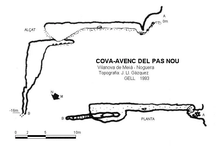
Topografia

Espeleoindex · CC BY-NC 4.0, https://creativecommons.org/licenses/by-nc/4.0/ · Immagine © del suo autore.
Foto
Espeleoindex · CC BY-NC 4.0, https://creativecommons.org/licenses/by-nc/4.0/ · Immagine © del suo autore.
Descrizione
Morfologia
The cave has a large entrance, narrow at one end and wide at the other. The access gives way to a gallery 8-10 metres wide that creates a broad vestibule. The cave has a total of 27 metres of passage, climbing progressively until reaching the final part.
Idrologia
In the final part there are some small pools that may be found full of water.
Progressione
The descent path to the cave first turns towards the SW and then turns towards the NW. It is a steeply sloping path, well marked by a series of cairns that lead to the very entrance of the cave. The descent is made along a narrow path, well traced and well marked by the cairns. The path has only one point of a couple of metres, which is relatively very close to the drop that falls over the Pas Nou. If you have any misgivings about passing this point, you can move close to the cliff wall where there is a small passage, more overgrown with vegetation, but which offers more security.
Storia
The first exploration was carried out by the SAS of the Club Gimnàstic Barcelonès in 1969. It is said that during the civil war (1936-1938) the soldiers entrenched at this point accessed the cave to fetch water.
Commenti degli utenti (0)
Nessun commento ancora.
Sii il primo a condividere la tua esperienza!
Esplorazioni registrate (0)
Nessuna esplorazione registrata.
Registra la tua visita a questa grotta!
Bibliografia
- Escolà, Oleguer (1970).-“Catálogo Espeleológico del Montsec”. Espeleòleg (11-12):453-542, ERE - CE Catalunya, Barcelona.
- Gàzquez i Pons, Josep Lluís.(1995).-“Catàleg Espeleològic de la Noguera”. Grallera (3-4):1-90. GELL – CE Lleida.
- Pallarés Personat,J.(1971).-”Resumen de las topografias publicadas en la presente”. 5º Campamento regional de Espeleólogos pp:5-6. SAS – CGB. Barcelona.
- SAS-CGB.(1967).-”Catálogo de cavidades del macizo del Montsec”. Cavernas (9):319-338. GE Badalona.
- Lopez Camps, Jordi. Blog Montsec de Meià. Itineraris de muntanya. Post del dia 9 de març de 2011. “montsecdemeia.wordpress.com”.
- Fotografies facilitades per Josep M. Molgó (GELL).
Grotte vicine
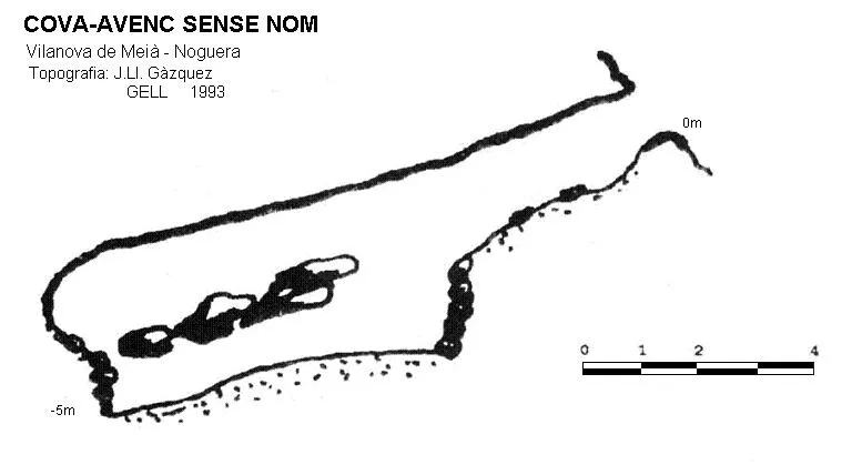


Fonte: Espeleoindex (espeleoindex.com), modificato. CC BY-NC 4.0, https://creativecommons.org/licenses/by-nc/4.0/