
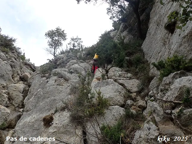
Cova de Barranquilla
A 40-metre-long cave in the Montsec d'Ares (Àger), with three entrance mouths that converge inside.
EspeleoWorld
Cova de Barranquilla
A 40-metre-long cave in the Montsec d'Ares (Àger), with three entrance mouths that converge inside.
Àger · Noguera
Sviluppo: 40 m · Profondità: 8 m
Scheda aggiornata
https://espeleoworld.com/it/c/cova-de-barranquilla
Le informazioni possono cambiare. Verifica sempre coordinate, accesso, meteo e condizioni della cavità prima di partire.
A 40-metre-long cave in the Montsec d'Ares (Àger), with three entrance mouths that converge inside.
Topografia
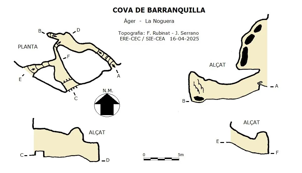
Espeleoindex · CC BY-NC 4.0, https://creativecommons.org/licenses/by-nc/4.0/ · Immagine © del suo autore.
Foto
Espeleoindex · CC BY-NC 4.0, https://creativecommons.org/licenses/by-nc/4.0/ · Immagine © del suo autore.
Descrizione
Morfologia
A 40-metre-long cave with three entrance mouths that converge inside. From the easternmost mouth it is possible to access an upper level which, through a narrow interior passage, leads to the highest part of the mouth, located at +8 metres in height. At a higher elevation, a couple of mouths can be seen in the cliff, whose continuity is unknown to us.
Progressione
From the easternmost mouth it is possible to access an upper level which, through a narrow interior passage, leads to the highest part of the mouth, located at +8 metres in height. The gully is equipped with chains that facilitate access; once at the base of the gully we will follow along the base of the cliff in a westerly direction until we reach the cave.
Altri dettagli
Up to this point we find remains of old beehives. Inside the cave we also find remains of these hives.
Storia
A cavity known since long ago by some people of the area, it was used to place hives or beehives for bees in the various hollows of the cave, especially at a certain height above the floor.
In 1983 Antoni Huguet, a resident of Àger, known as 'Tonet de Barri', accompanied Francesc Rubinat to the cave, but as they did not bring surveying equipment they agreed to return. Finally, 42 years later, the work has been resumed and completed.
Commenti degli utenti (0)
Nessun commento ancora.
Sii il primo a condividere la tua esperienza!
Esplorazioni registrate (0)
Nessuna esplorazione registrata.
Registra la tua visita a questa grotta!
Bibliografia
Dades extretes del blog de Joan Ramon Segura 'Carreteret', (excursionsdeljoanramon.blogspot.com)
Totes les dades han estat facilitades per Juli Serrano, Montse Roca (SIE-CEA) i Arcadia Cabanas, Francesc Rubinat (ERE-CEC). Abril de 2025.
Grotte vicine


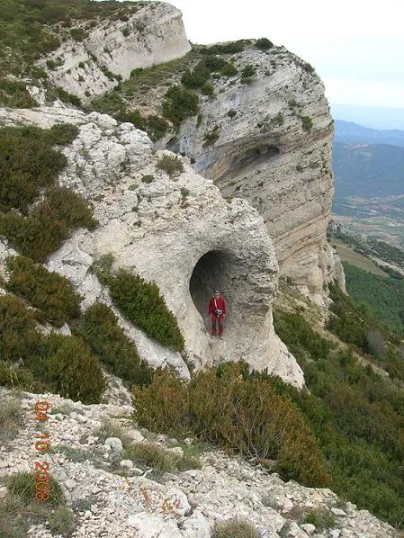


Fonte: Espeleoindex (espeleoindex.com), modificato. CC BY-NC 4.0, https://creativecommons.org/licenses/by-nc/4.0/