
Torca
EspeleoWorld
Torca
Ruesga
Length: 60 m · Depth: 41 m
Updated record
https://espeleoworld.com/en/c/torca-ruesga-cantabria-4
Information can change. Always verify coordinates, access, weather, and cave conditions before setting out.
Shaft in Ruesga (Cantabria). Length 60 m. Depth 41 m. Entrance altitude 675 m.
Topographic
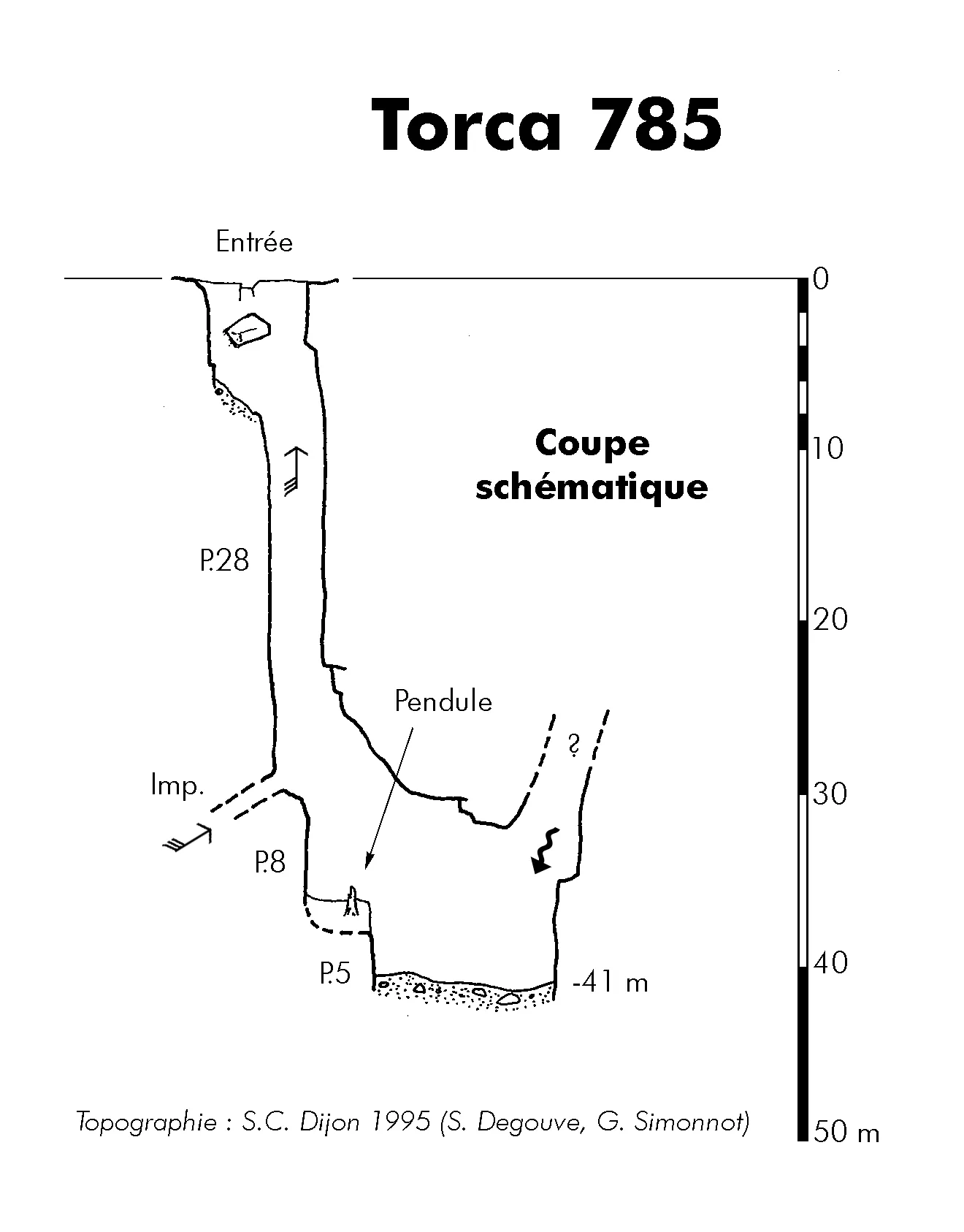
© G. Simonnot (SCD) · CC BY-NC-SA (version not stated by the source), https://www.karsteau.org/karsteau/index.php · Karsteau: Croquis de la cavité n°785 (numérotation SCD) · https://www.karsteau.org/karsteau/recherche/entree/recherche_entree.php?entree=21473
History
Description :
Un puits de 28 m coupé par un palier terreux est aussitôt suivi par un P.8. Un petit pendule permet d'atteindre un P.5 débouchant dans une diaclase longue d'une dizaine de mètres avec arrivée d'un autre puits et léger ruissellement. Aucune suite évidente au fond.
Un courant d'air soufflant est très sensible dans le P.28 d'entrée. Une partie provient d'un petit conduit non pénétrable à la base de ce puits.
Géologie :
Niveau 4 : Calcaires de Bucebron (Aptien)
Résurgence : Cubiobramante
Historique des explorations :
Repéré le 30 avril 1995 (Martin et Muriel Simonnot). Exploration S.C.Dijon le 1° mai 1995 (Degouve S. et Simonnot G.)
User Comments (0)
No comments yet.
Be the first to share your experience!
Registered Explorations (0)
No explorations registered yet.
Register your visit to this cave!
Nearby caves

Source: Karsteau (Fédération Française de Spéléologie et Canyon) (www.karsteau.org), modified. CC BY-NC-SA (version not stated by the source), https://www.karsteau.org/karsteau/index.php Karsteau (Fédération Française de Spéléologie et Canyon) · Text by Karsteau (FFS) contributors · https://www.karsteau.org/karsteau/recherche/entree/recherche_entree.php?entree=21473 · data as of 2026