
Torca del Jou sin Tierre
La Torca del Jou sin Tierre (CS-9), in Cillorigo de Liébana (Cantabria), is the deepest cavity in Cantabria: 1,203 m of depth difference and about 4,258 m of development.
EspeleoWorld
Torca del Jou sin Tierre
La Torca del Jou sin Tierre (CS-9), in Cillorigo de Liébana (Cantabria), is the deepest cavity in Cantabria: 1,203 m of depth difference and about 4,258 m of development.
Cillorigo de Liébana
Length: 4258 m · Depth: 1203 m
Updated record
https://espeleoworld.com/en/c/torca-del-jou-sin-tierre-cillorigo-de-liebana
Information can change. Always verify coordinates, access, weather, and cave conditions before setting out.
La Torca del Jou sin Tierre (CS-9), in Cillorigo de Liébana (Cantabria), is the deepest cavity in Cantabria: 1,203 m of depth difference and about 4,258 m of development.
Photos
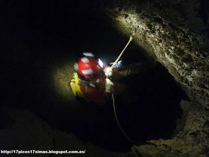
© 17 Picos 17 Simas (blog) · none-stated · 17 Picos 17 Simas · https://17picos17simas.blogspot.com/2014/08/cantabria-cs9-1203m.html
Description
Morphology
It is a pit of great verticality, typical of high limestone mountain terrain. The entrance is narrow and gives way to a succession of shafts, among them one of 29 m and the Pozo Berta, of 62 m. Further down are the largest shafts of the cavity: the Apocalipsis Now, of 184 m, the Lotería, of 143 m, and the Fredo, of 118 m. The horizontal sections are scarce, although some are very beautiful and present speleothems. At about 950 m of depth there is an underground bivouac with room for five or six people, which served as support for the exploration campaigns.
Hydrology
A research project of the Instituto Geológico y Minero de España maintained a network of temperature sensors in the cave for years.
The pit is 1203 m deep and ends in a sump surrounded by sediments. The water from this part of the massif is thought to exit through the Cueva del Nacimiento, in the Urdón valley. The bottom of the pit lies lower than the upper part of that spring. If the connection, which is not proven, existed, the system would have a depth difference of about 1594 m.
Other details
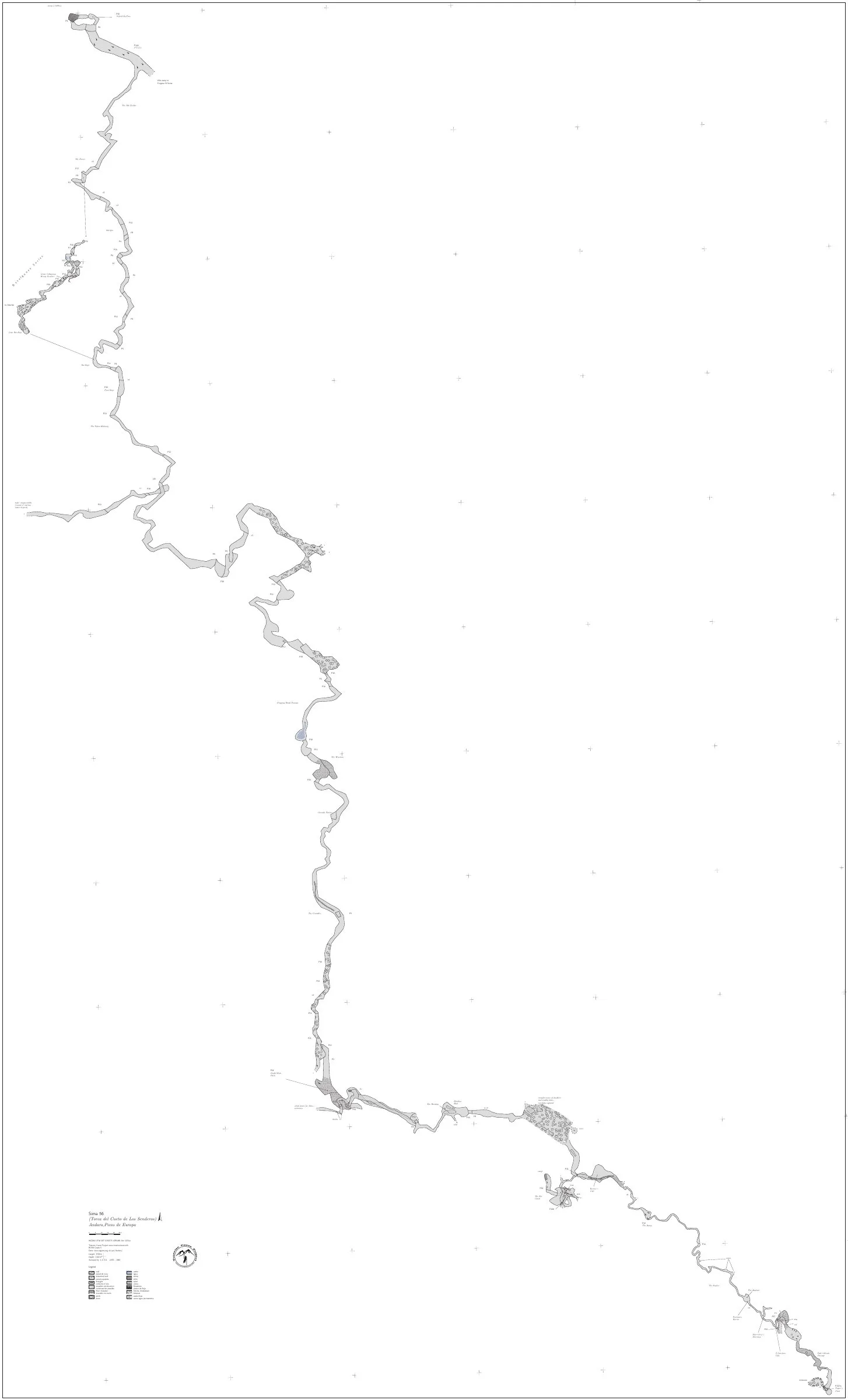
The current figures come from the list of large cavities of the Federación Española de Espeleología (2024): -1,203 m (August 2012) and 4,258 m of development (December 2015). The IGME inventory of geological interest sites cites it as the deepest in Cantabria, with 1,200 m. Another large pit in the same sector, the Torca del Cueto de los Senderos (Sima 56), reaches -1,169 m; the sources consulted treat them as distinct cavities and none states that they are connected. This record therefore carries its own figures and is not integrated into any larger system. Some sources give somewhat different values for the altitude of the entrance (2,067, 2,070 or 2,074 m) and for the potential depth difference to the Nacimiento (1,594 or 1,604 m); the difference is not clarified.
History
The cavity was discovered in 2002 during the Bejes campaign, a Spanish interclub expedition with the association AD KAMI as protagonist, and that year 120 m of depth was reached. In 2003, 300 m were reached and in 2004, 580 m. In 2005, 706 m were reached and in 2006 about 870 m. The following campaigns, with the collaboration of the clubs Tracalet and GE Flash, added small extensions. In 2012 the exploration reached 1,203 m and the pit surpassed the Sima 56 as the deepest of the eastern massif. In August 2014 a group of cavers visited the cavity from an outside camp and descended to the final sump to collect the sensors; that year AD KAMI completed the derigging of the pit. The British clubs of the Tresviso Caves Project continue to keep an eye on this pit: if it were to join with the Cueva del Nacimiento, it would form one of the deepest underground traverses in the world, although they consider that the deep parts would first have to be re-explored.
User Comments (0)
No comments yet.
Be the first to share your experience!
Registered Explorations (0)
No explorations registered yet.
Register your visit to this cave!
Nearby caves

Contains information from Grottocenter (Wikicaves), grottocenter.org, made available under the Open Database License (ODbL 1.0, https://opendatacommons.org/licenses/odbl/1-0/), modified. · https://grottocenter.org/ui/entrances/168598 · data as of 2026 · Source: Grottocenter (Association Wikicaves), worldwide collaborative cave database (grottocenter.org), modified. CC BY-SA 3.0, https://creativecommons.org/licenses/by-sa/3.0/ Grottocenter (Wikicaves) · Text by Biboc (Torca de Jou sin Tierre) · https://grottocenter.org/ui/entrances/168598 · data as of 2026 · Text written by Espeleoworld from public sources. Please ask us before reusing it. · Text by José Luis Membrado Julián (Grandes Cavidades Españolas 2024), Tresviso Caves Project (Tresviso Caves Project - Location), Tresviso Caves Project (Tresviso Caves Project - 2012), Tresviso Caves Project (Tresviso Caves Project - 2002), Tresviso Caves Project (Tresviso Caves Project - 2003), Tresviso Caves Project (Tresviso Caves Project - 2004), Tresviso Caves Project (Tresviso Caves Project - 2005), Tresviso Caves Project (Tresviso Caves Project - 2006), Tresviso Caves Project (Tresviso Caves Project - 2010), Tresviso Caves Project (Tresviso Caves Project - 2014), Tresviso Caves Project (Tresviso Caves Project - Deep Shafts), 17 Picos 17 Simas (blog) (Cantabria: CS.9 -1203m), IGME (IELIG CA008b: Karst del Campo de los Senderos (Picos de Europa)), Phil Walker (Tresviso 2024) · adapted by Espeleoworld (normalized, translated); the adaptation is licensed Our own text, written from public sources. Please ask us before reusing it. · The derived data is available on request under the ODbL: [email protected]