
Surgència de Rus
Important surgència activa de 555 m de recorregut a Castellar de n'Hug.
EspeleoWorld
Surgència de Rus
Important surgència activa de 555 m de recorregut a Castellar de n'Hug.
Castellar de n'Hug · Berguedà
Length: 555 m · Depth: 25 m
Updated record
https://espeleoworld.com/en/c/surgencia-de-rus
Information can change. Always verify coordinates, access, weather, and cave conditions before setting out.
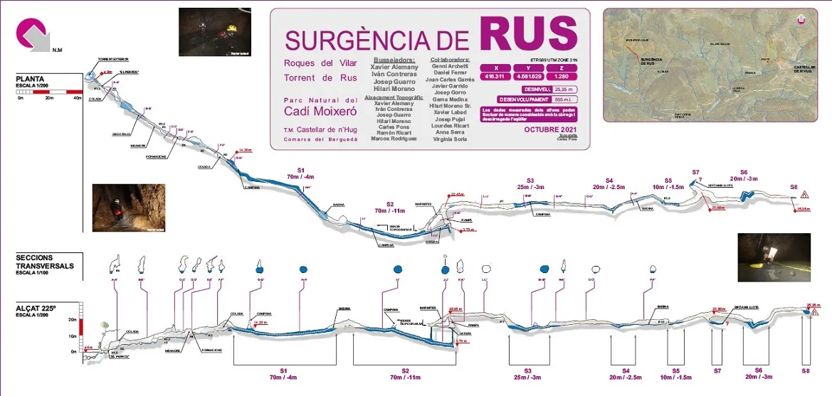
Active spring with a 555 m route in Castellar de n'Hug, with six sumps passed and 215 m completely flooded.
Topographic

Espeleoindex · CC BY-NC 4.0, https://creativecommons.org/licenses/by-nc/4.0/ · Image © its author.
Photos

Espeleoindex · CC BY-NC 4.0, https://creativecommons.org/licenses/by-nc/4.0/ · Image © its author.
Description
Morphology
The cavity has a route of 555 m, of which 215 m are completely flooded. The highest point of the cavity is at +25 m from the entrance.
Hydrology
The spring is the main water supply of the Torrent de Rus. The active course of the river comes from the third sump through narrow conduits, and is found again at the start of the second sump. In times of great water circulation, the active course appears through a narrow conduit in the floor of the chamber and soon becomes flooded.
Progression
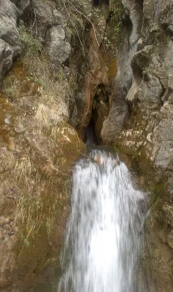
To reach the entrance of the cavity, a first waterfall about 4 m high must first be overcome, with a short scramble and a traverse, which was equipped with rope and a handline. The handline leaves us at a hanging pothole; once crossed, we find an ascending passage that is a little narrow, “el Parrús”, where if the spring is very loaded with water as in the thaw season, it makes entry completely impracticable.
Having climbed “el Parrús” we reach a small chamber, and immediately begin to climb small steps, small waterfalls and some potholes until reaching the first sump, from here on we must continue with cave-diving equipment.
The first sump has a route of 70 m and a maximum depth of -4 m; near its start there is an air chamber that we pass underneath. Once this sump is passed, we find a short gallery of 20 m that soon leaves us at the entrance of the second sump; this also has a length of 70 m and a maximum depth of 11 m. About 20 m from the start of the sump we find a fork to the left, from where the active course of the river comes, which through narrow conduits carries the water from the third sump; however, we must leave this fork and continue along the main conduit, without water current, until the depth of -11 m where a wall bars our way; here we must ascend through a narrow chimney, where a lot of sediment accumulates which makes the water quite muddy. Once this vertical chimney is climbed we come out to the surface in a gallery with an ascending ramp.
Here we must take off the cylinders and diving equipment, and climb a ramp of about 15 m of route and 8 m of drop, where a zip line was installed so that the transport of the cylinders and diving equipment would not be so arduous.
Once this ramp is passed, a comfortable horizontal gallery appears that after about 30 m of route leaves us at the head of a 7 m pit, equipped with rope, at the bottom of which we find the entrance of the third sump. Right at the start of this (S3 25 m / -3 m) we find on the left a narrow conduit through which the active course disappears downstream, which as we have mentioned we find again at the start of the second sump.
Once this short third sump is crossed, we continue upstream for another 30 m and we find the fourth sump (S4 20 m / -2.5 m); after passing it a long pool leaves us at the foot of a 1.5 m step that places us at the entrance of the fifth sump (S5 10 m / -1.5 m); after passing it, a short ramp leads us to a comfortable chamber.
Here different continuations appear: on the left a descending ramp leaves us at the entrance of an inactive sump (S7) and with a lot of sediment and mud that makes visibility become totally nil as soon as a foot is put in the water.
Returning to the previous chamber, in times of great water circulation we observe that the active course appears through a narrow conduit in the floor of the chamber and that it soon becomes flooded.
If from the chamber we continue forward the gallery begins to descend among blocks and leaves us at the entrance of the sixth sump (S6 20 m / -3 m); this, depending on the time of year, presents quite variable levels. Once passed we access a short ascending gallery that places us at the highest point of the cavity at +25 m from the entrance, in an eighth sump, very narrow and that for the moment marks the final point of the cavity.
History
Spring certainly known since time immemorial by the farmers and inhabitants of the farmhouses of the Monnell and el Vilar, although it had gone unnoticed by the speleological world.
Around the year 2013, Ramon Ricart, a former forest ranger, rediscovered it, widened the entrance passage and travelled the first 100 m of gallery until reaching a sump (S1). Being unable to continue the exploration, he made known the existence of the cave to members of the PROTEUS group, who in the following years and until the present explore and survey the cavity, passing six sumps and totalling a route of 555 m, of which 215 m are completely flooded.
Participants in the explorations:
Cave divers:
Xavi Alemany, Ivan Contreras, Josep Guarro, Hilari Moreno Jr.
Topographic survey:
Xavi Alemany, Ivan Contreras, Josep Guarro, Hilari Moreno Jr., Carles Pons, Ramon Ricart, Marcos Rodriguez
Collaborators:
Genni Archetti, Daniel Ferrer, Joan Carles Garrés, Javier Garrido, Josep Gorro, Gema Medina, Hilari Moreno Sr., Xavier Labad, Josep Pujal, Lourdes Ricart, Anna Serra, Virginia Soria
User Comments (0)
No comments yet.
Be the first to share your experience!
Registered Explorations (0)
No explorations registered yet.
Register your visit to this cave!
Bibliography
- Totes les dades, topografia i fotografies han estat extretes de la memòria presentada per PROTEUS (Associació Catalana d'Espeleologia Subaquàtica) i que va ser guardonada amb el Premi Mn. Norbert Font i Sagué (2021) atorgat per la Federació Catalana d'Espeleologia.
Nearby caves
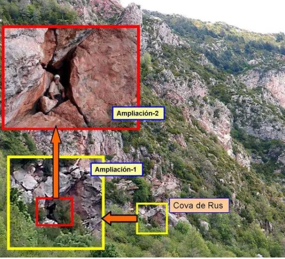
Cova de Rus
1.3 km · W
Castellar de n'Hug (Berguedà)
1 topo.6 photos
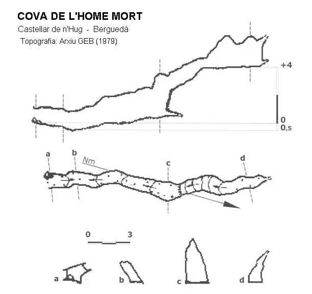
Cova de l'Home Mort
1.8 km · N
Castellar de n'Hug (Berguedà)
1 topo.
Forat Nº1 del Tarter
1.8 km · N
Castellar de n'Hug (Berguedà)
1 topo.1 photos
Forat Gran del Tarter
1.8 km · N
Castellar de n'Hug (Berguedà)
1 topo.2 photos
Source: Espeleoindex (espeleoindex.com), modified. CC BY-NC 4.0, https://creativecommons.org/licenses/by-nc/4.0/